Hiking the PCT in sections is fun, you are always excited to be there, and a lot easier than doing a thru hike, but it does take some logistical planning in getting to and from trail entries and exits. In June we exited the trail at Mulkey Pass, because it's a short hike out and right
before Cottonwood Pass where it is required to use a bear canister. It is likewise an easy spot for re-entry to the PCT. The 395 corridor has excellent bus services, and back in June we had tentatively decided on using busses for our re-entry. Instead, our friend Dave decided to hike too and we used 2 cars for the logistics of getting to and from the trail.
--------------------------------------
Trip Report:
Pre-Hike
We meet Dave in the afternoon at Tuolumne Meadows with big grins splashed across all our faces. We will basically be hiking the JMT from the south to the north, with a bit of deviation in the beginning and end. We've hiked the JMT from the north to the south once before, Dave 3 times, but look forward to having the sun on our backs and new vistas before us. We think of it as the TMJ. It's smoky in Tuolumne from the Rough Fire and all the JMT hikers there tell us that people are being told to get off the trail between Piute and Kearsage passes. "It isn't going to happen", says the clerk at the Tuolumne store when we tell him our plans and he gives us other ideas for hiking nearby. We are disappointed and make a list of 3 hiking options, Number 1 being hike the trail from south to north as planned. Logically it doesn't make any sense to rigidly plug ahead with an old plan when everyone tells us that the smoke is too thick, and yet that is what we feel led to do. Dave then suggests breakfast at THE Mobile in Lee Vining, nearly legendary in our experience, and it is on the way, so we decide to give our planned hike a try. We can always get off trail quickly if it proves to be too smoky. We sleep well in the Tuolumne backpackers' camp even after the ranger tells us that our campsite is where they found 2 dead squirrels that tested positive for the bubonic plague!!
Day 1: Mulkey Pass to Chicken Springs Lake
9 miles
The Mobile in Lee Vining is great! If you are in the area, you really should stop and have a bite to eat. It will be the best gas station food you ever have. Guaranteed. It might even be some of the very best food you ever eat.
At 10:20 we are at the Lone Pine Ranger Station under clear skies, after driving through quite a bit of smoke during the last 2 hours. There is a bit of a hold up in getting our permit. From 8:30 until 10:30 we could have just walked up and gotten our permit, as the Mulkey Pass/Trails Pass Trailhead is a non quota trail, but since we arrived at 10:20 and have to give approximate places that we are going to camp for the next 14 days, the ranger says there isn't time to enter all the data before the computer shuts down for the lottery. A lottery? When I called during the planning stages, no one told me about this. He assures us that we will get our permit, but it might be a few hours. Really!? We draw number 3 so our wait isn't long and we hike out of Horseshoe Meadows right before one o'clock. In 1.3 miles we are back at the exact spot we left the trail in June. It feels good to be back on our trail home.
 |
| Each pack carried a liter and a half of water, food for 8 days plus our gear. The guys packs weighed about 37 pounds each (the green ULA ones) and mine weighed 26 pounds. This is about 22 percent of each of our body weights. Heavy loads. I blame the bear canisters! |
The sky is clear and beautiful. No smoke to be seen. Awesome. After a fairly easy 9 mile hike we are at Chicken Springs Lake and go for a swim before dinner. A great beginning to our hike.
 |
| Nice views and fairly easy hiking |
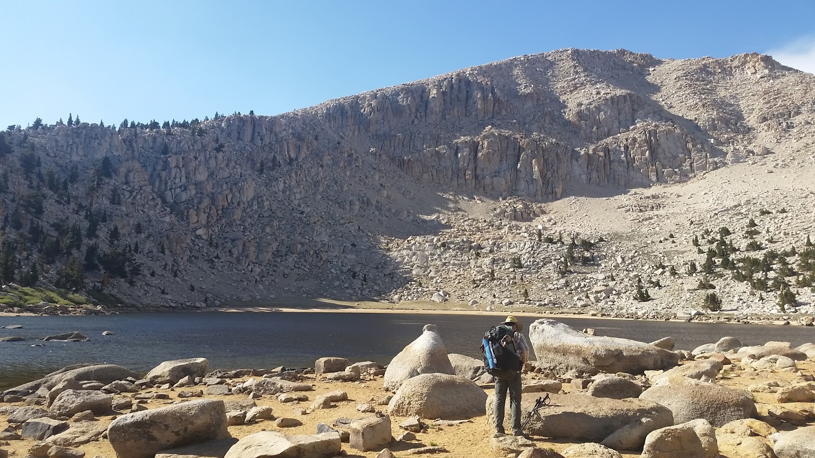 |
| Chicken Springs Lake |
Day 2: Chicken Springs Lake to Lower Crabtree Meadow
16 miles
Awake to clear skies and start hiking by 8:00. Chicken Springs Lake is at 11,500 feet and our plan is to hike down the 9 miles to Rock Creek by lunch, and then hike in the afternoon up to Guyot plateau and then on to Lower Crabtree for our next camp. This will make a 16 mile day, but most of it is downhill. Ha. Our downhill to Rock Creek was decidedly rolly polly and we went up and down slightly all morning. The altitude was probably also a contributing factor to our tiredness.
 |
| Our lunch stop on Rock Creek |
While we are resting for a couple of hours, smoke rolls in and our climb out of Rock Creek ends up being a bit of a slog. It is hot and the air is dirty, it is our first full day of hiking and our packs are heavy too. We stop often and its late when we reach Lower Crabtree Meadows. The smoke hides the peaks surrounding the meadow, but it is an idyllic spot nonetheless. While gathering water at the creek I sit and enjoy the surroundings. Fish with bright orange bellies propel themselves from the water after insects and deer linger on the lush meadows. A spotted fawn kicks up its heels and races around its dam. There are even two burros out grazing. It's beautiful and I am happy to be alive.
Day 3: Crabtree Meadows to Large Tarn below Forester Pass
12.5 miles
The day dawns gloriously clear and exciting. Let me backtrack. I had been experiencing some irregularity, so the night before I have a cup of Smooth Move tea. Then second guessing the tea's effectiveness, I take a laxative right before retiring for the night. Well.... they worked. Unfortunately, I couldn't make it the required 100 feet out of camp and just eliminated behind the nearest tree available, without digging the required 8 inch hole either. Both Mark and David couldn't stop laughing and we renamed the meadows, Craptree Meadows. I apologize to whoever camped in that spot the next day, or maybe even until it rains.
We had decided beforehand to forgo the hike up Whitney as we have done it before and our schedule doesn't really allow the extra time needed, but we are really looking forward to the Big Horn Plateau and Forester Pass just ahead. We hike with a quickening in our step as the tiredness of the night before is gone and I bet I am at least 5 pounds lighter too! Ha.
 |
| awesome vistas |
 |
| Tarn on Big Horn Plateau |
We seize the day and strip down and dive into the tarn on the Big Horn Plateau. Grand granite monoliths surround us and we are on top of the world. The ducks on the tarn are a little perturbed with us disturbing their waters, but then they realize we stirred up some good food, so they get busy eating as do we, stretched out lazily on the grass in the warm sun. It is a special moment that we all savor.
Smoke rolls in around Tyndall Creek a few miles ahead. We rest a bit before hiking on toward Forester. The approach is decidedly uphill, but gradual. The views are dimmed because of the smoke. We pass the junction for the Lake of South America. South America? Did we make a wrong turn? We meet a hiker who is going there and our minds wonder about this place. We must come back and check it out someday. It gets smokier and the wind picks up. We decide to not go over Forester today, but wait until the morning, which might be clearer. It would be a shame to have the 13,200 foot view occluded. We make camp next to the highest of two big tarns below the pass. It is windy and cold at 12,000 feet. After pitching our tent and fluffing our bags it is only 4 pm, so Mark and I wander around watching the marmots and picas gather food for the winter. It is fun just hanging out and doing nothing.

Day 4: Tarn below Forester to Upper Rae Lake
15.5 miles
 |
| Heading to the pass |
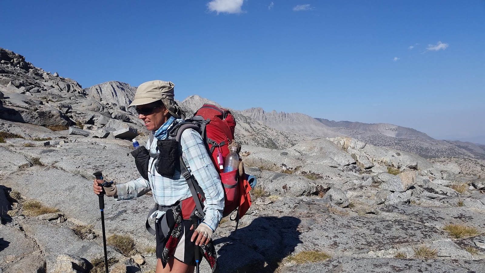
It is clear. Hallelujah! Mark and I pack up first and head up to the pass. There are already a few people climbing the switchbacks and my competitive gene kicks in and I ditch Mark to begin climbing, while he waits for Dave. I get a rush climbing. It must be endorphins or something. The man in front of me stops after a while and lets me pass and I set my sights on a man in a kilt. Kiltboy, I call him in my mind, as he is the age of my kids. I get close, but I don't pass him. I stop and enjoy the view. I smell the clear, thin air. I love it! The sky is above and around and granite is everywhere. I make it to the pass and everyone there gives me a hearty cheer. Kiltboy (Brad) comments that I almost took him. It is crowded on Forester this morning. I eat some nuts and wait for the guys, who show up looking strong.
 |
| Almost to the pass |
 |
| Requisite photo on Forester |
We leave after kibitzing for a bit and meet lots more people climbing up from the north. Where did all these people come from? Is this going to be the trail scene from here on out? We can see the valley between Forester Pass and Glen Pass stretched out flat. We decide to hike over Glen too. Why not? We Got This! We stop for a bite to eat at a beautiful little spot full of endangered yellow legged frogs. I hope I didn't sit on one. We even meet some excited young ladies with nets who are going to count them or something.
 |
| Just north of Forester |
 |
| Lovely valley hike |
We hike on resolutely with a creek flowing beside us and bird song filling the air. It is a lovely valley with high granite walls on both sides, but it begins to seem a lot longer than it looked and it isn't flat either. Almost flat, maybe, but not exactly flat. At Vidette Meadows we stop and take a break in a large camping spot and I do a little wash and hang it to dry on my pack. We eat and laze around a bit before starting the steep climb up Glen. The smoke burns in our nostrils and we talk of stopping when we come to a lovely spot beside a little brook, but it is early in the day. We are committed now. WE Got This, I say as we go on up the trail. It is tough. Really tough. I mean, what were we thinking? Three 50 something softies climbing two passes in a day in thick smoke. I feel like giving up and laying alongside the trail until morning. Ha. Then I see two ladies up ahead and that gene kicks in again. I'm bad, I know. Ellen and Carol from Bend are super nice when we pass, and of course like all my other competitors, they don't even know it's a race. But that extra little imaginary competition did it for me and we GOT it. We climbed that pass too.
 |
| The only bright thing on Glen |
 |
| Dave heads down from the pass |
We stumble down the other side with our cold weather gear on as it has gotten late and chilly after our celebratory time at the pass. Where did the day go? I stumble on and on. I don't really pay attention to my surroundings and basically collapse when we get to Rae Lakes, where we find Dave actually collapsed on a rock. He barely raises his hand in greeting. The Painted Lady is so embarrassed by this she hides, although it could have just been the smoke that hid her from view. (The painted lady is a natural marking in some granite that kind of resembles a lady or perhaps Jaba the Hut) Mark does all the camp chores. He is getting stronger. This always happens. His body thrives on this stuff. Me, I eat quickly and go to sleep with a mask on to keep out the smoke. I hope it is clear again in the morning. Otherwise I am outta here and the ranger at Lone Pine made me the leader on our permit, so there!
Day 5: Rae Lakes to pond below Pinchot Pass
10 miles
It is clear in the morning. I guess we will hike some more. It is an absolutely beautiful day and we decide to enjoy it leisurely. No passes today. This is a wonderful area to just enjoy. A low mileage day of swimming and picnics is planned. Spring break!
 |
| Rae Lake and The Painted Lady |
 |
| Lovely Hike |
 |
| Grazing as we go |
 |
| Golden Gate of the Sierra. Crossing Wood's Creek |
 |
| One of our swimming spots |
As you can see from the above photo, the smoke blankets the ground once again in the afternoon and hiking up the trail we meet a few wild west looking fellows with bandanas over their faces. I use my Buff, of course, to cover my nose and mouth from the smoke as we hike towards the little pond below Pinchot Pass, which is our camping destination. There we meet Carolyn, a woman about my age, who is hiking for a month by herself for the first time. Not just being solo, but backpacking for the first time. (Well, she did an overnighter once in her 20's, but I don't really think that counts.)
Meeting people and hearing their stories is part of the draw of a popular trail like this.
Meeting people and hearing their stories is part of the draw of a popular trail like this.
Day 6: Pond to Palisades Lake Waterfall
15 miles
We practically fly over Pinchot Pass in the morning. Hikers along the way call us ' The Animals'. Ha. We want the view, gosh darn it, and make sure we beat the smoke. Basically though, it is a super easy climb from our pond and we make good time enjoying the hike to the top.
 | ||||
Clear skies at camp in the morning
|


Smoke rolls in and the open landscape is occluded. Just big granite rocks close by and dry grass fill our view. Out of the blue, a nice tenor voice starts singing, "Go Tell it on the Mountain". It is Dave and it is very apropos. All of a sudden we are transported to Israel and the hills of Judea, and we join along as we hike along the boulder strewn and magical tarn landscape all shrouded in smoke, that I pretend is fog.
We make it to the actual climb and I begin tearing it up at a whopping 1 mph, Ha, but it is bit longer than I reckoned and at one point near the top I get winded and my legs just STOP. I have to pause a moment. Then we make it to the top and see basically a sea of smoke. I am a bit beat. There is no one there because most sane people don't hike in this smoke, or maybe because it is late.
 |
| We got this! Mather Pass. |
Down the other side to the waterfall between the two Palisades Lakes. It's beginning to get dark when we get there and Mark goes under the waterfall for a shower. It looks amazing, but cold.
Day 7: Palisades Lake to the 10,000 foot elevation marker on Muir Pass
14.5 miles
 |
| Good Morning |
Morning is clear again, there is a definite pattern here, and we pack up and hike down the Golden Staircase and have a lazy creek walk all morning. Midday it is smoky once again and we stop at the Forks in Le Conte canyon and go swimming and eat, before hiking on. It starts to snow. Well, it is ash really, but snow sounds so much better, doesn't it? When we pass the Le Conte ranger station we read the dire warning posted there that ends with these words: Help may not be available. I guess that they don't really want us out here hiking in this smoke. Except for a few hours each day it really doesn't seem that bad.
We call it a day right before the 10,000 foot sign and after dinner create a bocce kind of game with rocks. I am terrible at it. Mark and Dave keep winning. Then we set up a rock target and we all just throw rocks like crazy, the winner being the one who hits it. I'm sure the guys got tired of throwing aimlessly until I finally did hit it. We are all winners here.
We call it a day right before the 10,000 foot sign and after dinner create a bocce kind of game with rocks. I am terrible at it. Mark and Dave keep winning. Then we set up a rock target and we all just throw rocks like crazy, the winner being the one who hits it. I'm sure the guys got tired of throwing aimlessly until I finally did hit it. We are all winners here.
 |
| Clear Skies in the morning |
 |
| Along the Golden Staircase |
 |
| Big trees in Le Conte Canyon |
 |
| Swimming hole at The Forks under golden, albeit smoky skies |
Day 8: 10,000 foot sign below Muir Pass to McClure Meadows
14.5 miles
It is clear when we get up and we hustle to get started on our climb. When we get to the unnamed lake at 10,869 feet we pause while Dave finds a special rock and takes some photos as on previous trips he named this lake after his wife, Charmaine. When you pass this lake, no longer call it unnamed, but Lake Charmaine.
 |
| Dave and Lake Charmaine |
 |
| Mark heading up to Muir Pass |
 |
| Santa Mark on Muir Hut |
The afternoon has us hiking down the hill and swimming in Evolution Lake and then hiking on quickly to McClure Meadows. I even lead for a bit downhill and kind of get into the whole controlled falling thing. I find that going downhill fast gives one similar endorphins as climbing. Ha. Thank goodness I didn't fall and break a hip.
 |
| Evolution Lake |
 |
| Deer crossing creek |
 |
| McClure Meadows |
Dave saves our lives, or our taste buds anyways, as we are short one savory dinner and would have been stuck eating peanut butter, sesame crackers and nuts if he hadn't shared!
Day 9: McClure Meadows to Muir Trail Ranch
13 miles
Morning dawns beautiful and we continue our practice of being downhill speedsters. Stopping occasionally only to take a photo or a pee. I don't even remember drinking much water. Otherwise it's an all out rush to get to Muir Ranch, because we want to get a cabin. It is pretty along the way with cascades and trees and mountain vistas. We stop at this huge rock with an inscription carved in 1917. Pretty cool.


 |
| Muir Trail, 1917 |
We get to Muir Ranch in a little over 4 hours and we do get cabins. Muir Trail Ranch is basically in the middle of nowhere and everything that is there has to be ferried across Florence Lake and then packed in on horses or in their Unimog built by the Germans in the 40's. The place is rustic and wonderful, but expensive. We have stayed here before and are happy to throw down the credit card with our mouths already drooling thinking about their meals and the amazing hot spring pools.
We had our resupply sent here as well and fetch ours and then go through the overflow buckets hoping to find some yummies. There are a lot of overflow buckets that hikers leave food and supplies in that they don't want. (As of 2020 there are no overflow buckets.) We get a huge bag of salami and tear into and then someone gives us cheese and we are in heaven. The Ranch has lemonade for their guests and we drink glass after glass of the stuff. We really should have drank more during those last 13 miles. The guys do the laundry while I shower. Awesome! All clean. Dinner is Mexican food and we open up some wine we had sent in our resupply. It is very festive and we have fun visiting with the other guests and later we walk back to our cabins with the light from a full moon.
 |
| 108 degrees of perfect |
Day 9: Muir Trail Ranch to Bear Creek Crossing
10 miles
 |
| Morning light at the Muir Ranch |
It is a bit smoky in the morning. Not the usual pattern. We hit the hot springs and then enjoy an amazing breakfast, followed by all the fixings to make a really super sack lunch to hike out with. We try to leave early, we do, and feel pretty good to leave just a bit after 9 am.

I am extremely slow leading the climb toward Selden Pass. Think Heinz ketchup kind of slow. It is hard to walk when you've eaten too much. You just want to curl up and sleep. So we kind of sleep walk up the hill. We meet some people. The Llama Team. A couple of guys at dinner last night told us about them, so we talk a while and they are a lot of fun. Wish they were going our way. We meet two nice men from Arkansas too. Chit Chat a while with them.
 |
| Selden Pass beyond yonder mountain |
While eating our amazing sack lunch at Sallie Keys Lake we see a unique couple. Let's just say they are simple folk. Dave then says that they are proof of evolution and we start laughing and kidding around and before you know it the Arkansas Triplets are born. I know, so bad. I'm Purl, Mark's Murl and Dave is Url (we don't spell too good seein as how we only went to school through the third grade). Well, you get the point. We turn into absolute idiots and laugh and joke our way over Selden Pass and then down the other side. We kind of forget about the smoke and how it was with us all day.
In the late afternoon we amble across Bear Creek and make camp. We only hiked 10 miles. Url and Murl continue their joshing. Those two, they get me laughing so hard that at times I thought I might just bust a seam. A cheerful heart is good medicine.
 |
| The amen of nature is always a flower. |
Day 10: Bear Creek Crossing to Silver Pass Lake
15 miles
I awake grouchy and groggy and I don't improve as we hike down the trail. It is a nice morning, cold, but beautiful. Bear Creek sings alongside us as we go downstream, but I don't feel well. They guys continue their Url and Merl gig and it makes me smile. Some days just don't go the way you want them to. I begin having dizziness and sound comes to me like through a tunnel. I stop talking much, as it is too much work, and just look 6 feet ahead. Plod, plod, plod. Up the incline of Bear Ridge and then down, down, down the switchbacks on the other side. There are a lot of switchbacks. Right before Mono Creek we come to one of my favorite spots on the trail. The big aspen grove.
 |
| Big aspen grove above Mono Creek |
When we make the 10 miles to Mono Creek, I start stuffing my face with Mark's food. I am craving salt and he brought a huge bag of corn chips from Muir Ranch. Sorry Mark, I stole your food once again. I then eat a snickers bar and pretzels and peanut butter and Mark makes me 2 bottles of electrolytes. I curl up on the rocks by the creek and doze listening to the water melody. When I wake I am miraculously cured. I think. We begin the climb toward Silver Pass and I know I am cured. Woohoo. We stop along the way and Mark slides on rocks while Dave dunks his head repeatedly in the icy water. It is hot and steep climbing out of Mono Creek.
 |
| Mark on the baby slide |
 |
| Lots of stairs along the way |
We meet an interesting man. He is David Casterson, who authored, "In the Company of Redwoods" . It is fun meeting new people and I sometimes wish they were going our way, north, instead of south, so we could get better acquainted. I think that is the one thing I don't like about going north on the JMT, there just isn't a social aspect to the hike as 90 percent or more of the hikers are going south.
As the afternoon wanes and the climb and smoke increase we fall back into our Arkansas Triplet routine and by the time we get to Silver Pass Lake, we is really loud and ridiculous and we are throwing our hiking poles like lawn darts. The campers there must have heard and seen us coming, because they just kind of wave us away. "Over there", "Go away", They shout. Ha. Oops. A couple of hikers we passed a ways back said no one was camping here. Oh well. I guess we can be known as the village idiots. Just please stop telling us that there "might be some good sites across the lake"...To really seal the deal, Mark strips down, and neatly dives into the frigid lake and swims across. He's crazy. The sun is already down. He tries to talk me into it, but I am already in my puffy and gloves and stocking cap. No way! I do wash my feet though as the one thing I don't like about hiking in trail runners is my dirty feet.
Day 11: Silver Pass Lake to Duck Creek Outlet
12 miles
Coyote alarm clock at dawn. While out doing his business behind some boulders Dave has a close encounter with one of the wily dogs. Poor thing, minding its own business and someone poops right in front of him. He howls in dismay and others answer in indignation!
 |
| Camp at Silver Pass Lake |
We usually pack up and then dry our gear at our leisurely lunch, but not today. Today we laze around and enjoy the beautiful morning at the lake. Interestingly enough, all the other campers left really early....


I am always on the lookout for the perfect toilet spot and today is finally the day. I am able to dig a nice size hole and then place two nearby small rocks alongside the hole to create a seat. I am in the morning sun, which is great, and I have an amazing view before me while my backside is hidden from camp and other hikers by big boulders. Perfection! Ha. This is the kind of stuff hikers talk about, in case you were wondering.
When we finally pack up and hike on it is only a very short climb to the summit of Silver Pass and the views are good, but we can see smoke north.
 |
| Silver Pass Selfie |
 |
| Looking north at one of the Native American named Lakes, I think it is Chief Lake |
Down, down, down we go to McGee Creek and then on to Tully Hole. It is a lovely hike. Creekside, trees, a bit of flowers still hanging on to the last of summer. At McGee Creek we visit with a 74 year old PCT hiker, Daybreak, who skipped this part in the spring and is coming back to finish. He started thru hiking the long trails after retirement.
 |
| Tully Hole |
We eat lunch along the creek in Tully Hole, our eyes looking up at the switchbacks that we will have to climb. They end up looking worse than they were, although they weren't easy. Up, up, up we go back into a granite landscape and sparse trees. At Lake Virginia a cold wind begins to blow and clouds play with the sun.
 |
| Lake Virginia |
We hike slowly on and by and by we come to Purple Lake crowded with backpackers. After a foot soak we continue slowly on to our camping destination at the Duck Creek Outlet. The whole day has been lazy and slow and it felt pretty good.
 |
| Purple Lake |
Day 12: Duck Creek Outlet to View of Mammoth Mountain
Hiked 13 miles, Rode 8 miles on bus
21 trail miles
Canyons are cold places to camp and our tent is covered in ice in the morning. Mark gets up and makes our coffee, he is so good that way. When I get out to drink my coffee and eat my morning Probar the inside of the rainfly ices over too. It is that cold. We later shake out our rainfly and make what looks like snow, each little crystal unique and beautiful sparkling in the morning light.
We are heading to Red's Meadow and our mouths start drooling thinking about eating a hamburger for lunch. It is all downhill, or mostly anyways and we make pretty good time. Hiking through the burned area of the 1992 Rainbow Fire is surprisingly beautiful and full of life. We watch the birds, deer and small critters for awhile and Dave hikes and talks on his phone to his wife. We have cell reception for the first time today. I do a little texting myself.

I'm dizzy again as we near Red's. I fix it by eating a double cheeseburger, potato salad, chips and peach pie with ice-cream and drink 4 glasses of water, coffee, Gatorade and a beer. The men sit with incredulous faces. How can a 120 pound woman eat so much. A lady at a nearby table says I better watch out because eventually the food will start sticking. Ha. If only she knew that in everyday life I have to count calories to stay trim, but out hiking, I eat all my food and some of Mark's too. There I admitted it. I am a food hog, sometimes I even gain weight hiking.
 |
| Drying our gear at Red's |
I feel sleepy, like I just had Thanksgiving dinner and we laze around in the sun. The waitress tells us we should always remember to saunter while we hike and gives us this little parable to read. Check it out here. We decide to really create a saunter and ride the bus to Agnes Meadows as we've hiked the following stretch numerous times and it just kind of follows alongside the road anyways. I feel really bad stinking up the bus though as we are pretty ripe.


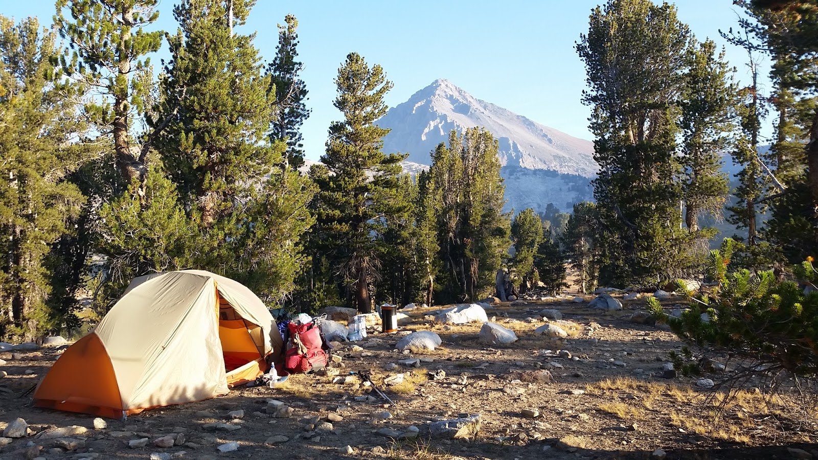
None of us has hiked the PCT High Trail before and we love it! Huge vistas, bubbling springs. We are glad that the waitress at Red's had suggested it as our route. We camp with a view of Mammoth Mountain just a few miles up the trail as I am really slow and bloated from ALL that food!
 |
| Mammoth Mountain |
Day 13: Mammoth View to beneath Lyell Glacier
14 miles
We saunter all day, it is our last full day, and one of our favorite stretches of trail. Visiting with almost everyone we meet, we sometimes forget to lose our Purl, Murl and Url accents and people smile and ask us where we are from. Ha. Fall colors are beginning, the skies are absolutely clear all day. Mark swims in Thousand Island lake and walks around an island claiming it as his own. I wash away some stink too and wash my shirt. I have gotten so stinky I am nauseating myself. We pass lots of newbies hiking the JMT and they are incredulous that we are planning to hike over Donahue Pass today. They question us. We smile and say we know, we've hiked it before. We will be okay, really. We got this! We go to the top and Mark pulls out a beer and chips and we toast our successful hike and sit and contemplate for awhile. Then down the other side to the tarn below Lyell Glacier. A perfect day, I think, although a few degrees warmer would have been nice. Fall is in the air.
 |
| Morning vista of the Ritter Range |
 |
| Thousand Island Lake and Banner Peak |
 |
| Url and Murl |
 |
| Up Donahue Pass I go, I think someone added a few stairs. |
 |
| Celebratory treat on top of Donahue Pass |
 |
| Upper Lyell Canyon Camp |
Day 14: Lyell Canyon to Tuolumne Meadows
12 miles
 |
| Dawn View |
Morning comes. I slept poorly and start off hiking sluggish and sad, for it is our last day. It is beautiful. Lovely Lyell Canyon. We pass lots of sweet smelling hikers, some ask us about the smoke in the south. It comes and goes, we say. Did we look and smell so clean when we started 2 weeks ago? By one o'clock we are having snacks in Tuolumne Meadows. Our hike is done. Now back to THE Mobile for food and on to Horseshoe Meadows to fetch our car.
 |
| Down the trail we go |
 |
| The long flat stroll through the Lyell Meadows |
 |
| Looking back from where we came |
---------------------------
 |
| These Feet Carried Us Well |
Total Trail Miles: 197.9 plus 1.5 detour to Muir Trail Ranch
Miles we hiked: 191.4
Elevation Gained: 30,776 feet
Vistas, laughs, and joy gained: priceless
Vistas, laughs, and joy gained: priceless
slideshow of our hike:
Love reading your adventures!! So glad you shared them! You are a great writer!!!
ReplyDelete