Day 1:
HWY 36/Chester
10 steps
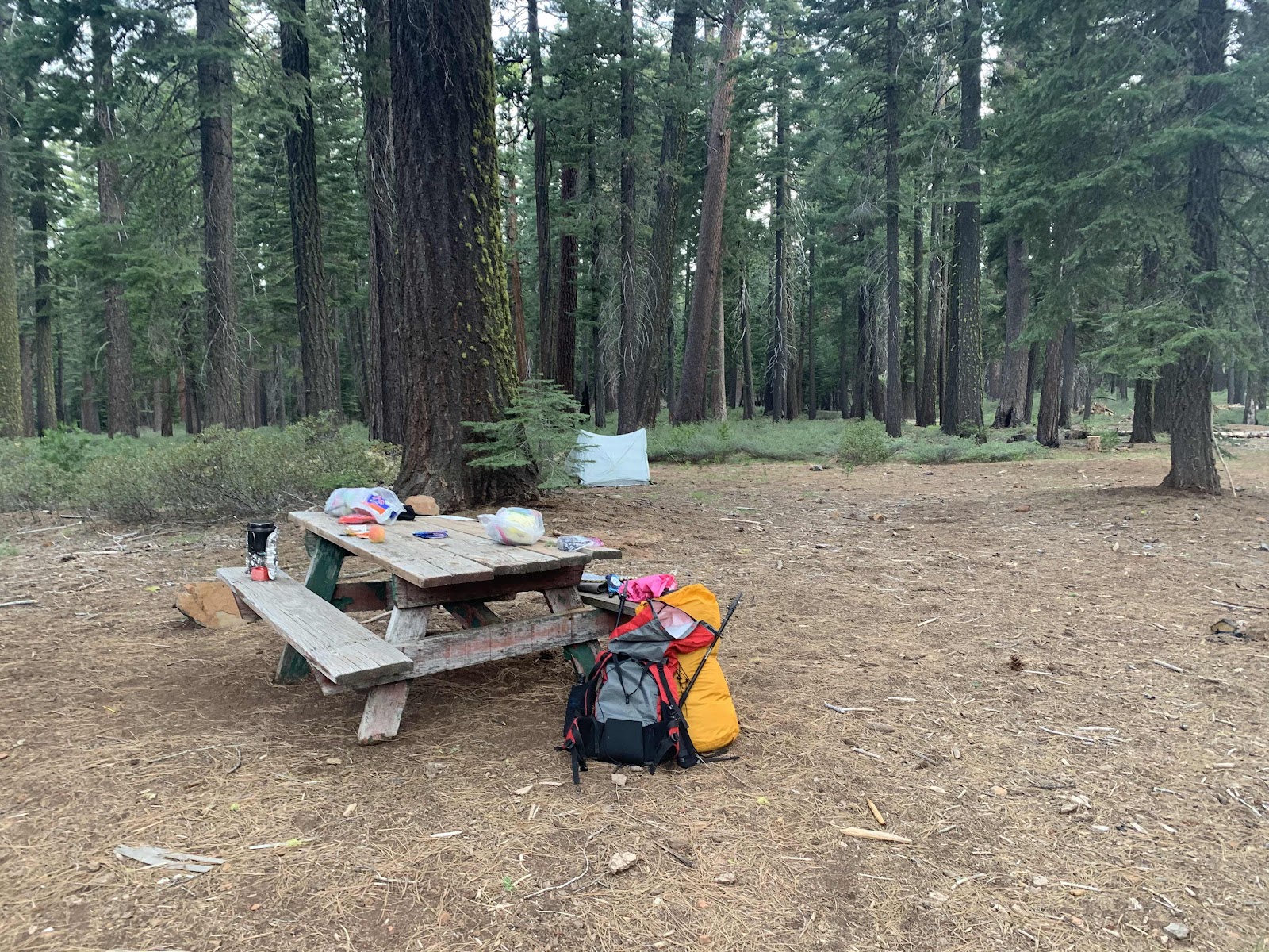
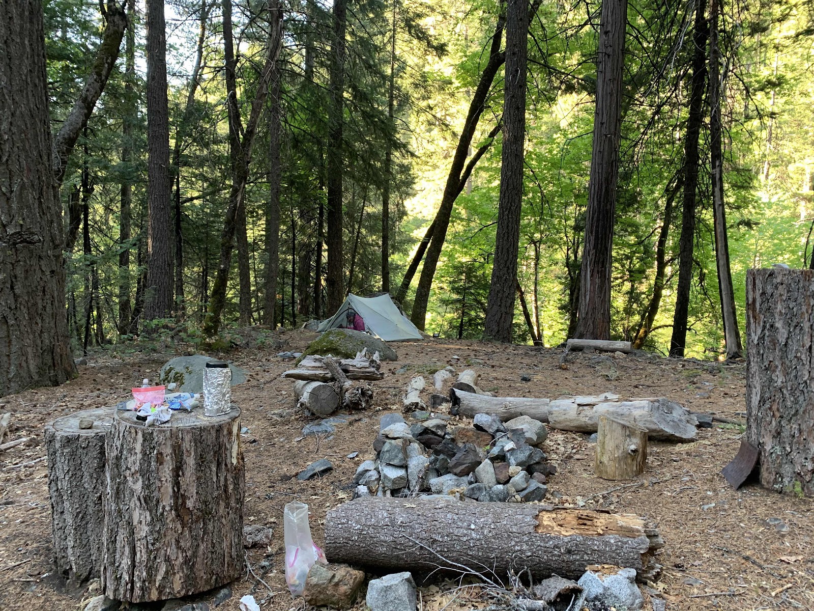
First night on the trail and we have a picnic table. Hawkeye loves a picnic table, only problem is it’s ten thirty at night and we are only ten steps from our vehicle. Haha! We are on the trail though, so that counts as day one in my book.
We had a rough time getting here with one crazy thing after another happening to us all day.
I’ll illustrate the last crazy event for posterity:
By the time we got to Beldon Town Resort (it’s not a real town) to drop off our return shuttle motorcycle, it was seven pm already. We had a burger and a beer anyways before driving to the equestrian trailhead, where we last left the trail last year. It was empty and big and peaceful next to the river as we waved good bye to our bike
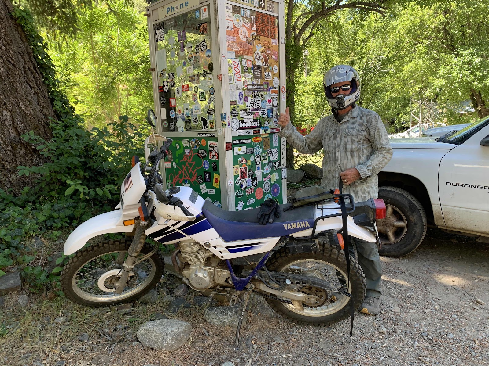
Jump forward thirty minutes later when we had to return to the trailhead, because we realized we had left the tools to unload the bike on our back bumper. We need those tools to reload the bike on the carrier. Now the trailhead was not peaceful. It was a full on tweeker camp with three carloads of folks. They helped us look for the tools a bit (no tools!) and then they leave. We then notice graffiti and trash and a big fire ring and realize this might not be a good spot for the bike and Hawkeye zooms off on it to check out the other trailhead parking on HWY 70. I follow in the vehicle. Even though it’s now dark, Hawkeye finds enough of our missing tools to be able to reload the bike later. A win! The trailhead is a bust as it is no longer a trailhead. All the signs say it is a rest stop for day use only. All overnight vehicles will be towed. Crazy! We drive back to Belden town hoping to ask someone at the restaurant if we can park our small bike there for a few days. It’s closed and we can’t find anyone to ask, so we just go ahead and chain it up to the old phone booth covered in stickers. It’s out of the way, but in full view. We stick on some duct tape to the tank with the words: “hiking PCT”. Who knows if it will be there when we get back, but it won’t get slowly dismantled by some crazies down by the river. It feels kind of providential that we forgot those tools and had to go back.
An hour and twenty minutes later we arrive at the not listed, not a real trailhead, parking on Highway 36 near Chester. There is a large gravel lot with another car parked and a picnic table right on the trail. It seems like a great spot. We tumble out of the car, walk ten steps, put up our tent and now listen to a multitude of vehicles drive by on the highway. It’s gonna be a long night.
It’s so weird how calm we were all day as one whack a doodle thing after another happened. We might finally be maturing.
Day 2:
Highway 36 to Junction with Little Cup Spring.
15.79 miles
South Bound on PCT
Our trailhead camp is actually in a demonstration forest. We find the kiosk when it’s light.
There are three areas: one with no management that is overgrown and straggly and a huge fire risk, another that they mechanically thinned and the third, that is behind our camp area in the photo, where they mechanically thinned and did hand work piling the woody biomass and burning it. It looks beautiful, but it isn’t really cost effective on a large scale. The mechanical thinning is the way to go and the west needs to embrace managing the forests in this way.
We meet Pat and his son Carter who are on a reconnaissance mission to prepare for there scout troops’ 50 mile hike starting next weekend. They were planning to hike to the first water source to check its flow, but we offer to scout the trail for them and text them the intel. Fun! We are on a mission and head onto the trail with added purpose.
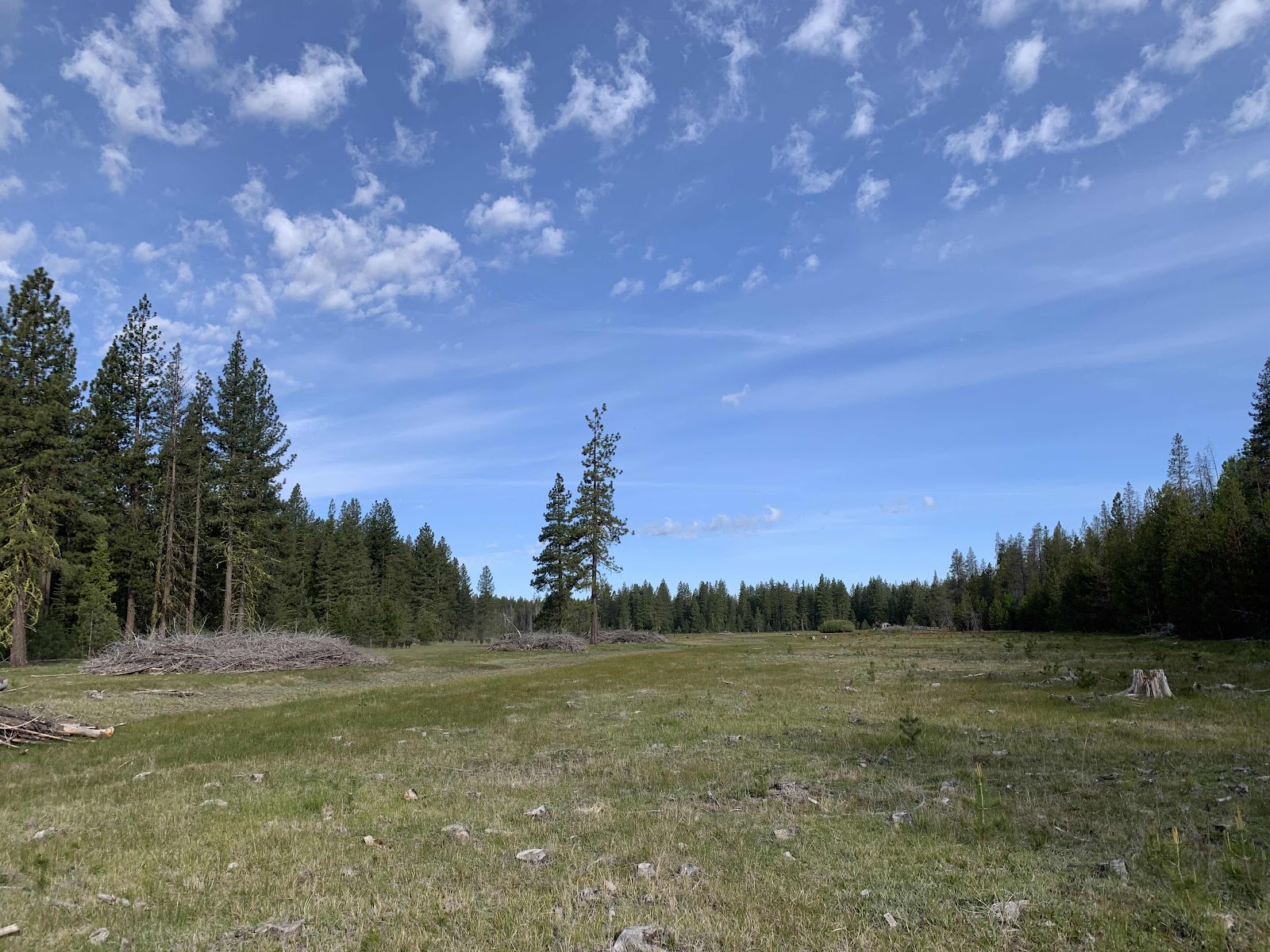
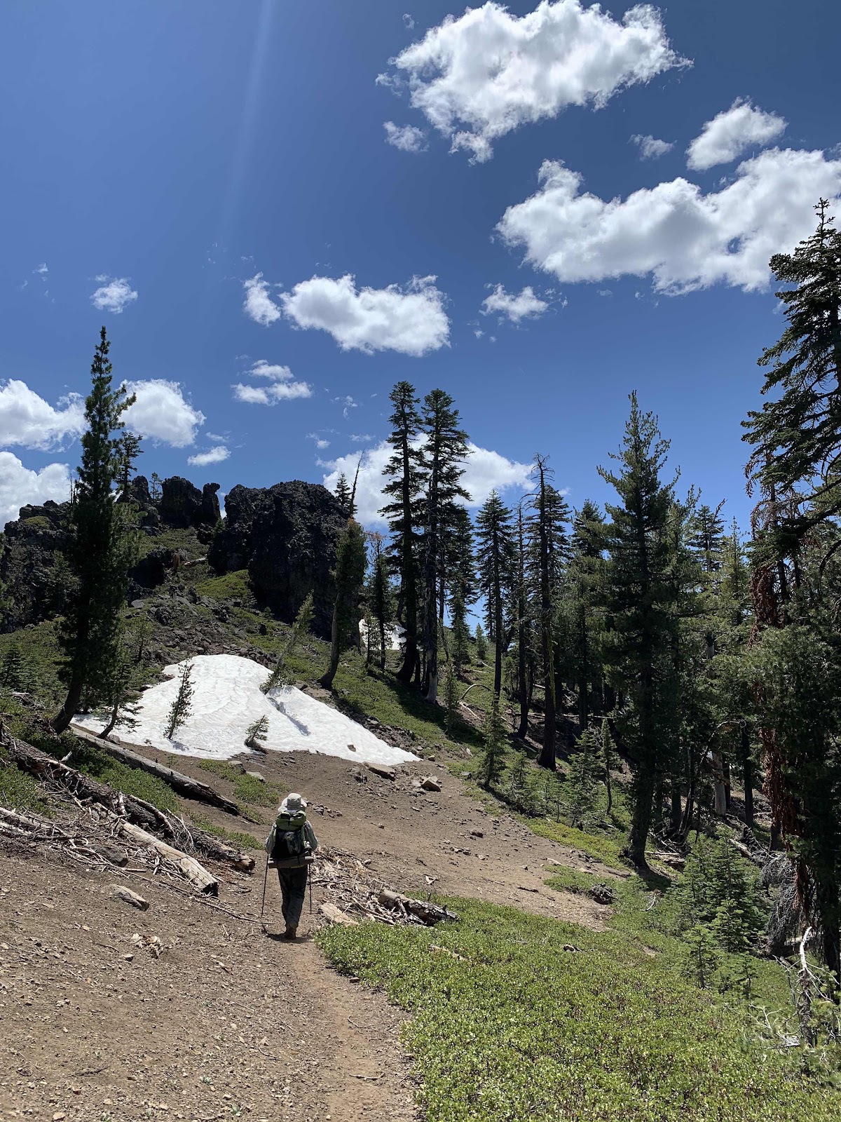
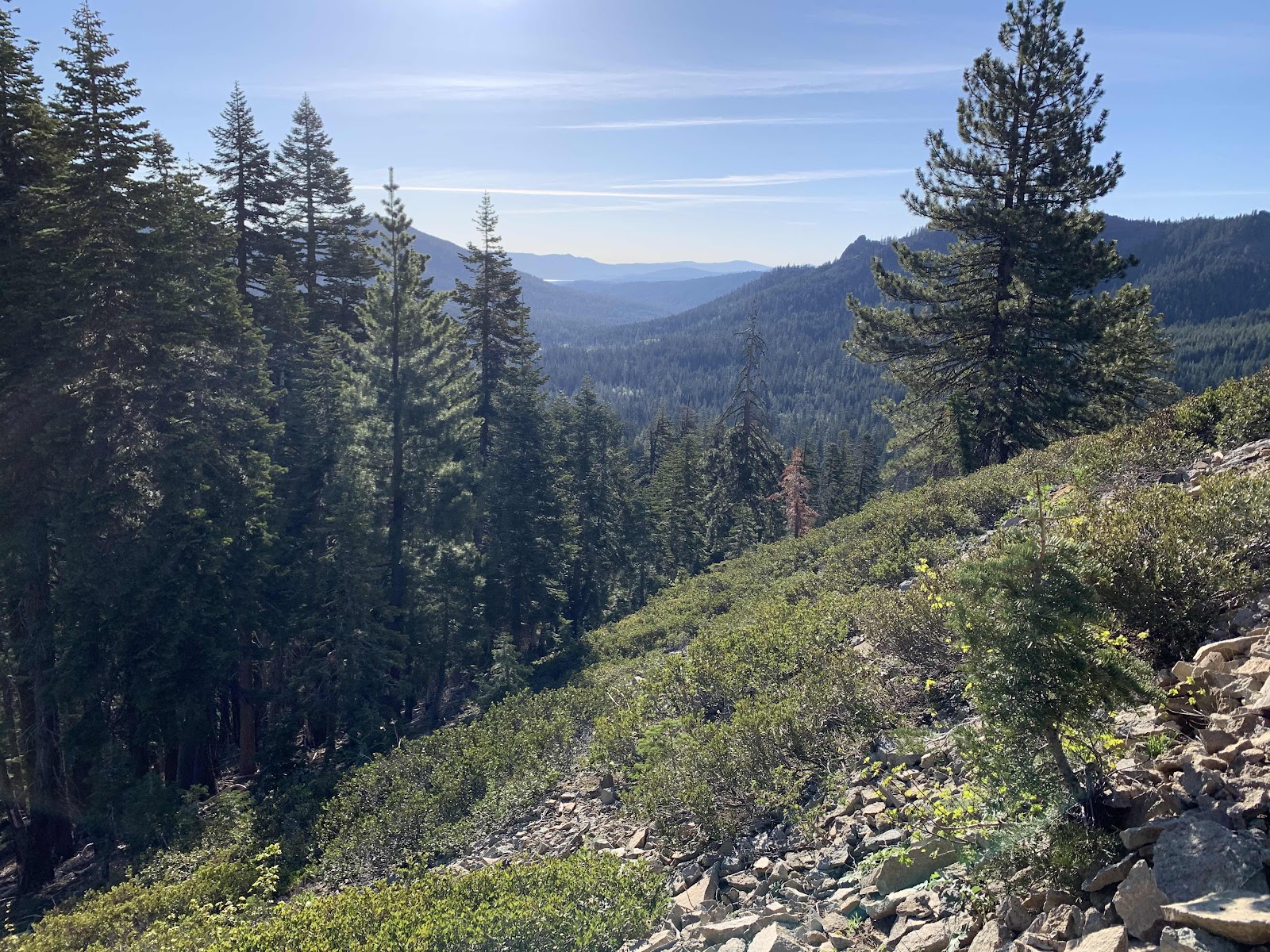
It’s a beautiful day. This is Soldier Meadow and the cattle grazing there run away when they see us. Flowers are blooming everywhere and our hearts are light. Our legs, or at least mine, are another matter as we begin the climb up Butt Mountain. The water at Soldier Creek at 3.5 miles is clear and cold.
After our last hike along the Arizona Trail this is like heaven. The trail is free of ankle twisting rocks and the water flows clear!
The dogwoods are in full bloom!
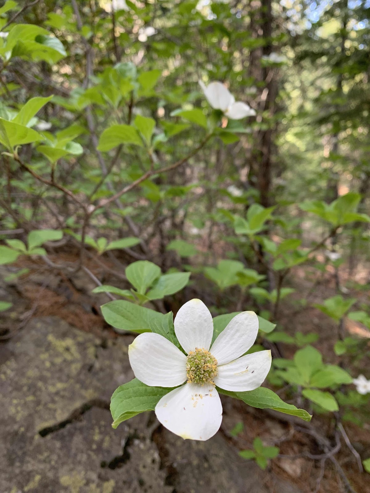
Morning on the trail
A delicate dogwood sings
Beauty to my soul.
This is a good time to hike this section of trail.
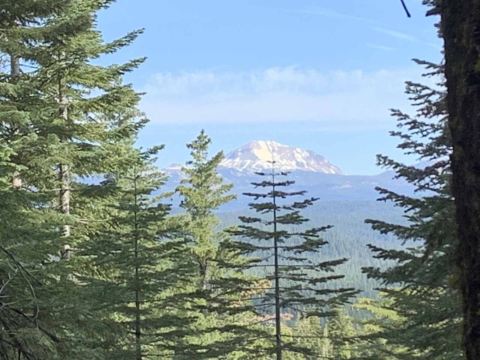
Lassen comes into view as we climb higher through the shady forest.
The highlight of our day though, is when we bump into this man.
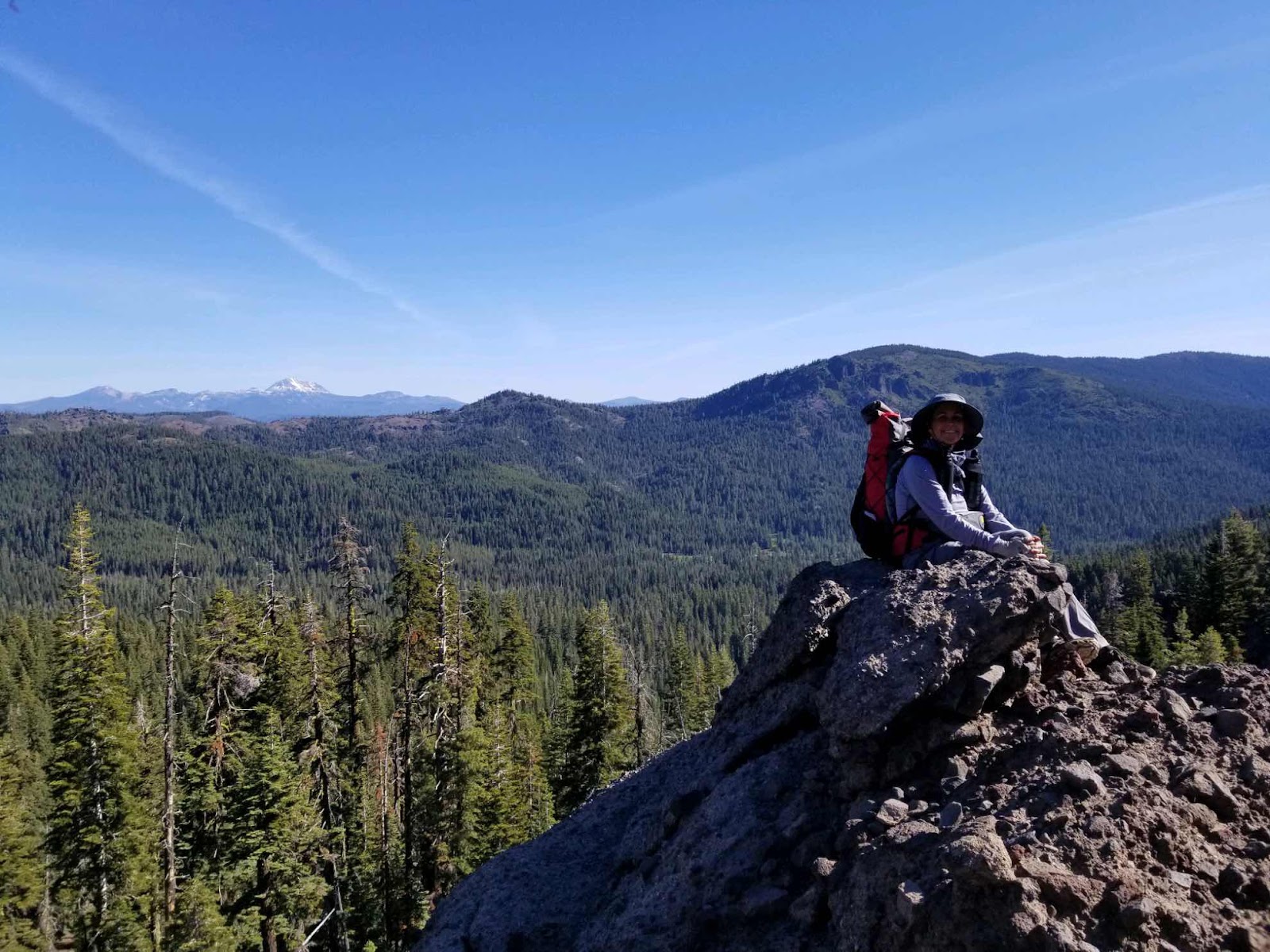
I was almost past him when he exclaims, “hey, didn’t I meet you guys in Arizona?” It’s Smash, the ex recon marine who gave us great advice and conversation when we were near Roosevelt Lake and the Four Peaks Wilderness. He’s a great guy and we are still so thankful that he told us to stop at Shake Spring before a storm blew in and dumped 4 inches of snow on us out there. It’s truly a small world in hiker land and we are really glad we could chat again. He started the PCT on March 24 and right before meeting us he crossed the halfway point. He’s covering the trail fast as he has a deadline with higher education beginning in the fall.
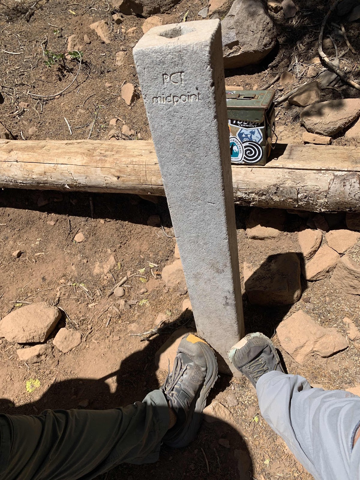
Halfway point marker
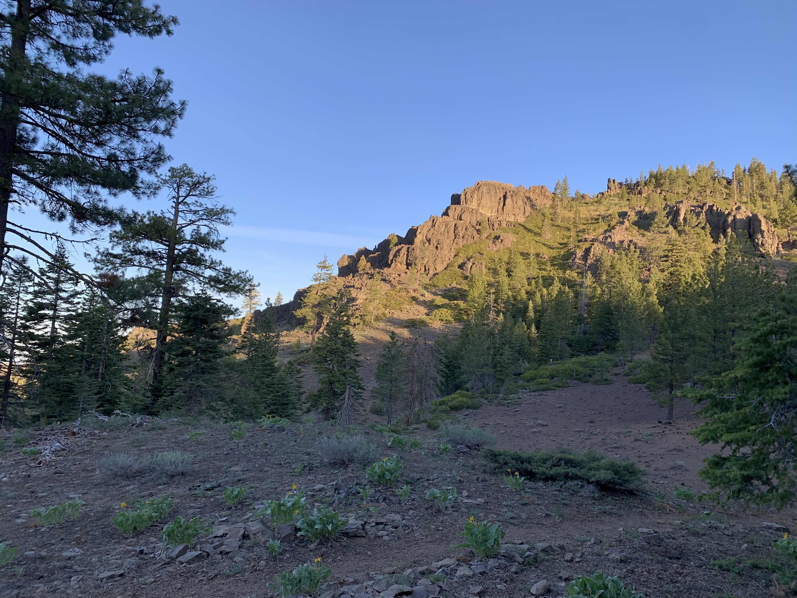
There is a bit of snow in patches on Butt Mountain and great views of Lassen in the distance.
Glorious day!
Lassen never gets old to our eyes.
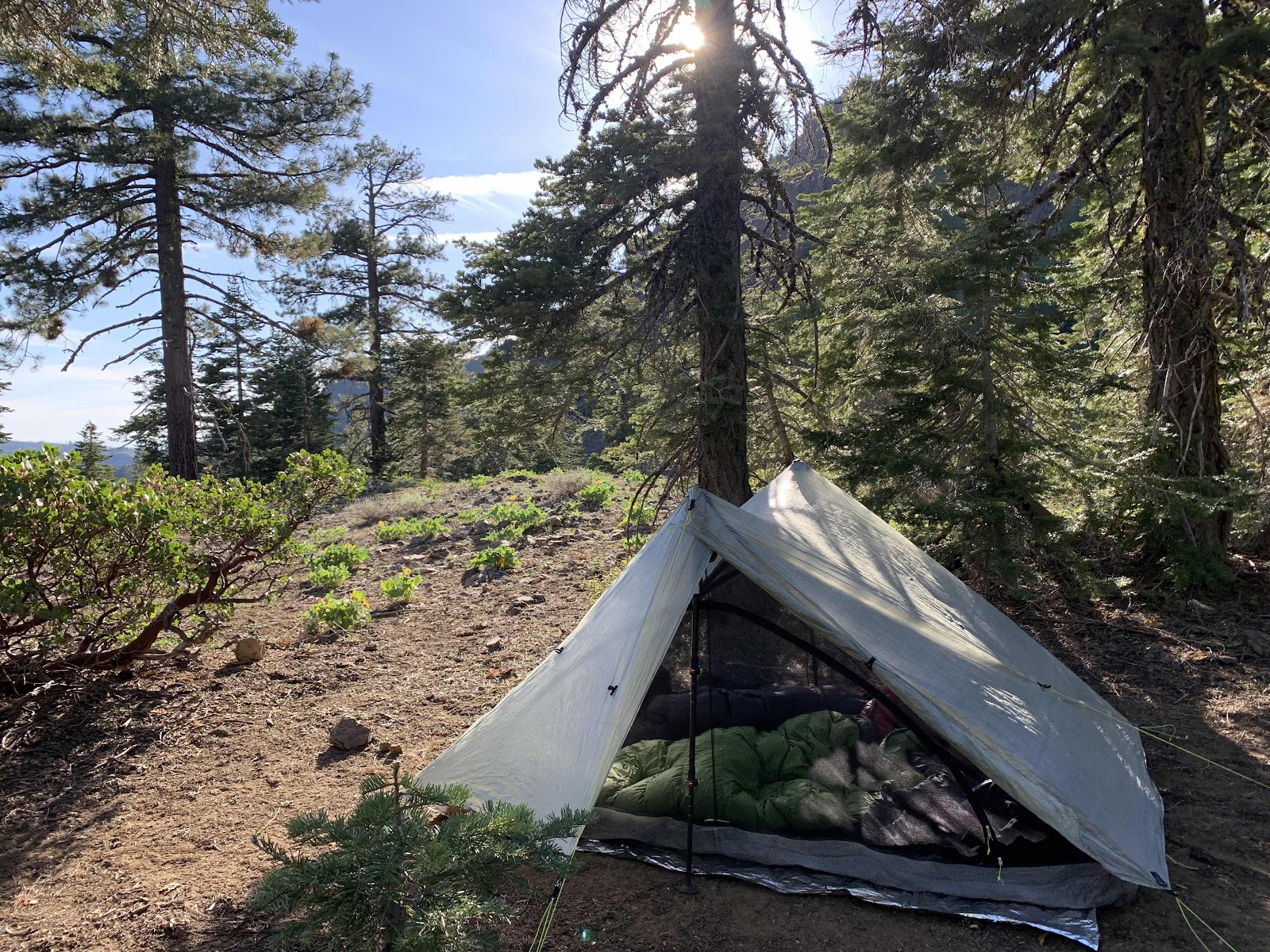
We make it to our chosen camping spot early and almost hike on, but change our minds as we’ve hiked enough miles today after our lack of sleep last night. I especially don’t want to wake up unable to move tomorrow.
We make it to our chosen camping spot early and almost hike on, but change our minds as we’ve hiked enough miles today after our lack of sleep last night. I especially don’t want to wake up unable to move tomorrow.
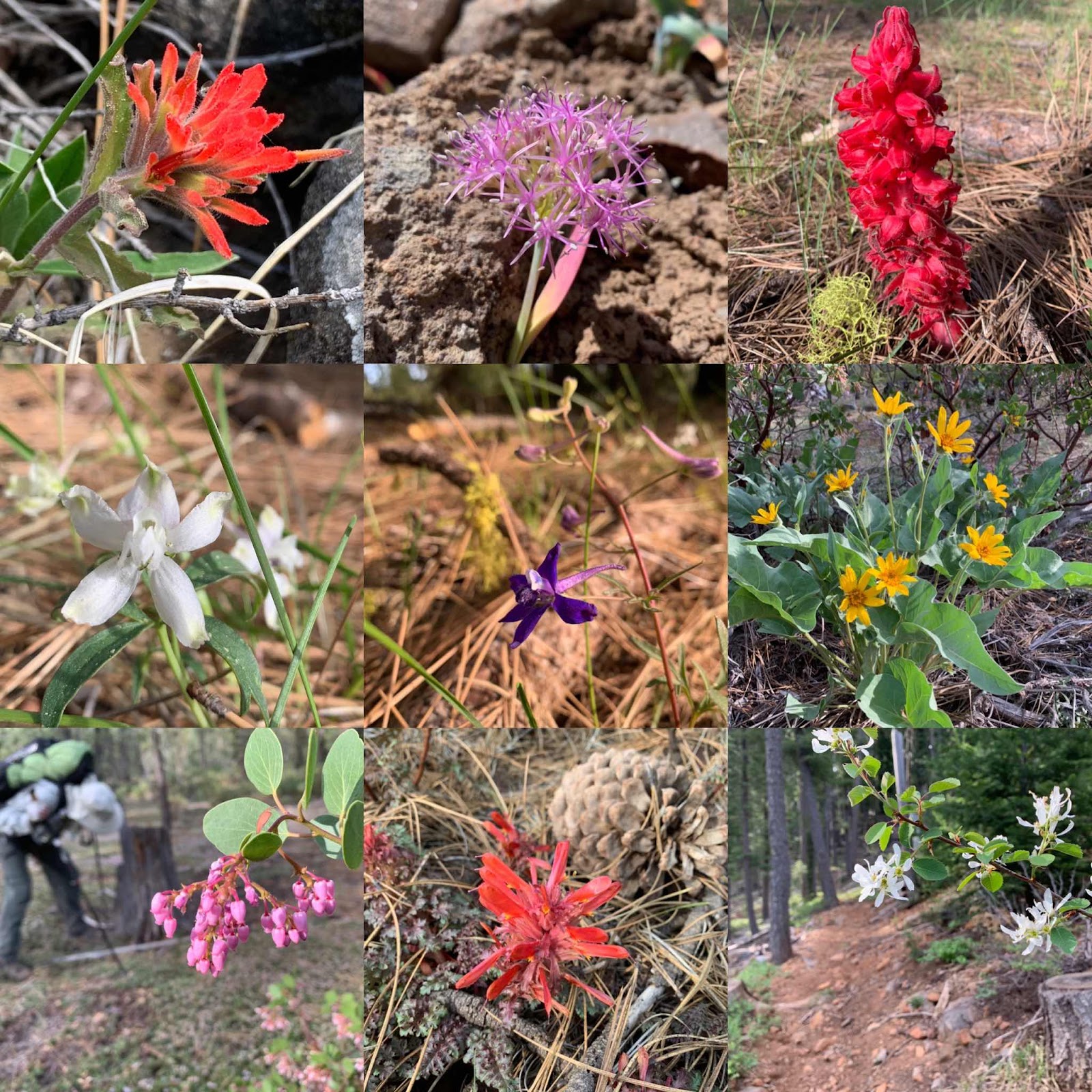
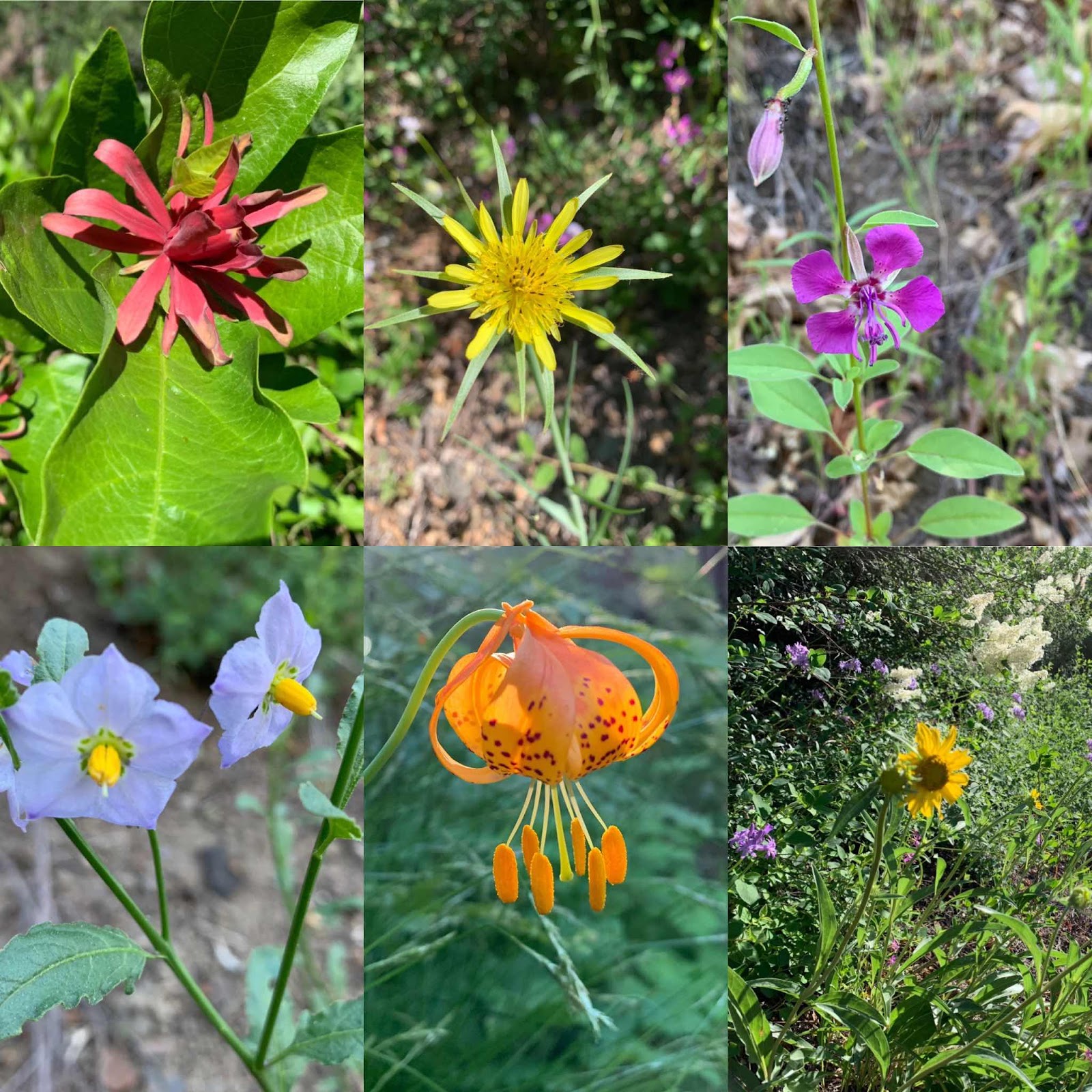
Some wildflowers along the way:
Day 3:
Little Cub Spring to Williams Flat
23 Miles
Left camp at 6:30 am as we want to hike longer miles today to set us up with a short hike out on Monday. The early morning light is magical. The air is crisp, cool and the low angle of light makes everything golden and we feel golden too.

Speaking of golden, while Hawkeye enjoyed the sunset last night (I fell asleep!) billowy clouds of golden winged termites rose from the earth to mate and then fall back to earth without their wings. He said it was an amazing sight. Our tent this morning had little wings lying all over it.
We soon run into another thruhiker named LabRat and later a guy named Strings. We are a bit surprised there are thru hikers already here as they had to cross the High Sierras in snow. Yesterday, Smash said it was a surreal and other worldly experience; everything being shades of black and white and all the lakes still frozen over.
The end of our scout reconnaissance mission is at hand as their itinerary has them leaving the PCT on a side trail, so we stop and enjoy the view while texting the scouts our findings. It was fun hiking along with our eyes viewing the hike from the perspective of having 20 scouts along. TWENTY! That’s not going to be an easy feat.
It’s a fairly easy hiking day with little ups and downs. And often big views.
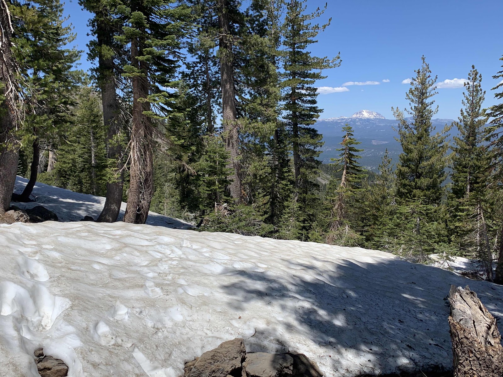
Our last climb of the day has us traversing some small snowfields and it’s fun.
We start wondering if we are in the Cascade Mountains or the Sierra Nevada Mountains and low and behold the trail provides.
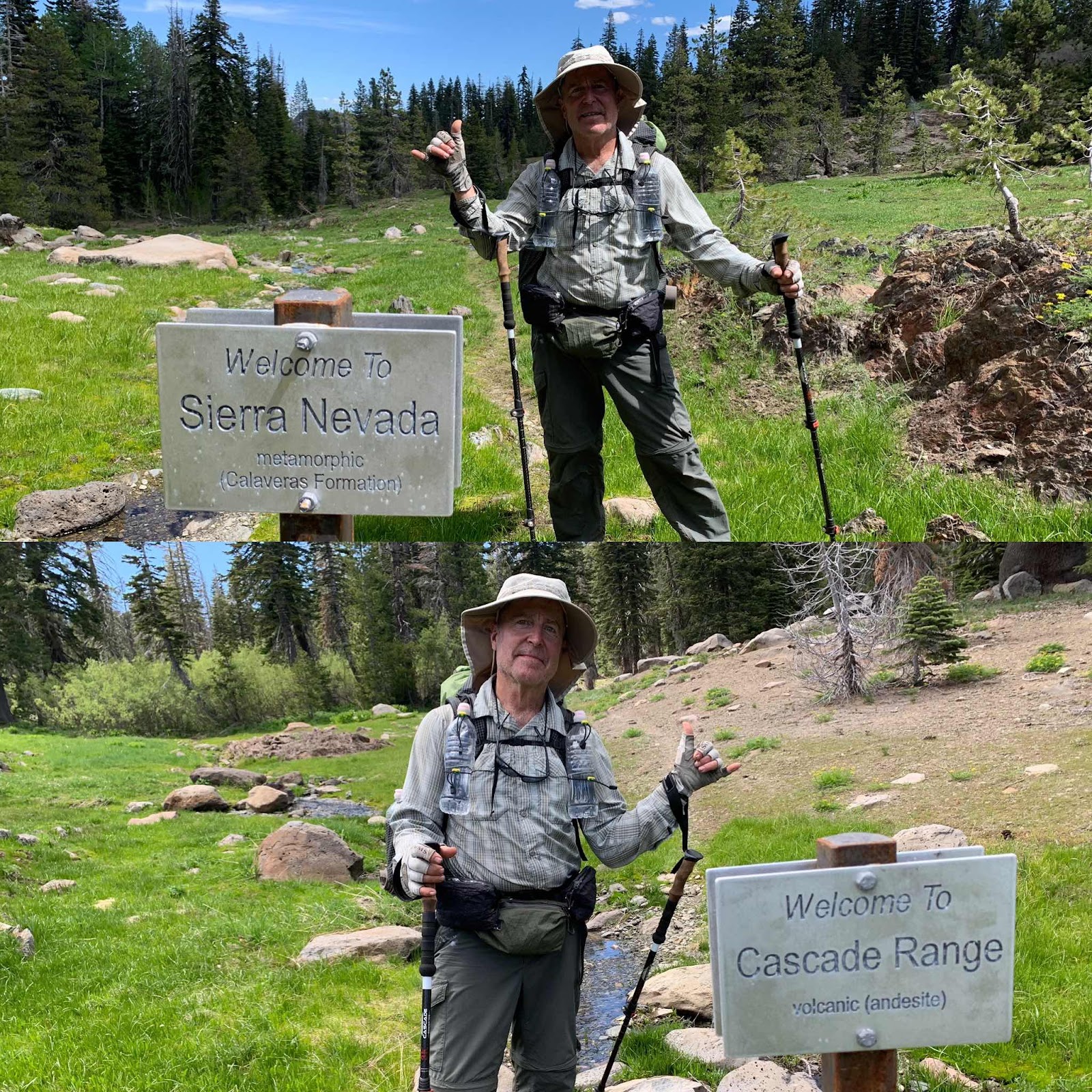
We had been in the volcanic Cascades and are now entering the metamorphic Sierra Mountains. Cool! Two mountain ranges hiked on one long weekend. Heehee! The water is plentiful in the Sierras and we see slate rock and granite. It’s weird how we can see a definite shift. We also spot our first bear of the year. Or, Hawkeye did. He always sees the cool stuff.
We are on a steady downhill trajectory now and soon come to the brand new Chips Creek bridge that was finished last December. Yay, for having a country that supports stuff like this. We are truly grateful.
Making our forests accessible for more people will hopefully help protect the forests because once you’ve experienced a little bit of nature, it holds onto your heart.
Chips Creek is making some pure mountain music that elevate our hearts, as we walk alongside down the canyon.

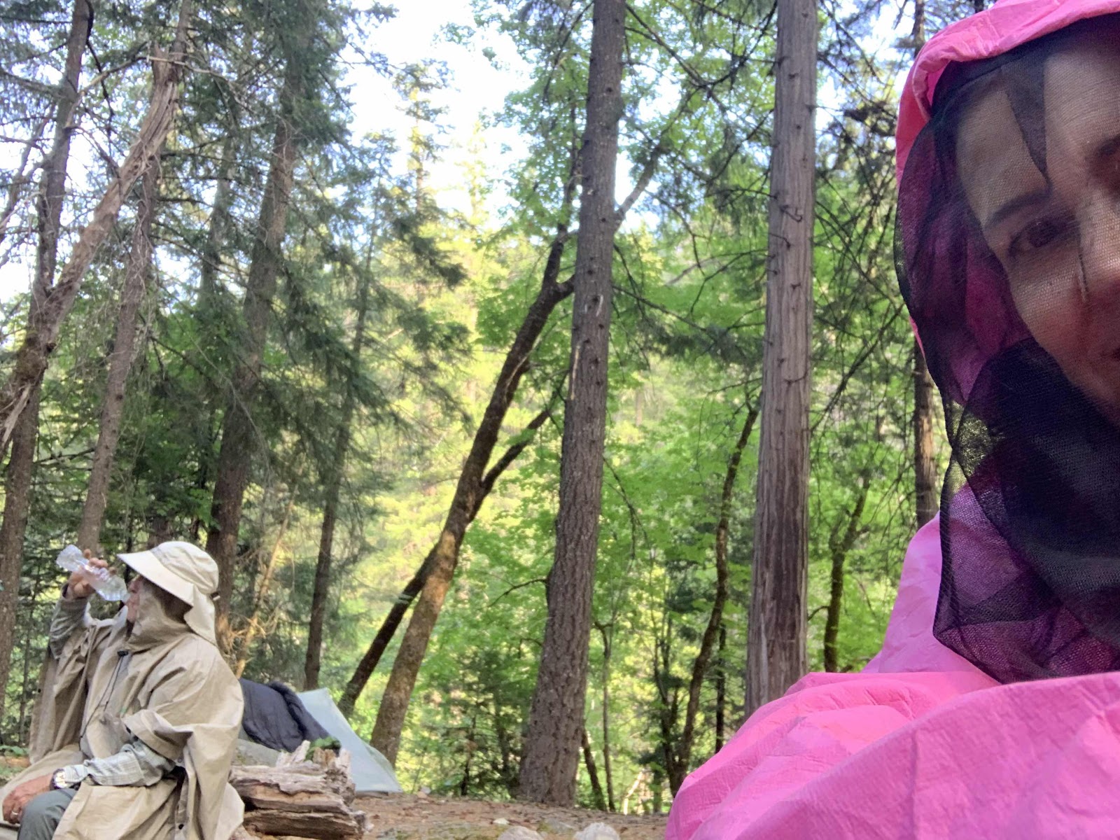
We stop to camp at less than beautiful Myrtle Tree Flat and almost get airlifted by some very hungry mosquitos, so we hurry off down the trail to Williams Flat. It’s got to be better. Williams Flat is much better and has a bit of breeze too which means a few less of the pesky feeders. Few, being the operative word. We still wear rain gear to keep them from biting.
A few new wildflower varieties alongside the trail today:

Day 4:
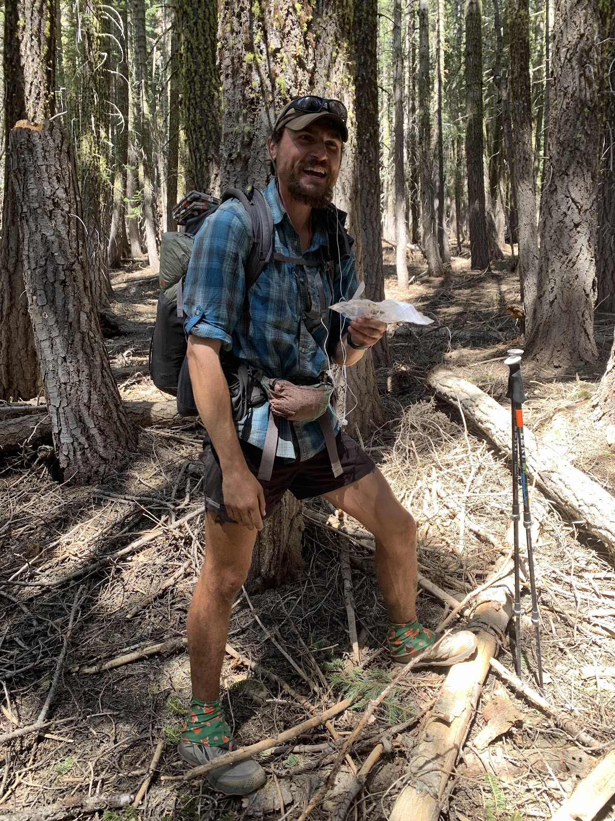
I forget my early morning resolution and sleep in and Hawkeye drinks tea waiting and snaps this photo. It’s a short 5.9 mile, mostly downhill, hike out today. Hopefully, our bike is still there waiting for us.
We are still hiking down canyon and the trail has a few more specimens of wildflowers for me to capture. So many beauties.
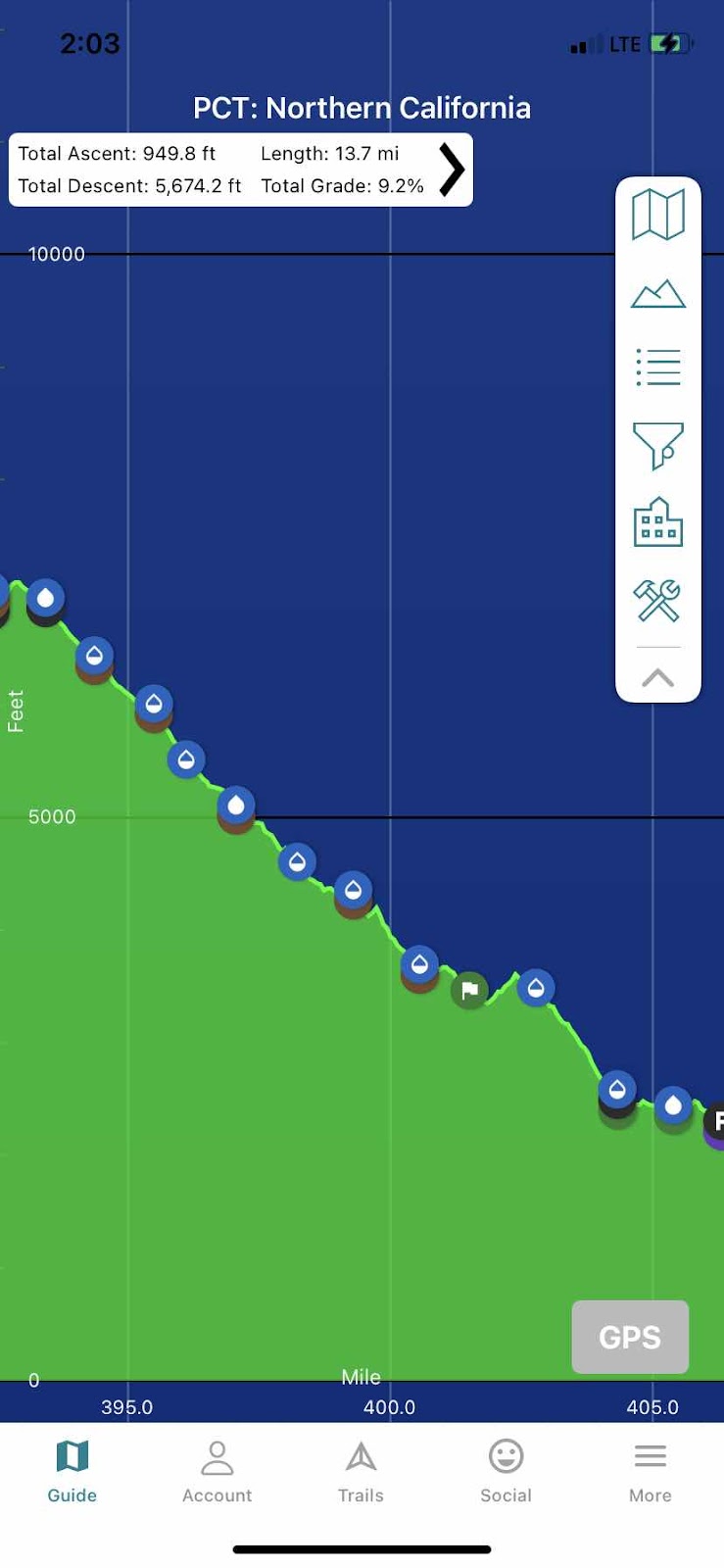
There is still a lot of water alongside the trail as well and that must be a blessing to those hiking the other direction. We are experiencing an easy downhill hike on a beautiful morning, while northbounders would be hiking a brutally hot, mostly shadeless uphill climb. As section hikers, we try to chose the best time to hike and the best direction for each section. This section was definitely a southbound section as we’ve been hiking predominantly downhill since crossing the snowfields yesterday.
Here’s an elevation from the top of the mountain yesterday to the Feather River and Belden on Highway 70. 13.7 miles and only 949 ft of up and a whopping 5674 feet of down!
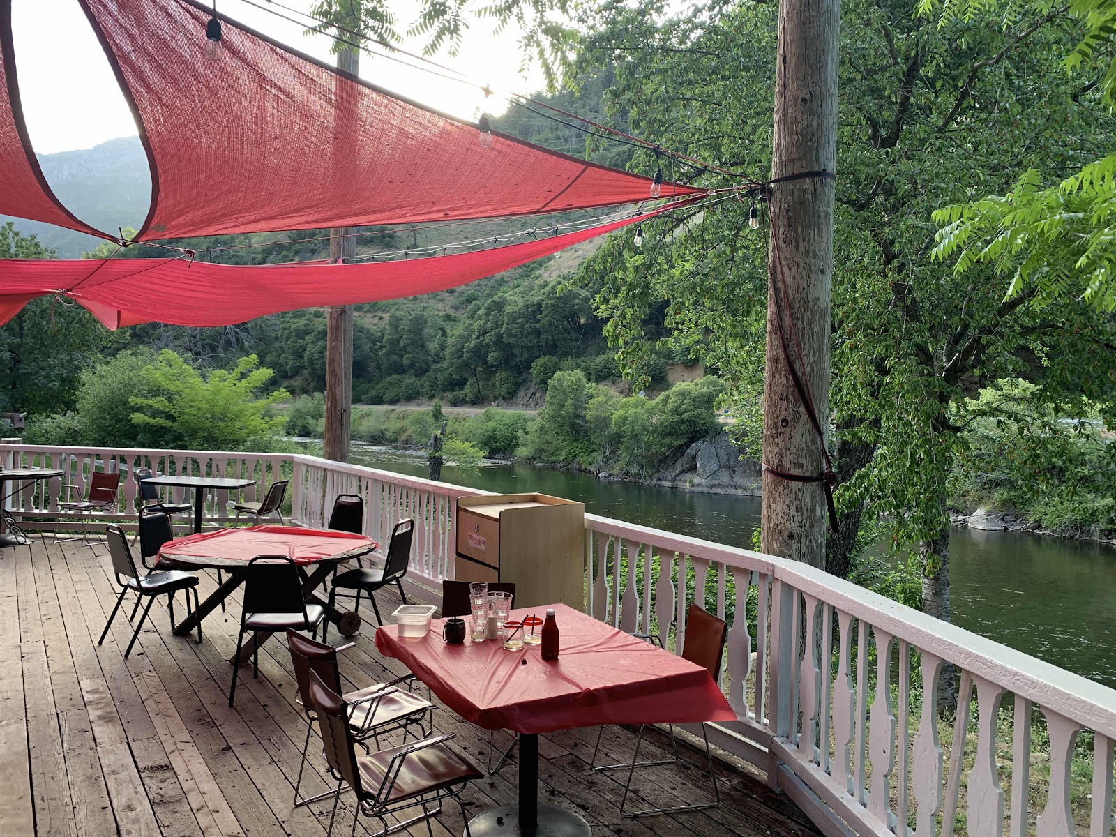
The Feather River is calling my name. Loudly. Last August we finished out our PCT section hike swimming in it and I’m looking forward to it again. There the river is right below us. We are almost done. Another hamburger might be an order too.

And our bike is right where we left it. Yippee! Another successful hike is in the bag and Hawkeye is jazzed to go on a fun ride back to fetch our truck on Highway 36.
PS:
The Feather River last August was deliciously warm. On the last day of May it is Not. Brrr! But I’m clean and my aching knees feel all better.
PSS: Hawkeye chatted with the PCT hiker Strings we met waiting for a ride on HWY 36. Hawkeye also had a heckuva fun ride.
PSS: Hawkeye chatted with the PCT hiker Strings we met waiting for a ride on HWY 36. Hawkeye also had a heckuva fun ride.
Comments
Post a Comment
We love your comments or questions. Have a great day and live a good life.