We hiked from Highway 36 to Belden Southbound as, frankly, it is easier.
Memorial Day Weekend 2021
Day 1:
HWY 36/Chester
10 steps
First night on the trail and we have a picnic table. Hawkeye loves a picnic table, only problem is it’s ten thirty at night and we are only ten steps from our vehicle. Haha! We are on the trail though, so that counts as day one in my book.
We had a rough time getting here with one crazy thing after another happening to us all day.
I’ll illustrate the last crazy event for posterity:
By the time we got to Beldon Town Resort to drop off our return shuttle motorcycle, it was seven pm already. We had a burger and a beer anyways before driving to the equestrian trailhead, where we last left the trail last year. It was empty and big and peaceful next to the river as we waved good bye to our bike
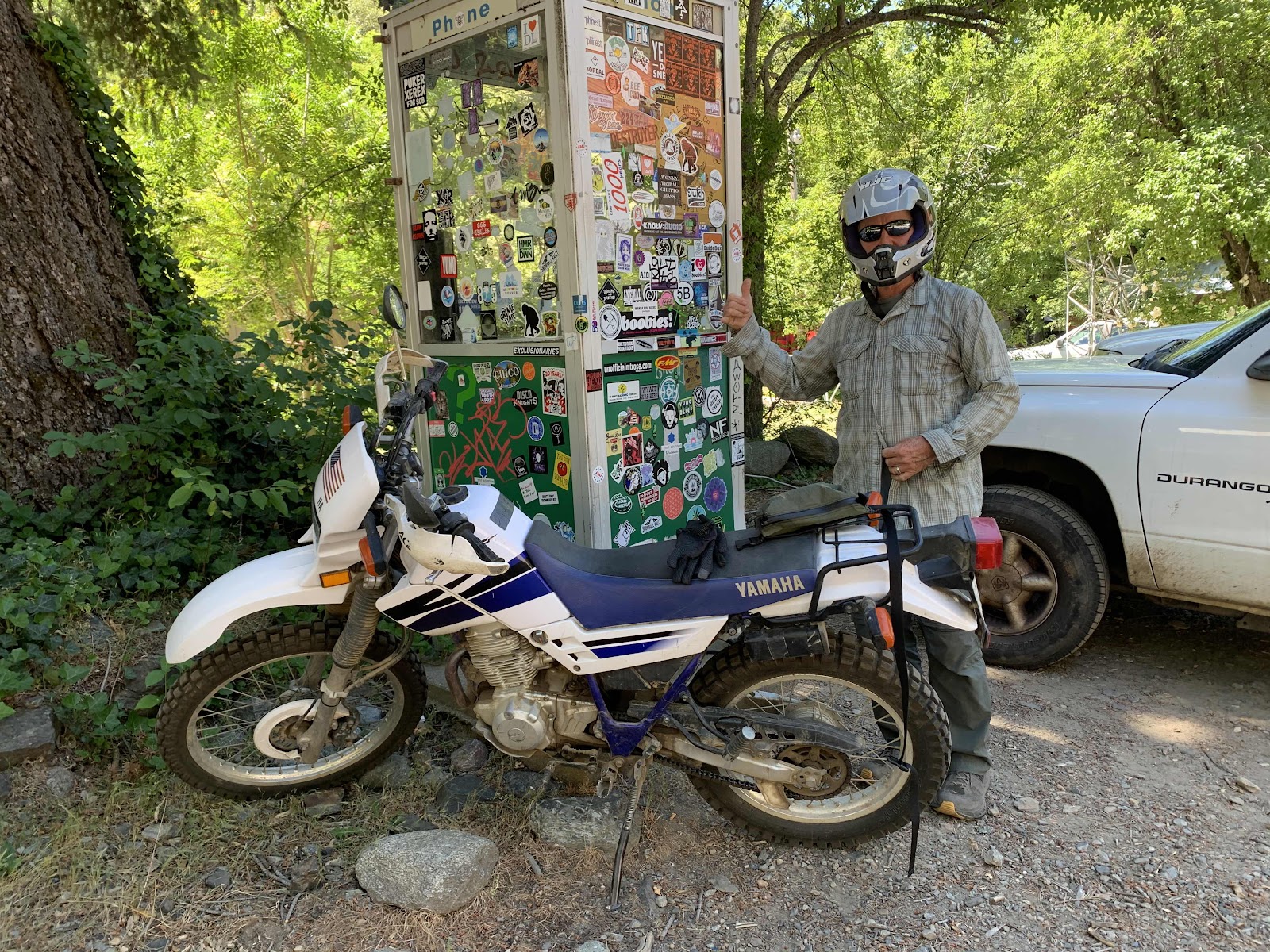
Jump forward thirty minutes later when we had to return to the trailhead, because we realized we had left the tools to unload the bike on our back bumper. We need those tools to reload the bike on the carrier. Now the trailhead is not peaceful. It is a tweaker camp with three carloads of folks. They were very nice nice and helpful and full of 'energy' to help us look for the tools (no tools found!) and then they load up their cars and leave. Looking around we notice graffiti and trash and a big fire ring and realize this might not be a good spot for the bike to sit and Hawkeye zooms off on it to check out the other trailhead parking lot on HWY 70. I follow in the vehicle. Even though it’s now dark, Hawkeye finds enough of our missing tools to be able to reload the bike later. A win! The trailhead is a bust, as it is no longer a trailhead parking spot. All the signs say it is a rest stop for day use only. All overnight vehicles will be towed. Alrighty then. We drive back to Belden town hoping to ask someone at the restaurant if we can park our small bike there for a few days. It’s closed and we can’t find anyone to ask, so we chain it up to the old phone booth covered in stickers. It’s out of the way, but in full view. We stick on some duct tape to the tank with the words: “hiking PCT”. Who knows if it will be there when we get back, but it won’t get slowly dismantled by some crazies down by the river. It feels kind of providential that we forgot those tools and had to go back.
An hour and twenty minutes later we arrive at the not listed on Guthook, not a real trailhead, parking lot on Highway 36 near Chester. There is a large gravel lot with another car parked and a picnic table right on the trail. We tumble out of the car, walk ten steps, put up our tent and now listen to a multitude of vehicles drive by on the highway. It’s gonna be a long night.
It’s so weird how calm we were all day as one whack a doodle thing after another happened. We might finally be maturing.
Day 2:
Highway 36 to Junction with Little Cub Spring
15.79 miles
We are now South Bound on PCT
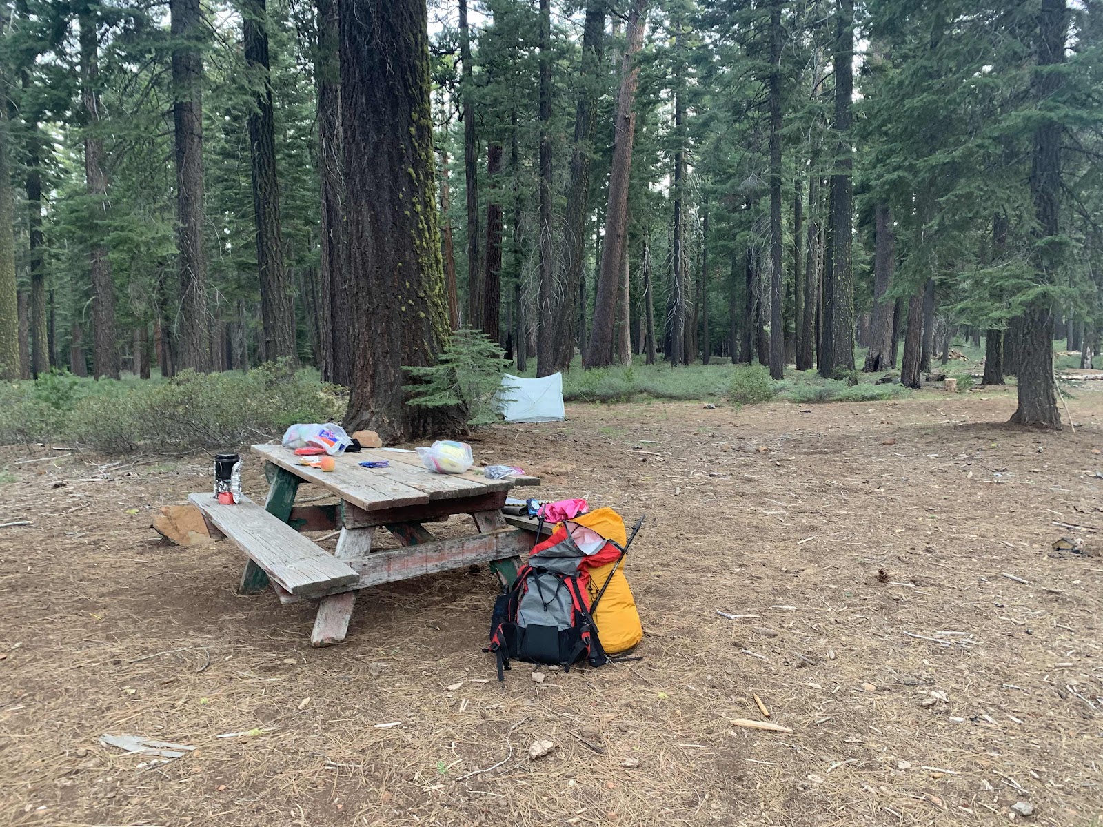
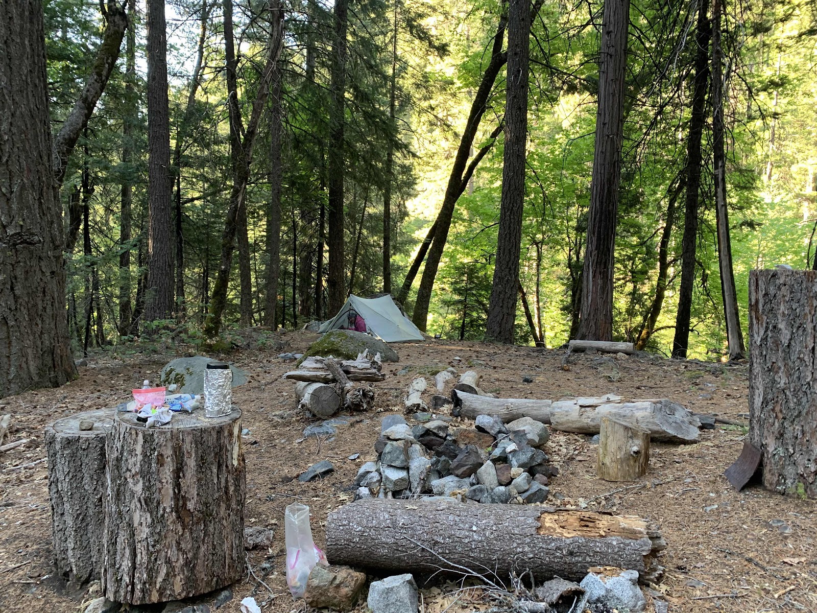
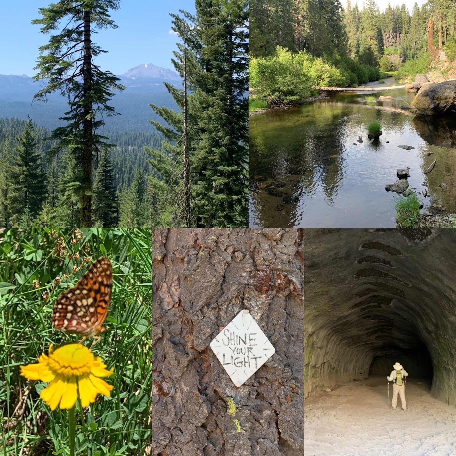
Our trailhead camp is actually in a demonstration forest. We find the kiosk when it’s light.
There are three areas: one with no management that is overgrown and straggly and a huge fire risk, another that they mechanically thinned and the third, that is behind our camp area in the photo, where they mechanically thinned and did hand work piling the woody biomass and burning it. It looks beautiful, but it isn’t really cost effective on a large scale. The mechanical thinning is the way to go and the west needs to embrace managing the forests in this way.
Before hitting the trail, we meet Pat and his son Carter who are on a reconnaissance mission to prepare for there scout troops’ 50 mile hike starting next weekend. They were planning to hike to the first water source to check its flow, but we offer to scout the trail for them and text them the Intel. Fun! We are on a mission and head onto the trail with added purpose.
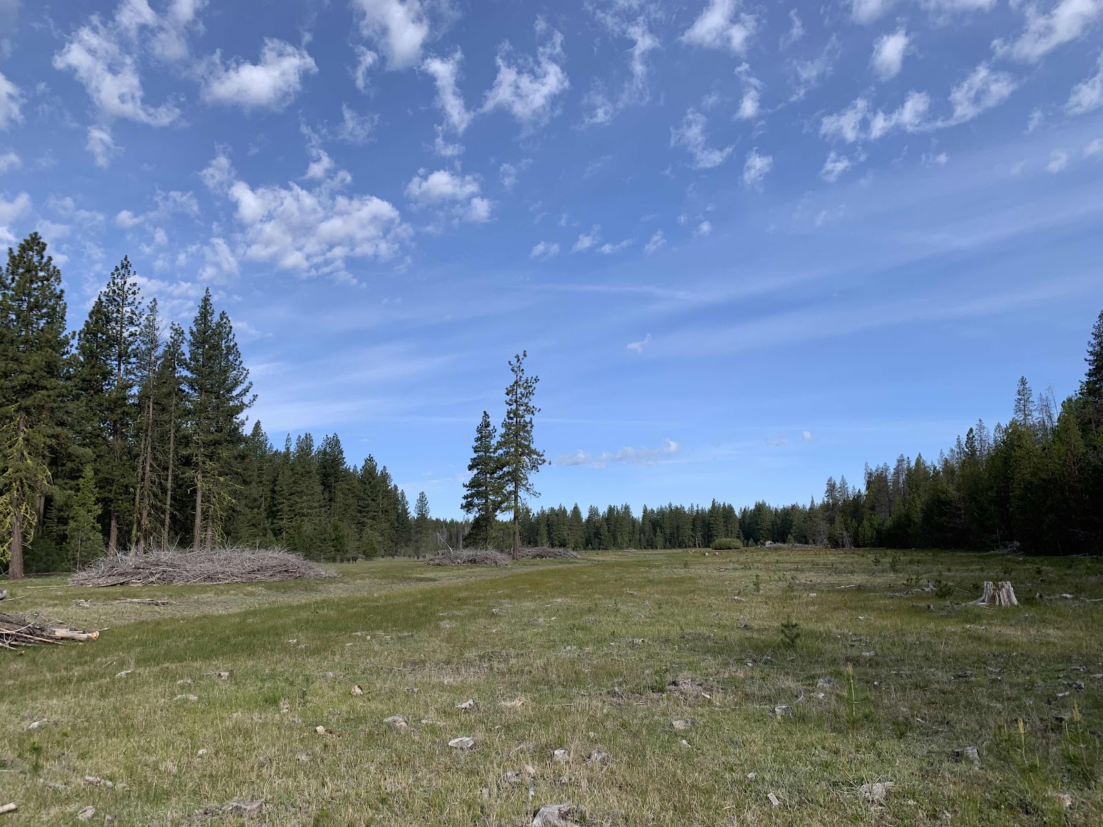
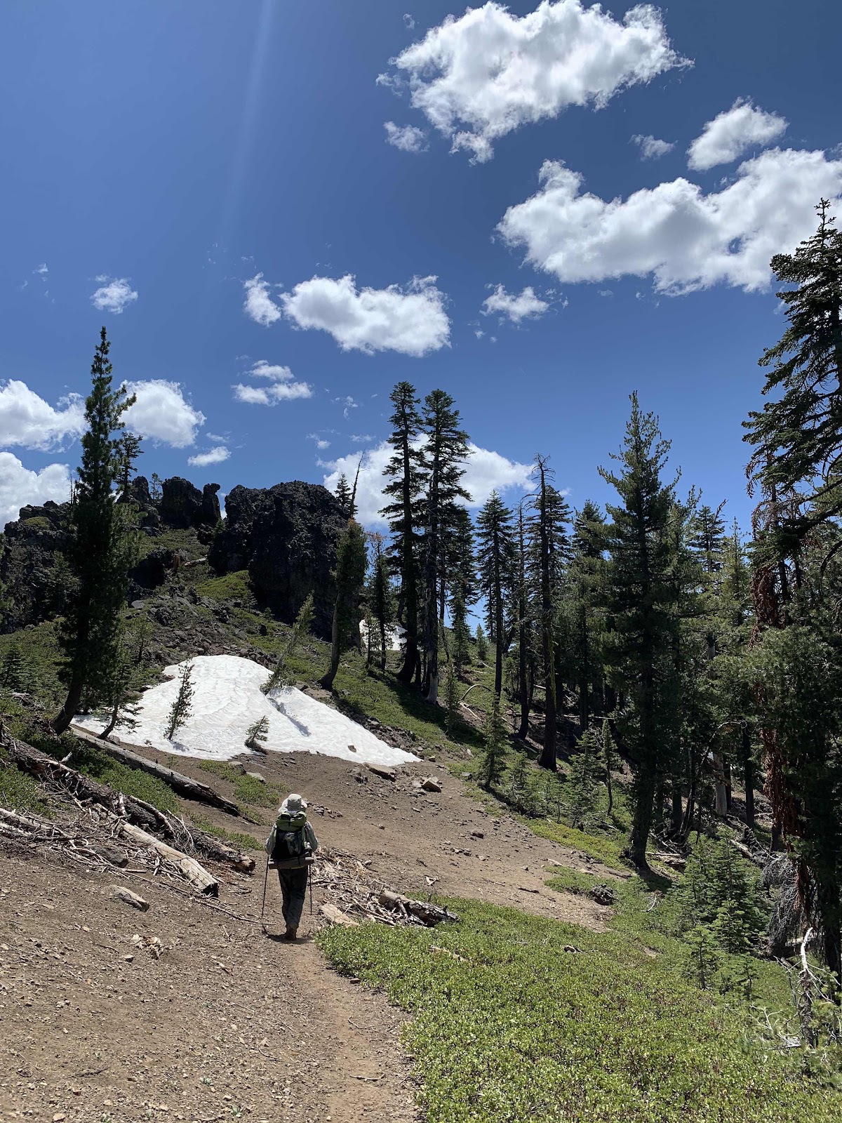
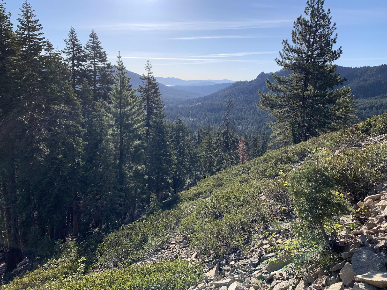
It’s a beautiful day. This is Soldier Meadow and the cattle grazing there run away when they see us. Flowers are blooming everywhere and our hearts are light. Our legs, or at least mine, are another matter as we begin the climb up Butt Mountain. The water at Soldier Creek at 3.5 miles is clear and cold.
After our last hike along the Arizona Trail this is like heaven. The trail is free of ankle twisting rocks and the water flows clear!
The dogwoods are in full bloom!
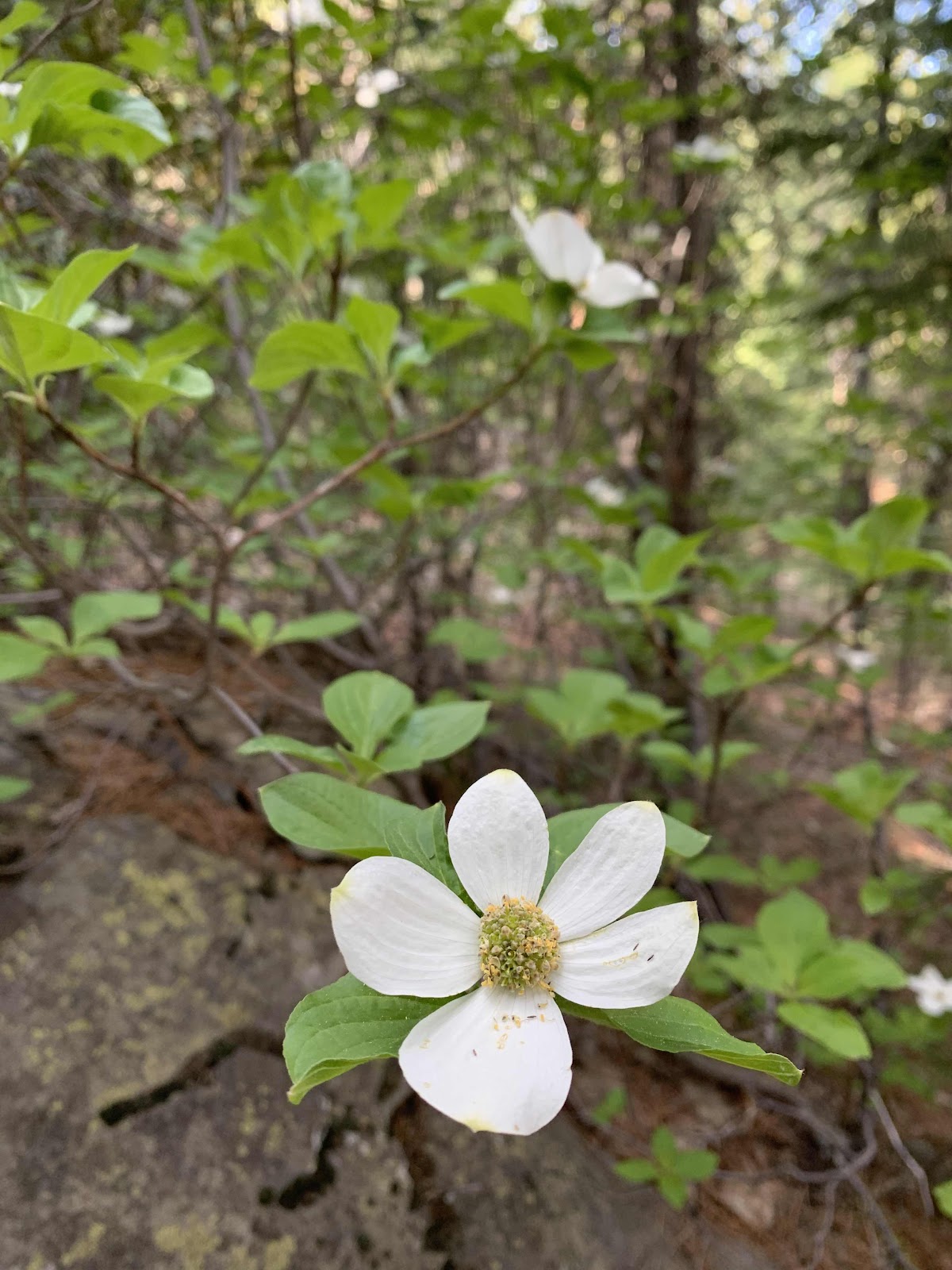
Haiku:
Morning on the trail
A delicate dogwood sings
Beauty to my soul.
This is a good time to hike this section of trail.
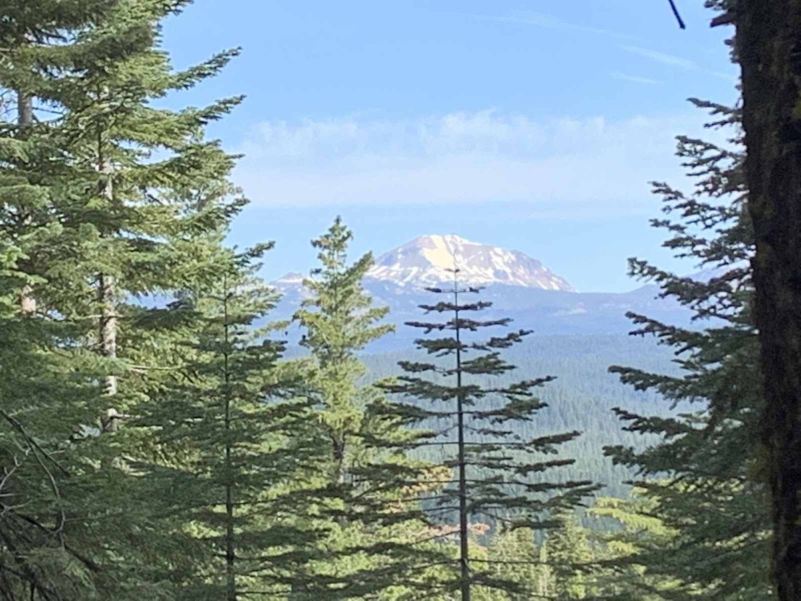
Lassen comes into view as we climb higher through the shady forest.
The highlight of our day though, is when we bump into this man.
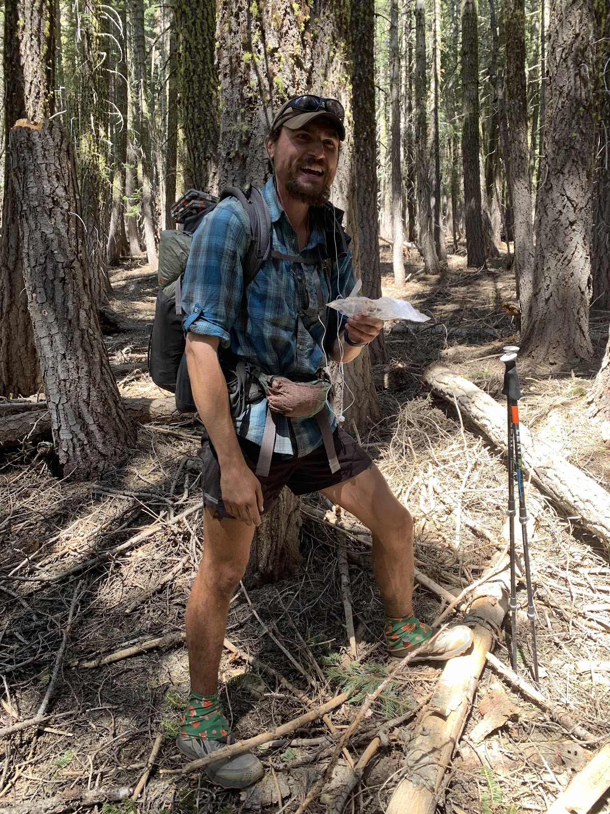
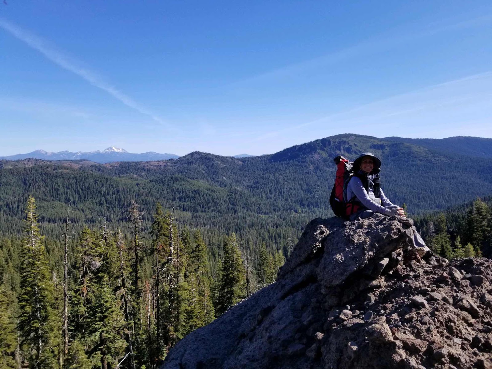
I am almost past him when he exclaims, “hey, didn’t I meet you guys in Arizona?” It’s Smash, the ex recon marine who gave us great advice and conversation when we were near Roosevelt Lake and the Four Peaks Wilderness in the early spring. He’s a great guy and we are still so thankful that he told us to stop at Shake Spring before a storm blew in and dumped 4 inches of snow on us. We didn't even know the storm was coming! It’s truly a small world in hiker land and we are really glad we could chat again. He started the PCT on March 24 and right before meeting us he crossed the halfway point. He’s covering the trail fast as he has a deadline with higher education beginning in the fall.
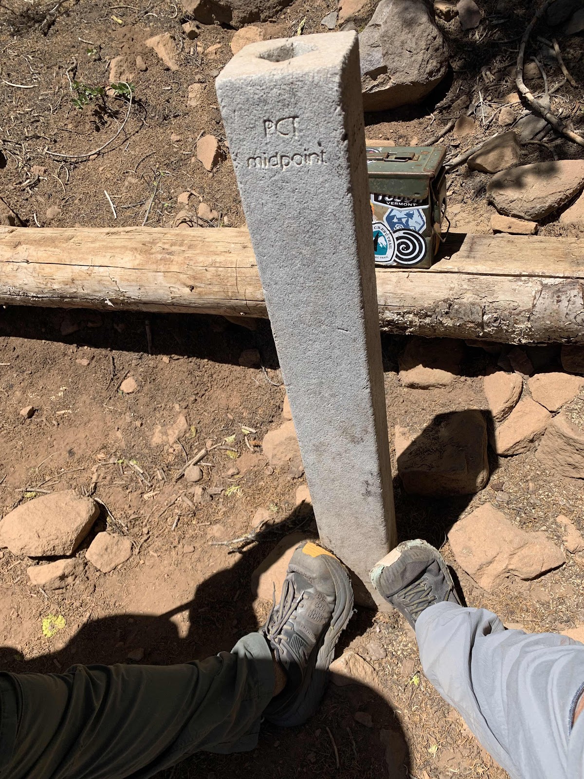
Halfway point marker
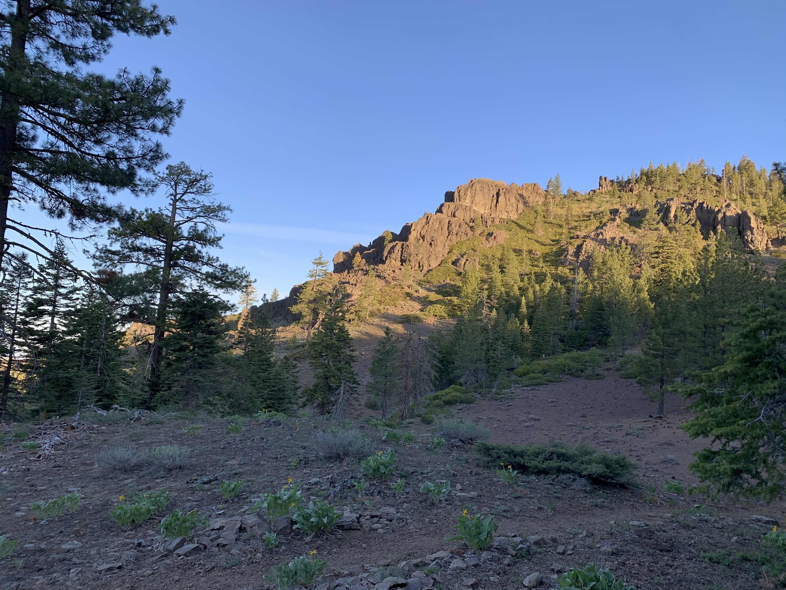
There is a bit of snow in patches on Butt Mountain and great views of Lassen in the distance.
Glorious day!
We make it to our chosen camping spot early and almost hike on, but change our minds as we’ve hiked enough miles today after our lack of sleep last night. I especially don’t want to wake up unable to move tomorrow.
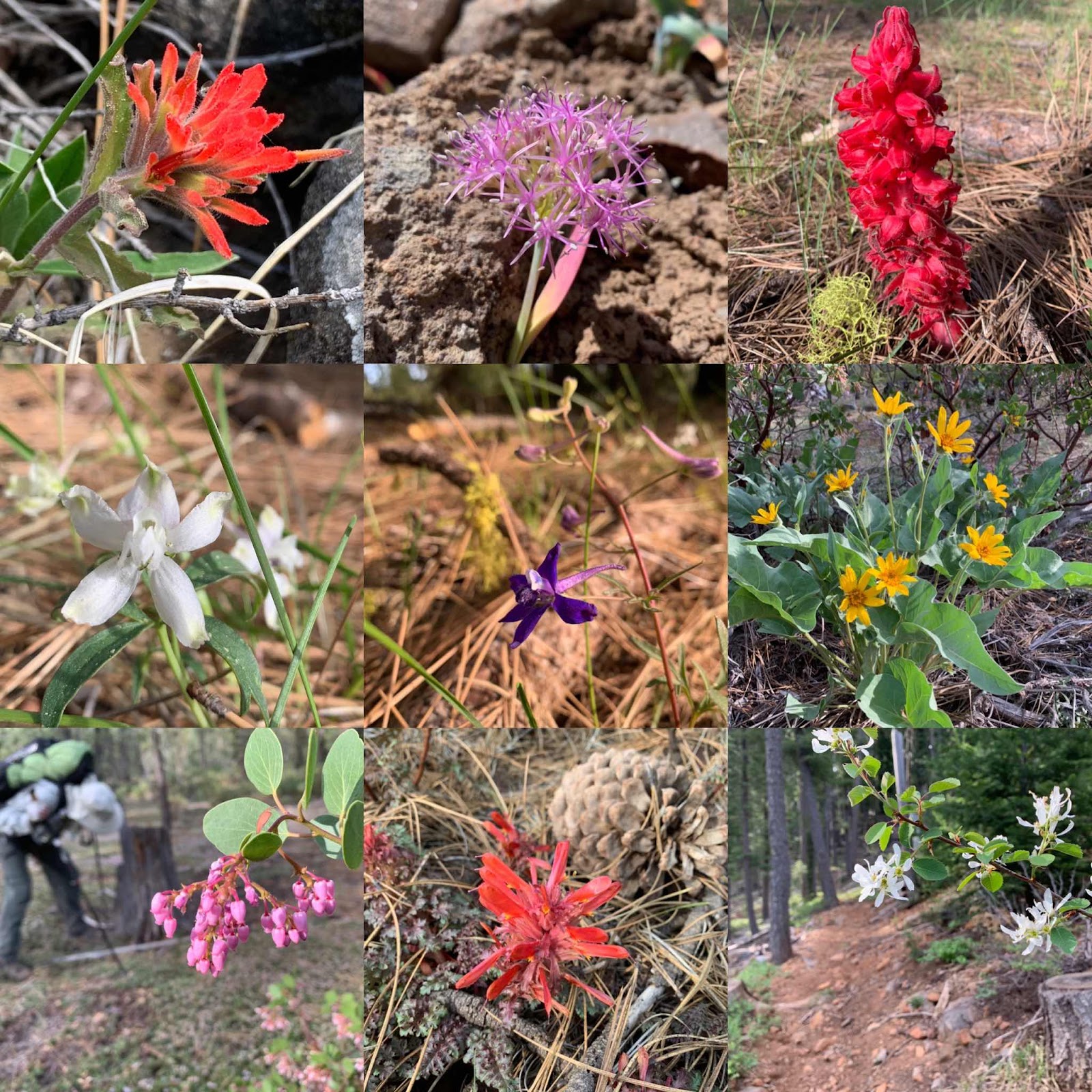
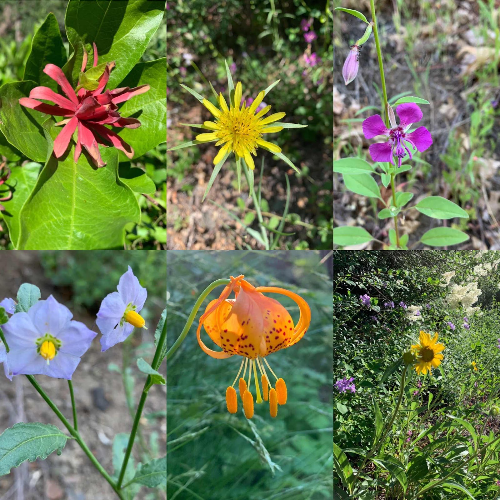
Some wildflowers along the way:
Day 3:
Little Cub Spring to Williams Flat
23 Miles
Left camp at 6:30 am as we want to hike longer miles today to set us up with a short hike out on Monday. The early morning light is magical. The air is crisp, cool and the low angle of light makes everything golden and we feel golden too.

Speaking of golden, while Hawkeye enjoyed the sunset last night (I fell asleep!) billowy clouds of golden winged termites rose from the earth to mate and then fall back to earth without their wings. He said it was an amazing sight. Our tent this morning had little wings lying all over it glittering in the sun.
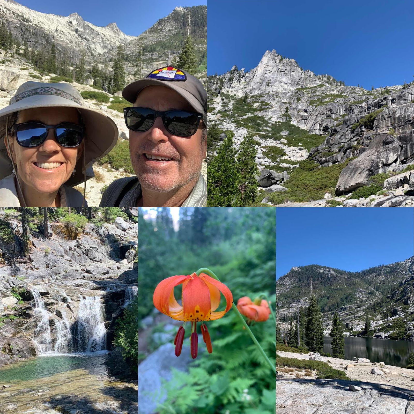
We soon run into another thruhiker named LabRat and later a guy named Strings. We are a bit surprised there are thru hikers already here as they had to cross the High Sierras in snow. Yesterday, Smash said it was a surreal and other worldly experience; everything being shades of black and white and all the lakes frozen over.
The end of our scout reconnaissance mission is at hand as their itinerary has them leaving the PCT on a side trail, so we stop and enjoy the view while texting the scouts our findings. It was fun hiking along with our eyes viewing the hike from the perspective of having 20 scouts along. TWENTY! That’s not going to be an easy feat.
It’s a fairly easy hiking day with little ups and downs. And often big views.
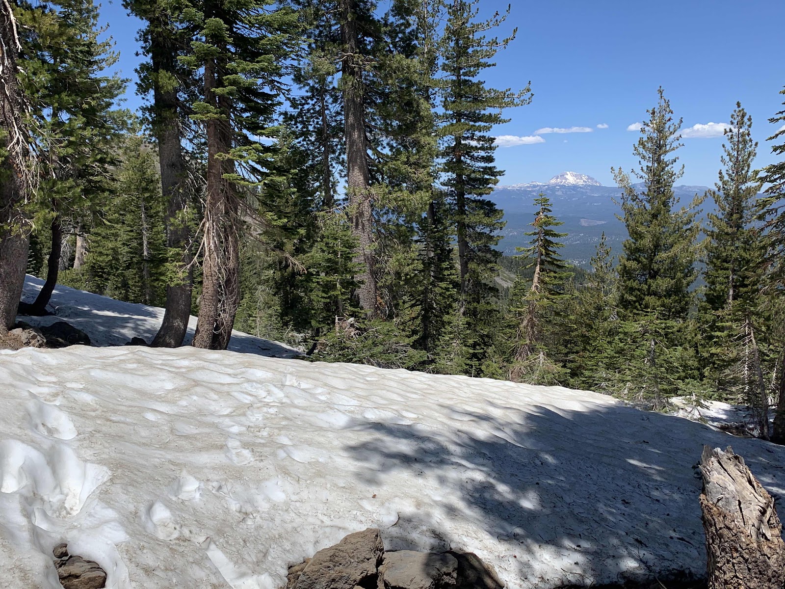
Our last climb of the day has us traversing some small snowfields and it’s fun.
We start wondering if we are in the Cascade Mountains or the Sierra Nevada Mountains and low and behold the trail provides.
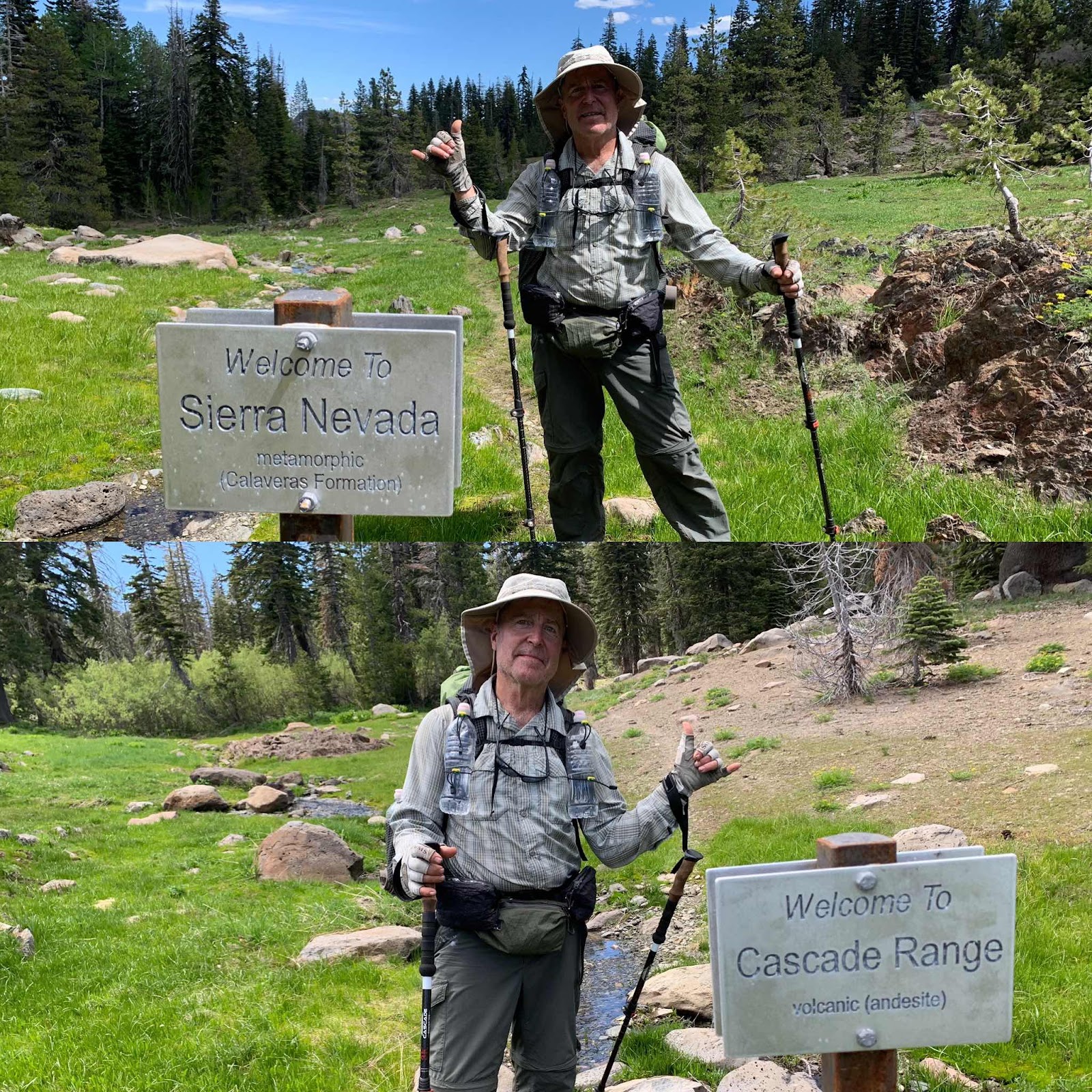
We had been in the volcanic Cascades and are now entering the metamorphic Sierra Mountains. Cool! Two mountain ranges hiked on one long weekend. Heehee! The water is plentiful in the Sierras and we see slate rock and granite. It’s weird how we can see a definite shift. We also spot our first bear of the year. Or, Hawkeye did. He always sees the cool stuff.
We are on a steady downhill trajectory now and soon come to the brand new Chips Creek bridge that was finished last December. Yay, for having a country that supports stuff like this. We are truly grateful.
Making our forests accessible for more people will hopefully help protect the forests, because once you’ve experienced a little bit of nature, it holds onto your heart.
Chips Creek is making some pure mountain music that elevate our hearts, as we walk alongside down the canyon.

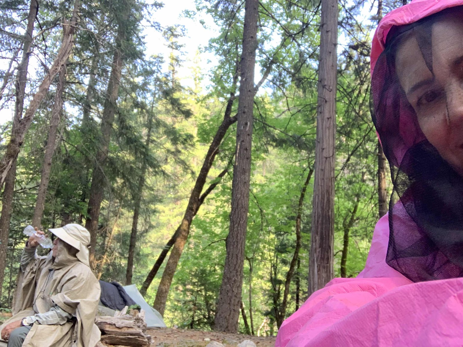
We stop to camp at less than beautiful Myrtle Tree Flat and almost get airlifted by some very hungry mosquitos, so we hurry off down the trail to Williams Flat. It’s got to be better. Williams Flat is much better and has a bit of breeze too which means a few less of the pesky feeders. Few, being the operative word. We still wear rain gear to keep them from biting.
A few new wildflower varieties alongside the trail today:

Day 4:
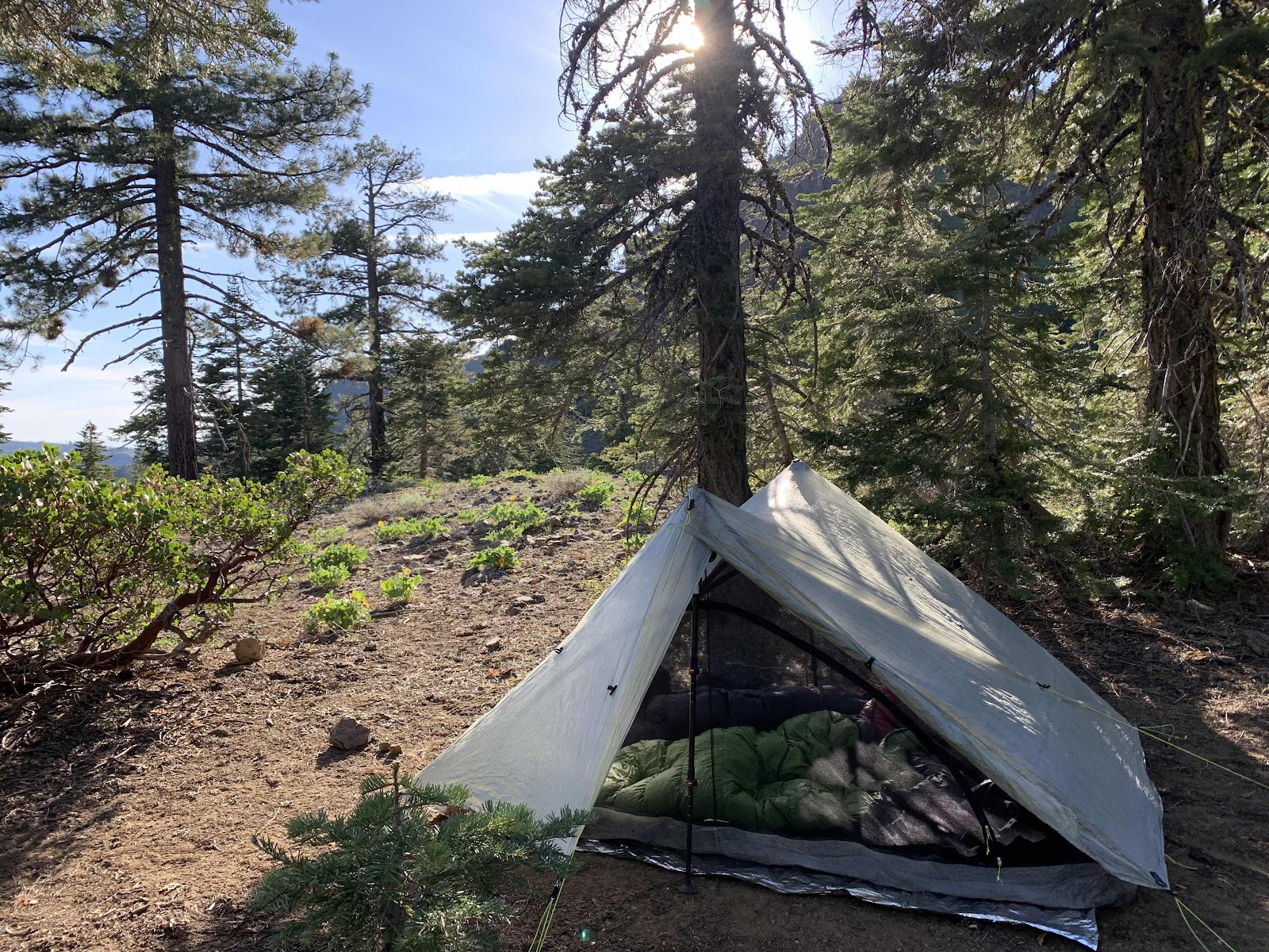
I forget my early morning resolution and sleep in and Hawkeye drinks tea waiting and snaps this photo. It’s a short 5.9 mile, mostly downhill, hike out today. Hopefully, our motor bike is still there waiting for us.
We are still hiking down canyon and the trail has a few more specimens of wildflowers for me to capture. So many beauties.
There is currently a lot of water alongside the trail as well and that must be a blessing to those hiking the other direction. We are experiencing an easy downhill hike on a beautiful morning, while northbounders would be hiking a brutally hot, mostly shadeless uphill climb. As section hikers, we try to chose the best time to hike and the best direction for each section. This section was definitely a southbound section as we’ve been hiking predominantly downhill since crossing the snowfields yesterday.
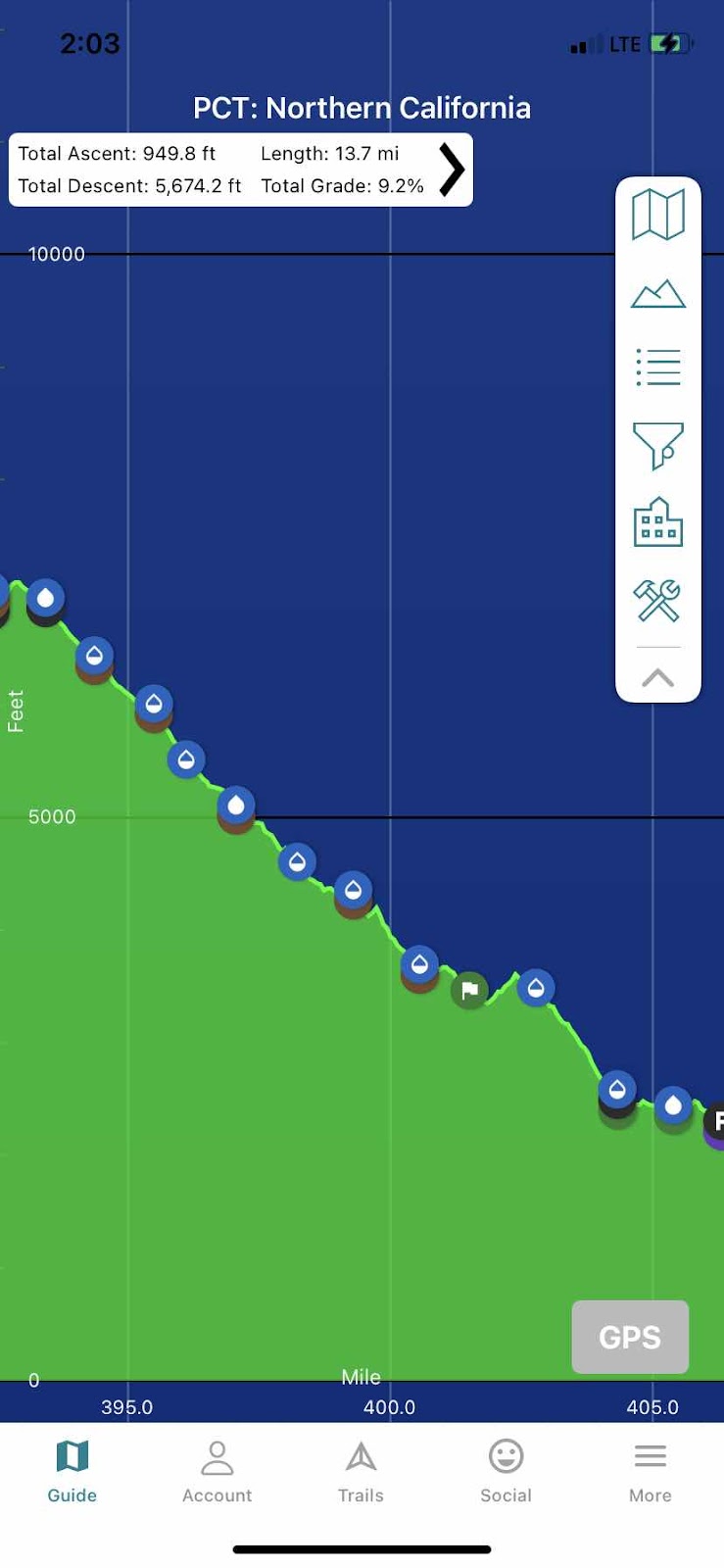
Here’s an elevation from the top of the mountain yesterday to the Feather River and Belden on Highway 70. 13.7 miles and only 949 ft of up and a whopping 5674 feet of down!
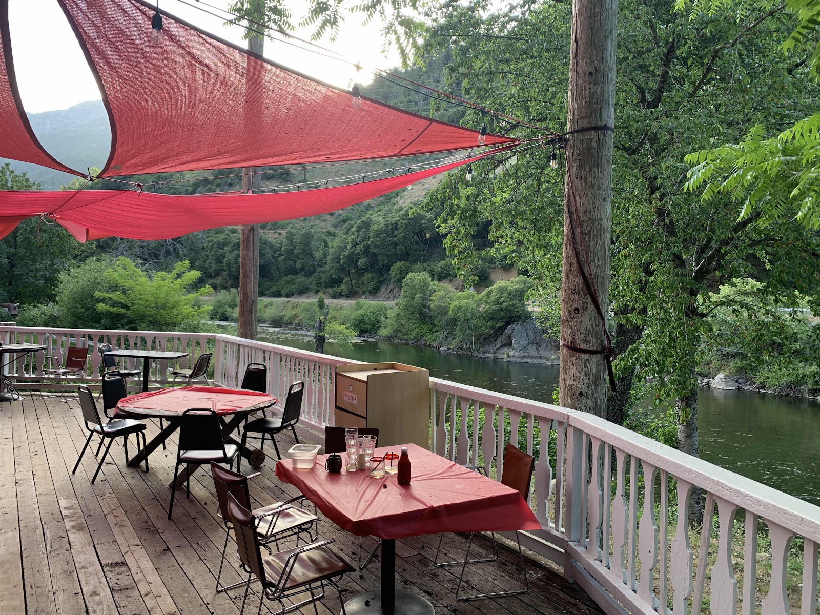
The Feather River is calling my name. Loudly. Last August we finished out our PCT section hike swimming in it and I’m looking forward to it again. There the river is right below us. We are almost done. Another hamburger and beer might be in order too.

And our bike is right where we left it. Yippee! Another successful hike is in the bag and Hawkeye is jazzed to go on a fun ride back to fetch our truck on Highway 36.
PS:
The Feather River last August was deliciously warm. On the last day of May it is Not. Brrr! But I’m clean and my aching knees feel all better.
PSS: Hawkeye chatted with the PCT hiker Strings we met waiting for a ride on HWY 36. Hawkeye also had a heckuva fun ride.
PSS: Hawkeye chatted with the PCT hiker Strings we met waiting for a ride on HWY 36. Hawkeye also had a heckuva fun ride.
____________________________________________
Fourth of July Weekend, 2021:
Day 1
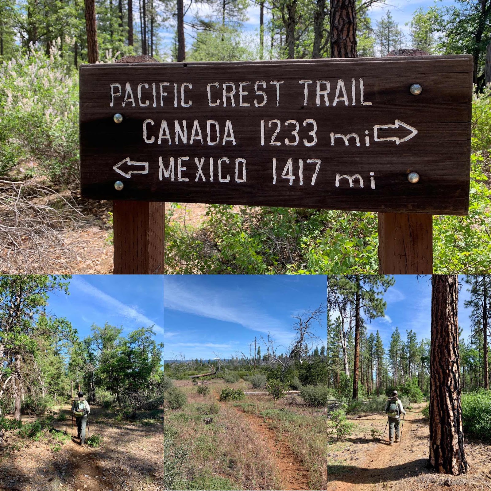
With a four day weekend at hand we decide to put in a few more glorious miles on the PCT. Our plan is to hike from The PCT near Chester northbound to the Hat Creek Rim Overlook. This will finish filling in the gap and we will have officially hiked from Mexico to I5 near Dunsmuir. Woohoo!
We contacted Larry at the Old Station Filler Up and he is going to store our return shuttle motorcycle for us as the Overlook might not be a safe place for it. This means our first short hike of the day is from the overlook down to the Filler Up. Subway caves is along the way and it’s huge and dark.
After doing a quick shuttle back for our truck we are on our way towards Chester and Highway 36. It’s a bit of a longer drive than we reckoned and we don’t start hiking until 12:30, so we decide to just hike to the North Fork of the Feather River.
It’s a hot day! I brought a thermometer and it reads a hundred degrees in the sun and 85 degrees in the shade. We have a mellow climb, but sweat drips like we are climbing a very steep mountain. Luckily there is water 4 miles out and we sit in the shade and watch the multitude of butterflies on the flowers. The pond is a mucky mess, but there is a piped spring, so the water is easy to catch and great tasting.
By 4:30 we are 9 miles up the trail, at the river, which is really more of a creek, and we strip off our sweaty clothes and sit down in the water and cool off. By six mosquitos are buzzing so we hit the sack after an early dinner.
It's hot so we lay naked on top of our sleeping bag and we doze off only to be suddenly awoken by a fisherman 'aheming'. I'm not sure why he needed to wake us up. I guess it made his day to catch two old folks laying naked. Ha! Ha! We said hi, covered up a bit and went back to sleep.
Day 2:
PCT mile 1340.7 to 1357.6

Morning dawns and we arise early. Hiking in the dimly lit forest brings a reverence and awe and a deep connection to nature and our place in it. Our voices are lowered and our loads feel light as we climb out of the creek drainage.
An hour or so later we exit the deep woods and spy a rocky spot with a view to eat our breakfast bar and enjoy a cup of coffee. We are immediately alarmed by what looks like smoke in the forest on yonder hill. It’s only after watching it a while and then looking at our map, that we realize it is what Lassen calls a terminal geyser. It’s steam we are seeing and we are very enthused to hike on and see this vent up close and personal.
The terminal geyser is just a wee bit off the trail, but so worth seeing, in our view. It’s eerie and the ground there covered in white deposits. Close to the vent the water boils. There is a bit of a otherworldly aroma too.
Later on down the trail we come to the Boiling Springs Lake and it’s other worldly as well. We have never been to Lassen Park before and we are starting to realize what an awesome geothermic park it is.
When we arrive at Drakesbad Resort, we stop and have a beer and learn that a Mr. Drake started the resort way back when. He was German and the German word for Bath is Bad and that’s why it’s called Drakesbad. Back in the day, people would visit this place to enjoy bathing in the thermal waters. It’s since been taken over by the National Park, but folks still come to enjoy all the geothermal activity and the beautiful scenery.
It’s a wee bit of a climb after Drakesbad and we sweat profusely, as it is also very hot. At the first stream we stop and dunk our heads and get water to drink. We also have a lovely chat with a Russian immigrant. She’s out for the long weekend dayhiking most of the trails in the park. She hikes with salad tongs and a garbage bag and collects any trash along the way. A very worthy endeavor.
When we arrive at Lower Twin lakes three young men in park service shirts stop us to make sure we have the required bear can. We do and we make camp on a bench above the lake. We are really surprised to see so many campers here. We check our map and realize that there is a short four mile trail to get here and the crowds make more sense.
We swim and enjoy the mountain sun and breeze and each other.
Later, while eating our dinner, two bold young ladies in bikinis rush into our camp and apologizing for the intrusion they ask if we saw the bear and cub. We didn’t. They say they were right behind us. We then notice the bear spray in their hand. They tell us a single bear had startled them earlier while they were reading in their hammocks. No noise would make it leave, so they sprayed it. Even though they knew it was illegal in California. They wanted to spray these bears too and make them leave.. They also told us they didn’t know they were supposed to have a bear can. We wondered how they got by the young rangers without a can, it just might have been the bikinis. Lol!
Day 3:

PCT mile 1357.6 to 1373.4
Soon after leaving the lake we entered a burned area. Sad! We took the Cluster Lakes alternative and it was easy walking. We flew down the trail as the weather heated up. Stopping at a creek to fill up on water we found ourselves dragging our feet as it is scorching hot. (This section should be hiked earlier). The prospect of making it to Old Station in time to get a burgee at JJ’s Cafe keeps us from laying down in the shade. We make it in time and enjoy a burger and a pitcher of ice water before we retrieve our bike from the filler up station next door.
I usually just sit in the shade with our packs and wait for Hawkeye to go retrieve our truck. Larry thought that idea a shame and he drove quickly home and got me helmet so I could ride the bike with Hawkeye! He stored our packs and we were off like a herd of turtles, because I get a little nervous on motorcycles. Larry was right though! Lassen Park on a motorbike was sublime. We loved it. We cruised along at thirty five and all the sights and sounds wrapped us up in a big mountain hug. Loved this ride!!!!

(I didn’t shoot many photos though, I just absorbed the flow)
Here’s a short video:
We got back to our truck safely and all aglow from our wonderful ride we started heading home after retrieving out packs from Larry. Thank you so much Larry!
We didn’t feel done with hiking though, and we were a day ahead of our schedule, so we camped in our camper at the Canyon Creek Trailhead in the Trinity Alps. Next morning we day hiked 8 miles in. Awesome day hike. We’ve backpacked here before and we knew it had some lovely views. After a quick swim we hiked back to our truck and then really headed home. What an awesome Fourth of July Weekend. Best ever.
Canyon Creek
_________________________________________________
JUNE 10, 2020
Hat Creek Rim to Sad Little Spot
Mile 1383.2 to 1401
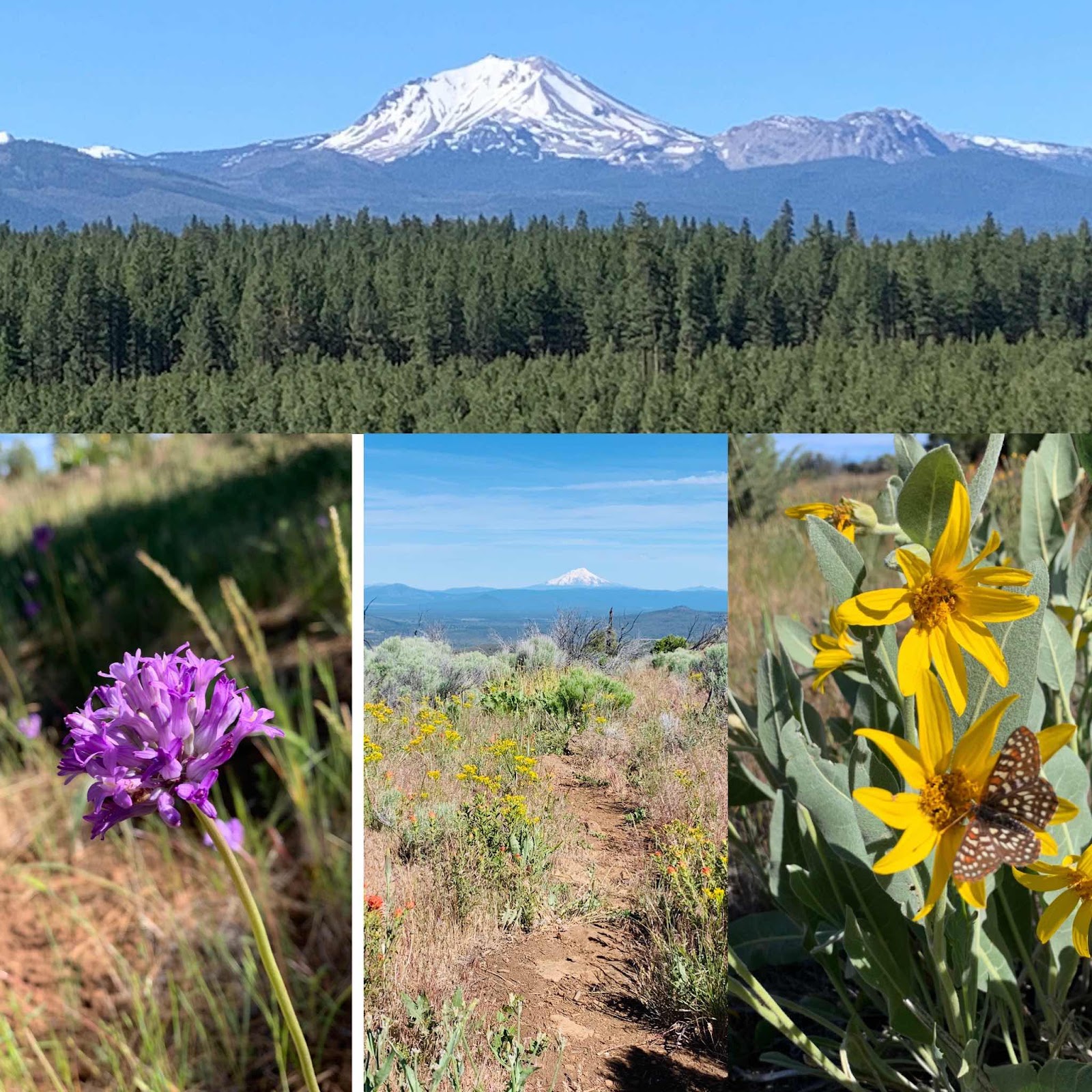
It got a little chilly in the night, and then morning dawned clear and warm. We are surrounded by eye stretching views. Mount Lassen is close and to the south of us with Mount Shasta far to the north. The trail is mostly flat, trending down and with a few undulations. We planned on only hiking 15 miles today, but it's only 3:00 pm when we finish our miles , so we hike a while longer and stop at 4:30. Now my darn knee hurts. Just because it’s easy doesn’t mean it isn’t too many miles to start out.
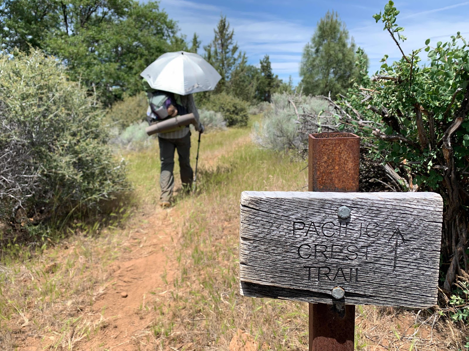
We loved walking today along a flower lined trail with eye stretching views and two mighty mountains. The most dominant wildflower was the bright fluorescent orange/red of Indian paintbrush. We were on a high narrow ridge with a steep drop off of about 700 to maybe 1000 feet to the west of us. A rim walk. A breeze blew some which really helped with the heat of the sun. Most of this day’s hike was treeless and so most of the day’s shade came from our umbrellas. We have a love/hate relationship with our umbrellas. When we use them, like today, we love them. When they just go along for a ride, unneeded, they are a half of a pound we hate.
Water was scarce. We carried our needed water in last night and then hiked 10 miles this morning to get to the water cache at Forest Road 22. Note to other hikers, the cache is not the big black tank. It is a small tank to the right behind the boards. There are flat spots to camp here as well.
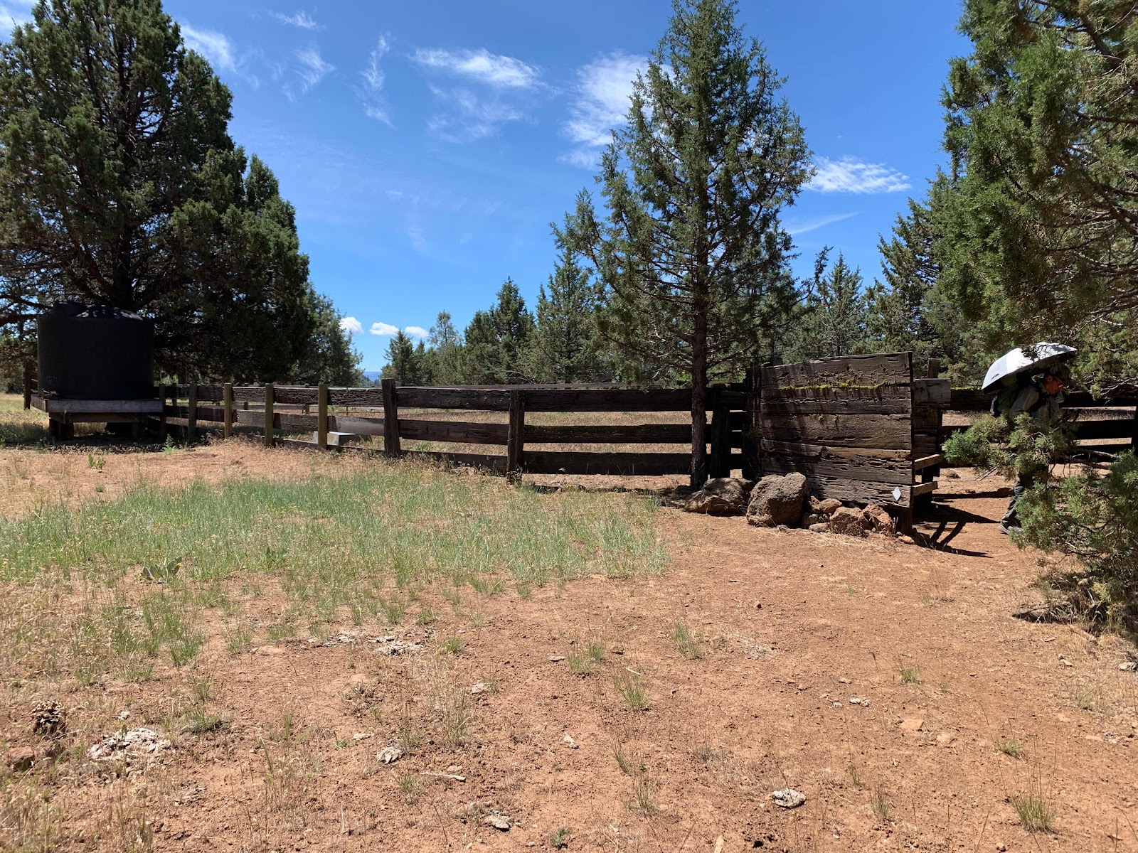
There are quite a few random camping spots along the rim. Once you drop down into the volcanic rock flows it is harder to find a camp. We are currently at an unlisted flat spot right off the trail (not on Guthook app) . It is a sad little spot, but it does have a peekaboo view of Mount Shasta. Almost all of this section of the trail has a view of Shasta!
We are enjoying the bird and bug sounds right now and especially this sparkly pine tree that we are sprawled under. Did I mention it is kind of hot? I think its needles look like water sparklers. They shimmer and shine just like sunlight on water. It’s quite a long time to sunset and my mind just starts to wander and wonder. We really wish we could have kept walking, but did I mention my knee hurts.
Sad Little Spot to Burney Guest Ranch
PCT mile 1401- 1409.7
It was a warm night . We enjoyed the starry skies and awoke to another beautiful day. My knee did not miraculously heal and is still a bit tender. It’s a short, easy 9 mile hike to the Burney Mountain Guest Ranch. More flowers and a couple of lakes and a fish hatchery are walked passed. We use the Guthook app by the power station and fish hatchery, as the trail is not well marked here. There are also lots of ancillary trails that fisher folk use that confuse the issue more. We see a few fisherman and fisherwomen and we realize we’ve only seen one hiker in three days. That’s pretty incredible for the popular PCT. Hiking in the time of Covid-19 is definitely different.
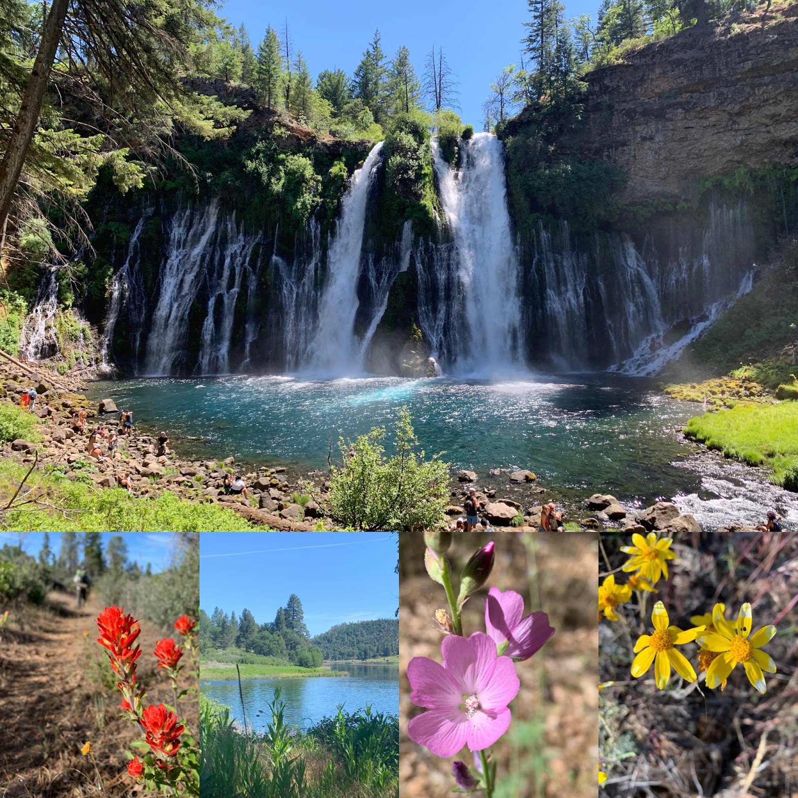
Once we arrive at the guest ranch we get in out truck parked there and we go fetch the Subaru back at the trailhead and then drive over to visit Burney Falls. It is amazing and awesome! Totally worth a visit. We leave a vehicle parked near the falls as we are going to just do a day hike to the falls tomorrow to see how my knee feels before we continue on to Dunsmuir.
Currently, we are poolside at the ranch. There is one other older hiker here and the owners. Linda, the proprietor, says there has been a few self contained section hikers this year, but not many. She is taking a lot of precautions as she has an elderly mother in law here. We are camping on the premises, but there are also cabins for rent and they also have an amazing hiker resupply store, cold drinks and microwave food as well as showers and laundry facilities. Usually she also provides two meals a day, but this year, alas, is different.
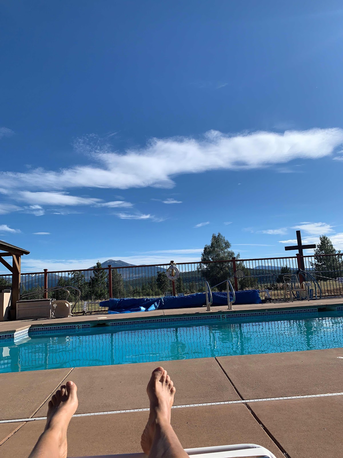
Poolside at the ranch with a view of Burney Mountain.
Burney Guest Ranch to Burney Falls State Park
PCT Mile 1409.7 - 1419
Pleasantly warm again last night and an easy hike to Burney Falls State Park where we left our car yesterday. My knee felt fine after it got warmed up. We will continue our section hike to Dunsmuir.
We traverse oak woodlands and ponderosa pine forests as well as a burned over area. We get airlifted a time or two by hungry mosquitos. We see two day hikers and another couple section hiking. They were the highlight of our day.
I wish I had taken their photo, but I will try to paint a picture with my words. We met them in the burned out area of our day’s hike. They were resting on a fallen log beside the trail. Canary was wearing a aquamarine long sleeve blouse over a blue t shirt and had on bright pink knitted gloves with a hole in the left index finger. I bet so she could use her phone, which also suggests she is left handed. She has on lightweight hiking boots and an ALPS pack sits beside her. I’m guessing she’s somewhere between 40 and 60 years old. I’m horrible judging age. Her hair is brownish blond and pulled back, but curls broke free around her face. Her smile is warm and unguarded. I liked her instantly. She proudly introduces us to her hiking partner, Tortoise. He’s 80 years young. He’s wearing clothes colored like a ranger with tan long sleeve shirt and olive green pants and boots. His pack is an old school external frame relic and golden brown. His skin is weathered and his eyes the color of the sky. He looks directly into your eyes and when he grins you see a large space between his front teeth. I fall in love. They started section hiking the PCT seven years ago and have plans to finish it this year. This encounter was an 'aha' moment that I’m always looking for. I am a bit of a gear junkie and always thinking lighter gear will make me a better hiker.. Ha! It hit me over the head that it’s not the gear that makes you a better hiker, but it’s the grit you have in your heart. These two ooze grit. They have another south bound PCT trip planned for the fall of a similar section we hope to do north bound, and I sure hope we meet again.
Talk about relics. The signs in this area are delightfully old and unblemished by bullet holes. Nice!

We are currently back poolside at the guest ranch and plan to move a car ahead to Interstate 5 near Dunsmuir this evening. It’s a straight shot up scenic highway 89 to I-5 then south to Soda Springs Road.
Comments
Post a Comment
We love your comments or questions. Have a great day and live a good life.