Burney Falls to Peavine Creek:
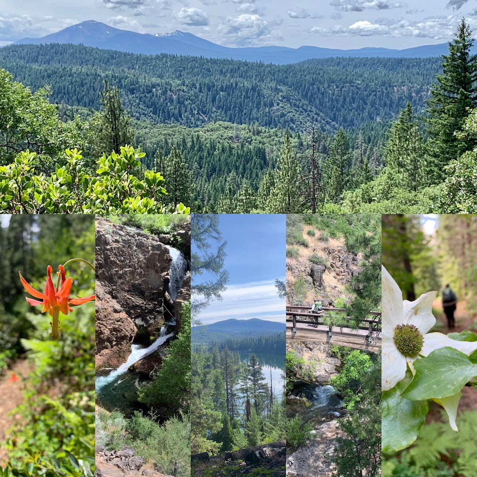
PCT trail mile 1419 - 1432.7
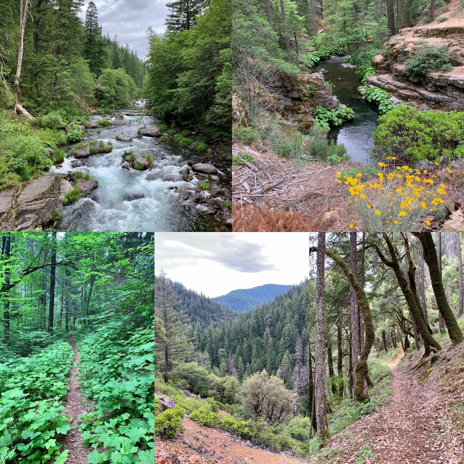
Great green tunnel hike today in the peaceful presence of a mighty diversified forest. We loved it. Birdsong accompanied us all day and we saw many orioles. There was the rush of wind off and on in the evergreen canopy overhead and billowy clouds could be seen when we looked up through the dancing trees. There was such diversity in this healthy forest: cedar, pine, fir, maple, ash, alder, oak, lots of dogwood and all kinds of shrubs and small plants too. We walked amazed. It was one big green experience and we even got to have an ice cold bath in Rock Creek. We like being chill. We didn't get in very far though, as there is a big waterfall right downstream.
A thunderstorm developed in the afternoon and it rained and spit some hail. With everything wet it allowed for a campfire.

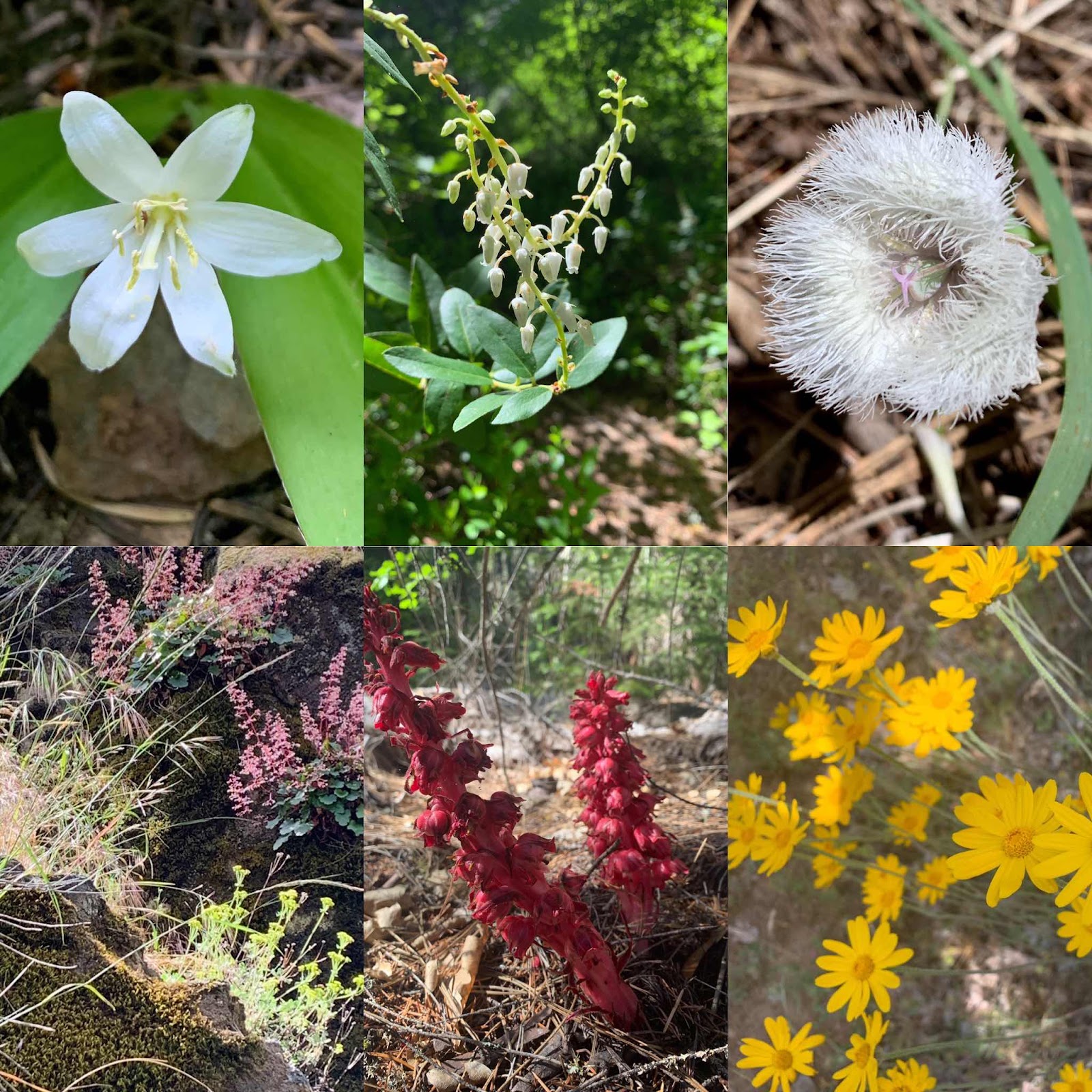
Just a small few of the many flowers we saw today.
Peavine Creek to Moosehead Creek:

PCT trail mile 1432.7 to 1447.3
It was cold. It was wet. There were water soaked trees flowers and bushes that drenched us from the thigh down as we walked. We brought only lightweight ponchos for this low elevation hike and the forecast did not project rain. Ha! Never trust the weatherman. I imagined having my rain pants on as water ran down my legs and squished out my shoes. Clouds swirled all around us and we could only see the path a few steps ahead and all those lovely wet, plants overgrowing the trail. Not to say that the flowers weren't polite as they all had their heads bowed as we walked by.
It could have been worse. We met a young man who two days ago got to his stopping place for the day and realized he had lost his tent. He slept without it that night and then backtracked to find it. He found it, but since he was almost out of food he is heading back to Burney to resupply before continuing. He was wet, cold and dejected. I hope we encouraged him. He started in Chester and wants to hike to Canada.
Hiking itself was easy with short ups and short downs. We are now happy to be in our tent in our warm down sleeping bags. I’m starting to feel my feet. Hallelujah! They were pretty much numb all day. The temp might have hit 50 degrees Fahrenheit and we might have seen the sun peek out once. Hence my few photos. My phone is not waterproof and I had on white kitchen gloves as a vapor barrier, then lightweight warm gloves and on top of it all surgical gloves to shed the water. To take a photo or open my phone was a bit of a chore, not to mention cold, so we mostly just hiked.
Moosehead Creek to Butcher Knife Creek:
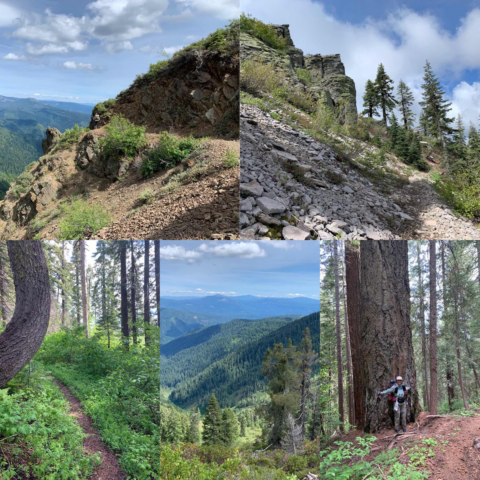
PCT Trail Mile 1447.3 - 1467
I heard Hawkeye blowing up his sleeping pad in the night and in the morning he was sleeping on a deflated pad. We used the nearby creek to submerge it, but were unable to find the hole to repair. By this time his pad was very wet and we were very lazy, so we sat in the sunshine enjoying a second and then a third cup of coffee while his pad dried. Poor Hawkeye! He will have a few more nights of blowing up his pad every couple of hours.
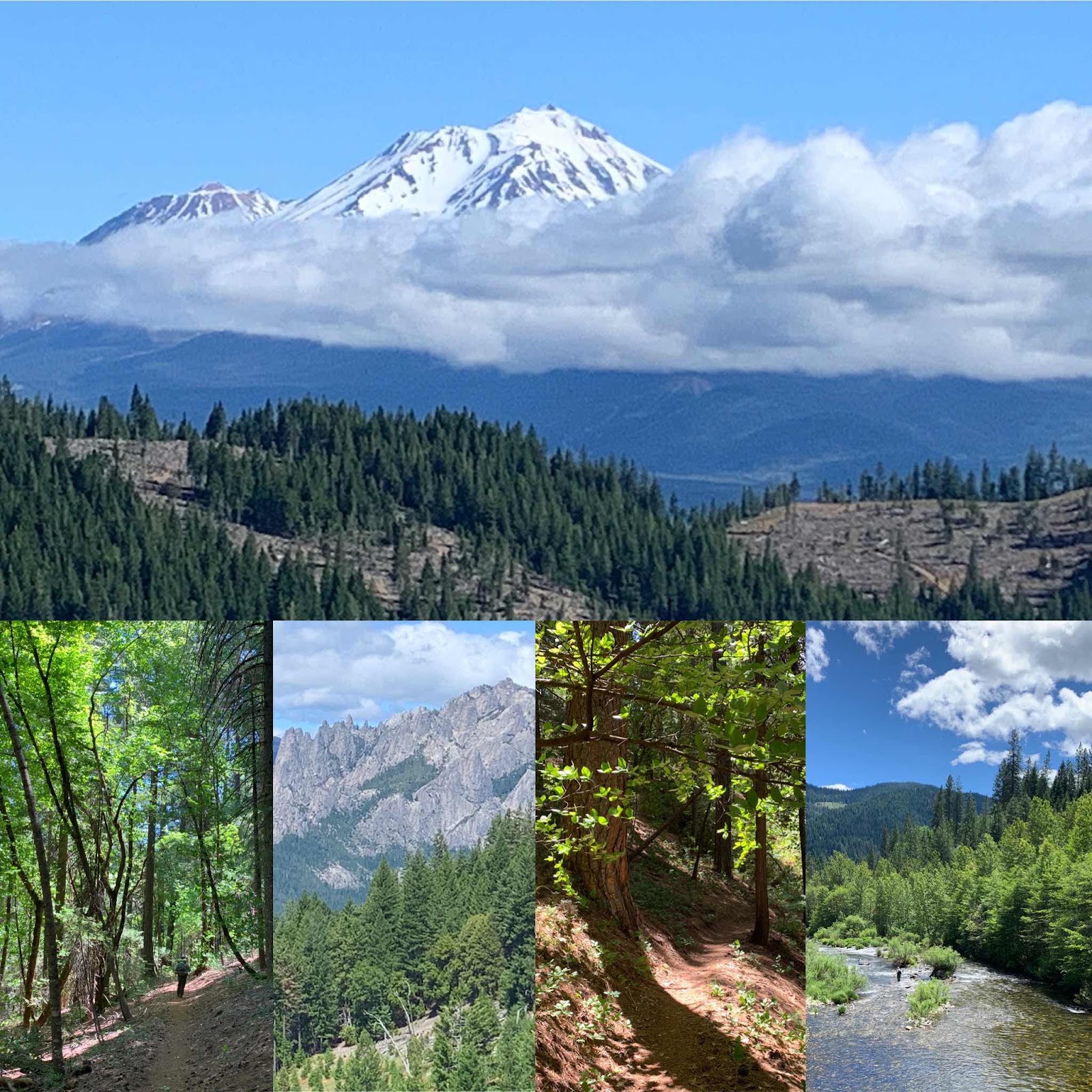
Today’s walk itself took us from deep forest to a cliff edge hike and then back again into an ancient forest full of old growth cedars and fir trees. We even saw a few patches of snow and a young, shiny black bear. The bear was in the brush just off the trail and we could hear it and see glimmers of his black coat. We introduced ourselves as it ran off briskly in the other direction with a lot of plants wiggling and shaking. He wasn't very sociable.
We also got a view of Mount Shasta today, Woohoo, albeit under the cover of clouds. We also spied Mount Lassen way off in the south. When we began this journey at Hat Creek Rim, Mount Lassen was quite close. We are always amazed at how far our feet can take us. We humans are wonderfully made, aren't we?
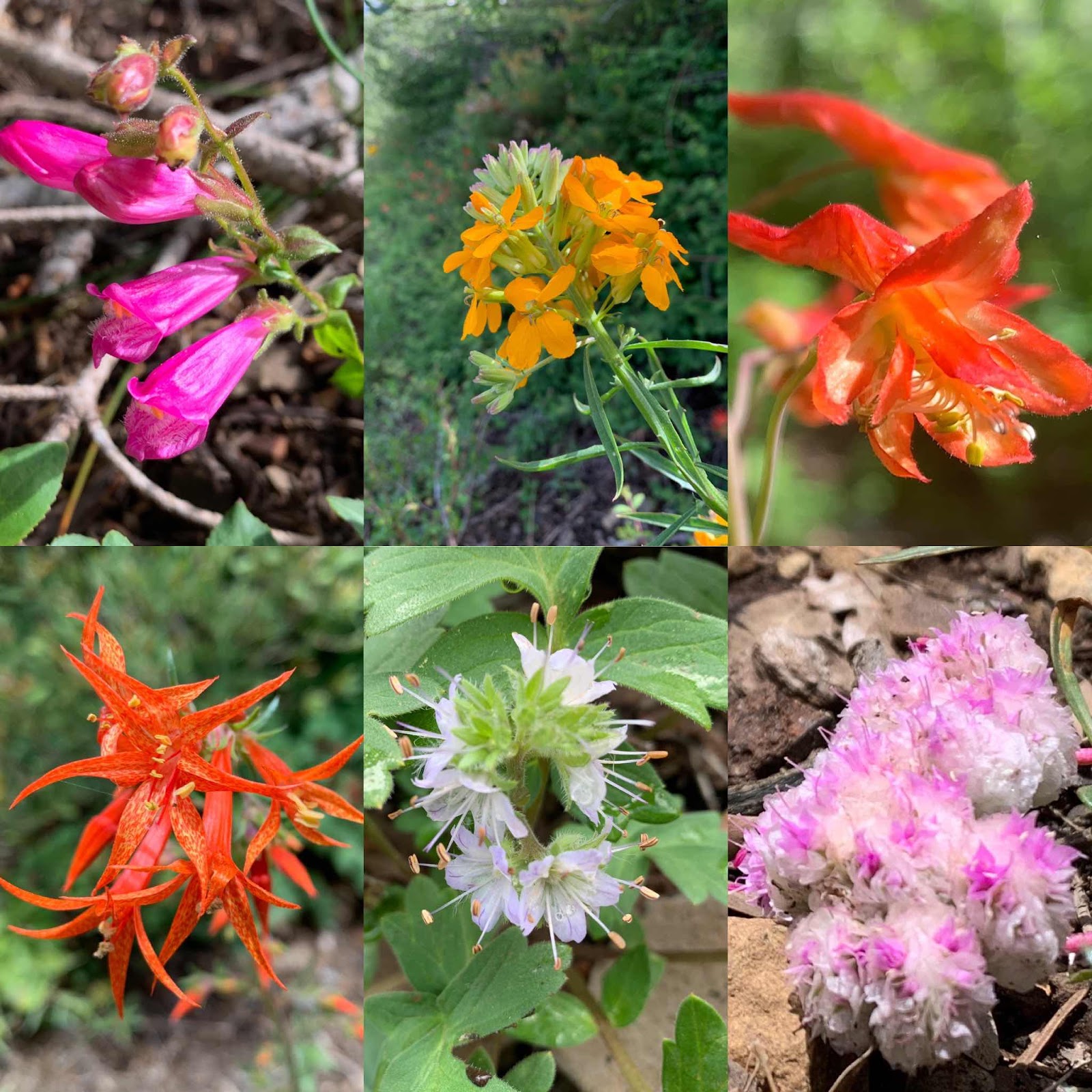
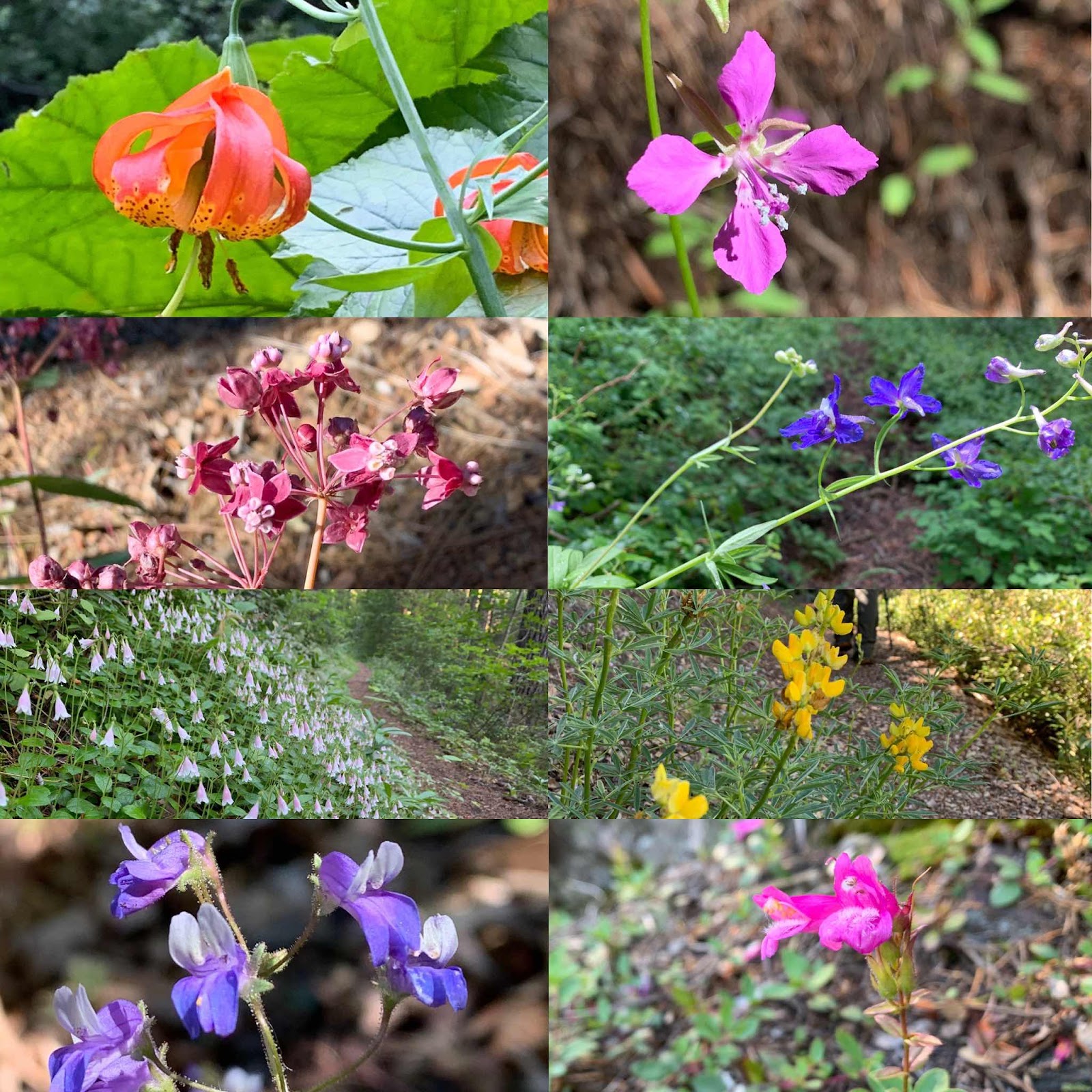
The weather was agreeable as well; neither hot nor cold. It made up for yesterday. I think. Water was plentiful, as were the flowers. I love seeing wildflowers. There were the standard show stoppers like columbine and the fluorescent orange Indian paintbrush, but there were so many others hiding in plain sight doing just what they were intended to do. I find the degree of similarities and differences in the plant world very satisfying. I think about how the differences in people are also beautiful and enriching. Too often, people, myself included, think they should be like others and aren't their best selves.
"Be yourself, all the rest are taken."
A few of today's new and varied faces:
Butcher Knife Creek to Squaw Valley Creek:
PCT Trail Mile: 1467.1 - 1484.6
Sunglasses not needed today. It made for nice hiking though and we did have our first sustained climb of about 1500 feet. This section of trail is overall pretty easy when 1500 feet is a big climb.
It’s beginning to sprinkle now as I finger type beside our little fire next to Squaw Valley Creek.
We left our cozy camp at Butcher Knife creek around 9 am. Although, how I can call it cozy with a spooky name like that? We looked around for knife, but only found large bear marks on a tree. YIKES. That was kind of spooky. Glad I saw them in the morning and not last night.
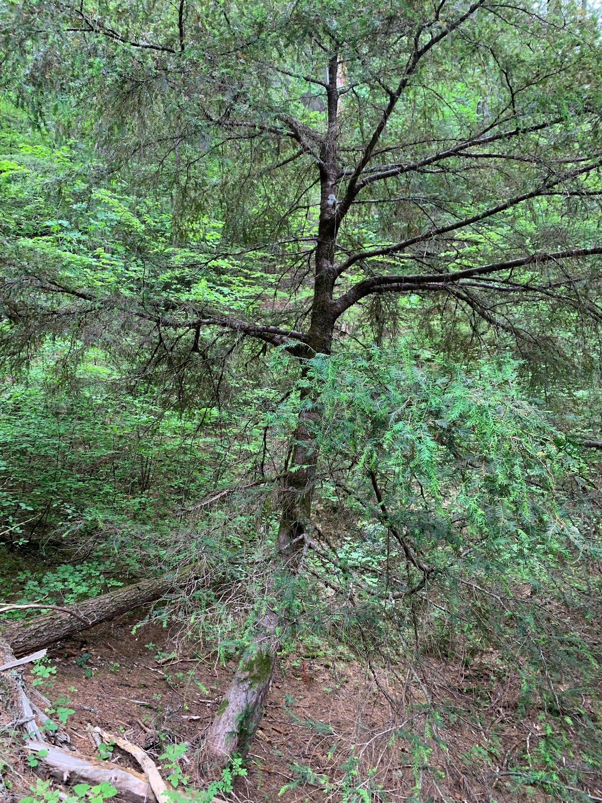
The trail trended down from camp and the drainage was very steep. All you see is trees and shrubs. There were more old growth trees to admire and we think this odd tree with needles like a redwood is a yew. We saw quite a few in this drainage.
We eventually came to the beautiful McCloud River and Ash Camp. It made me wish I had a fly pole and a day of fishing. Not that I’m any good at fly fishing mind ya, but I’ve spent some really nice days in nature going upstream trying to present a fly to a hungry fish. The McCloud is the river on the left in the first photo. The river on the right is Squaw Valley Creek and it’s a beauty too. We are camped right above it at the nearby trailhead.
There are lots of flat spaces at the trailhead and one thing in short supply today were flat spaces. These are some rugged mountains we hiked in. We would leave one drainage, climb over a ridge and enter another steep sided drainage. We went through various zones depending on the elevation. At our highest we were right under 4000 feet in elevation and the lowest elevation I believe was 2200. Some areas were green and lush and others were dry oak scrub.
Part of today’s fun was avoiding, or trying to avoid the poison oak. We called it 'hot lava' and tried not to get burned up. Time will tell how well we did as it nearly covered the trail in some areas. Flowers too were everywhere. Here are a few of the ones we saw today.

We are so appreciative that the people of our great nation took the time and resources to make, maintain, and allow for trails such as this. May these values of protecting wild places continue. It is obvious that this trail was not easy to build nor to maintain and it is an absolute blessing and honor to be here experiencing a pure and simple life surrounded by nature.
Squaw Valley Creek to Soda Springs:
PCT Trail Mile 1484.6 - 1501.2
Last day on the trail for this section hike. Boohoo! I love, love, love living the simple life on the trail. I love, love, love moving my body across the land. The connection to nature that we humans have is deepened by spending all our time interwoven with it. No concrete or wood underfoot, just earth. It’s wonderful and grounding.
We pack up and leave our camp early as upon completion of our hike we will have a five hour drive to home. There is a six mile climb out of the valley, but like all of the PCT, it is gradual and evenly graded. The weather is brisk and helps to make the climb easy. We get to the top of the ridge faster than expected and realize we could break our speed record. Haha. We walk down the other side as speedily as we can and enjoy going through all the ecological levels again. We especially enjoy seeing Mount Shasta. Wow! What an awesome mountain.
I take less photos than usual and we stop only two times. Once to talk briefly with a bicyclist and once to go to the bathroom and have a bite to eat, but not at the same time. Haha. We drink about a liter of water in the 16 miles and arrive at our car at 1:30 pm, about 6 hours of walking. Overall, this section of trail seemed easier than others we’ve hiked on the PCT . It could be, though, that our last hike was on the southern section of the Arizona Trail. That trail it is so steep in a few places that I was actually climbing on all fours a couple times. Haha. Whatever the case, we’ve really found this hike pleasant.
Today’s flowers:
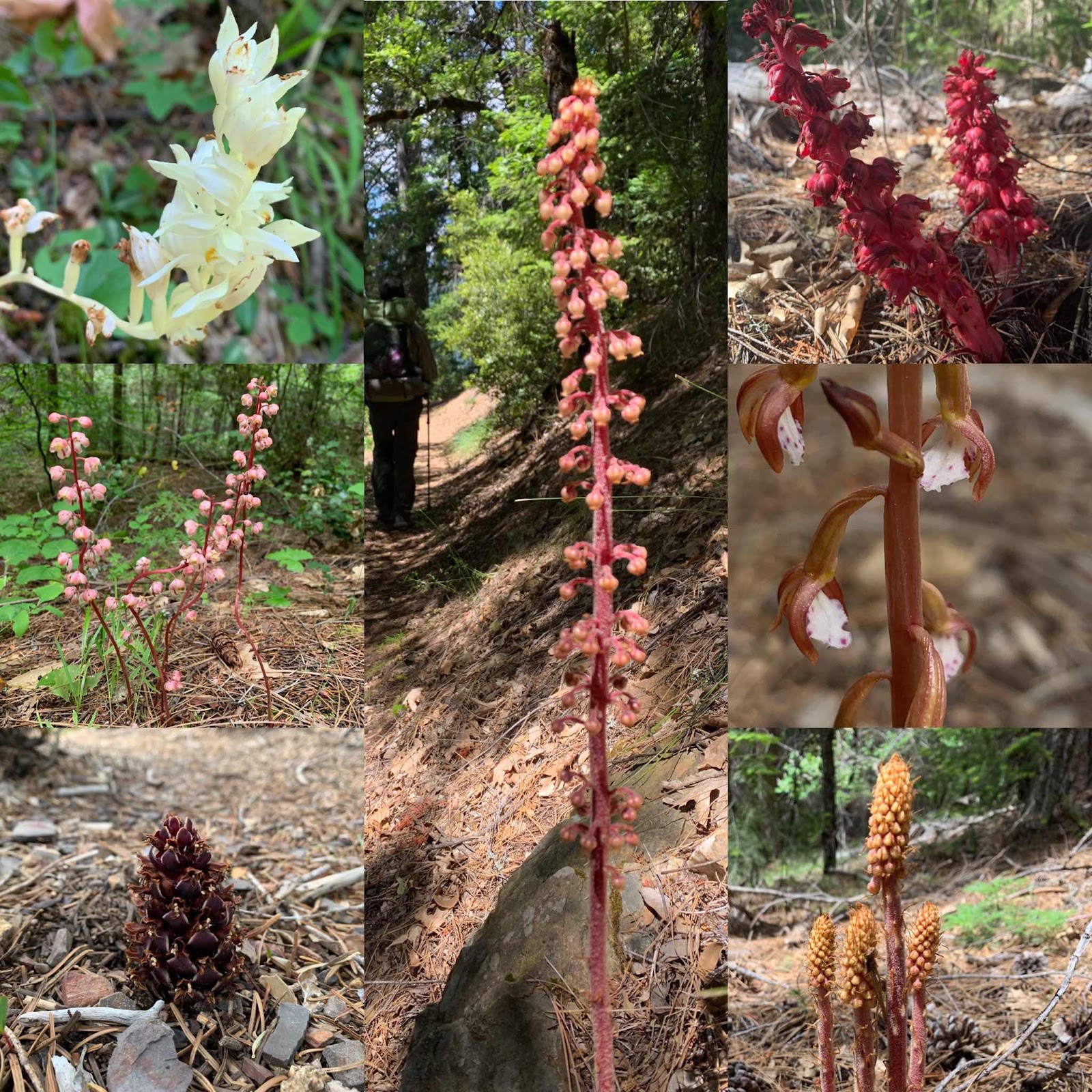
And these strange plants were all along the trail since Burney Falls. They are from the orchid family, corallorhiza. Commonly called Coral Roots. We have them on our ranch too and they must be tasty as the cattle often eat them.
Comments
Post a Comment
We love your comments or questions. Have a great day and live a good life.