The Ocean to Lake Hiking Trail in South Florida is 61 glorious miles long. Most folks hike it from Lake Okeechobee to Hobe Beach, because ending at the Atlantic Ocean is a lot more of a climax and logistically it’s a bit easier. We discovered the trail to be a microcosm of the 1100 plus miles of the Florida Trail that we thru hiked in 2019. It covered many of the same habitats that the FT did. This trail brought back a lot of good memories for us and also created quite a few more.

I had earlier in the month gotten a free permit from the Dupais WEA for camping, so we set our GPS for there. Camping at Dupais was great. We heard a huge pack of coyotes run by howling in the dark. It was super cool and eerie. In the morning we drove to the picnic pavilion to begin our hike. We followed the white blaze to the orange blazed OTLHT. We had been told that our car would be safer here than the NENA trailhead. We also left a note on our dash, just in case a ranger came by. The mileage is about the same as starting from the LOST/NENA trailhead at Lake Okeechobee. Another option would be to Uber from Hobe Beach to the NENA trailhead.

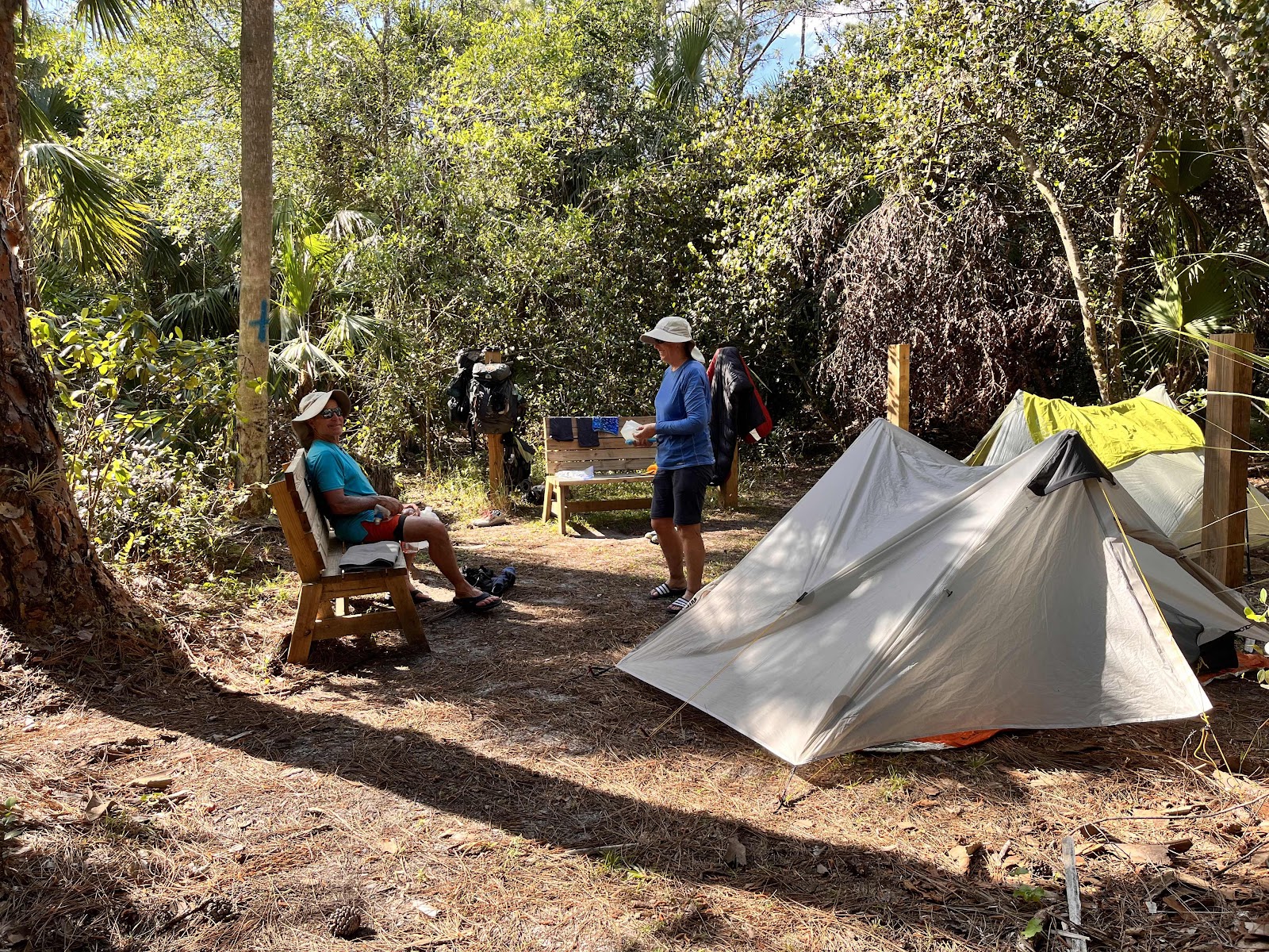
We hiked for a few miles before stopping to dry our gear out. Florida hiking generally means a lot of condensation and scheduling in some drying time is important to us. We hiked through a controlled burn area for a while and while taking a break at the four mile camp we met a young man on his very first backpacking trip. He had been dreaming of this hike since 2020 and his excitement was contagious. Later, we all camped together at the Powerline Camp at trail mile 14.5. There’s quite a bit of room along the levee for tents and there’s multiple posts for hammock hangs.

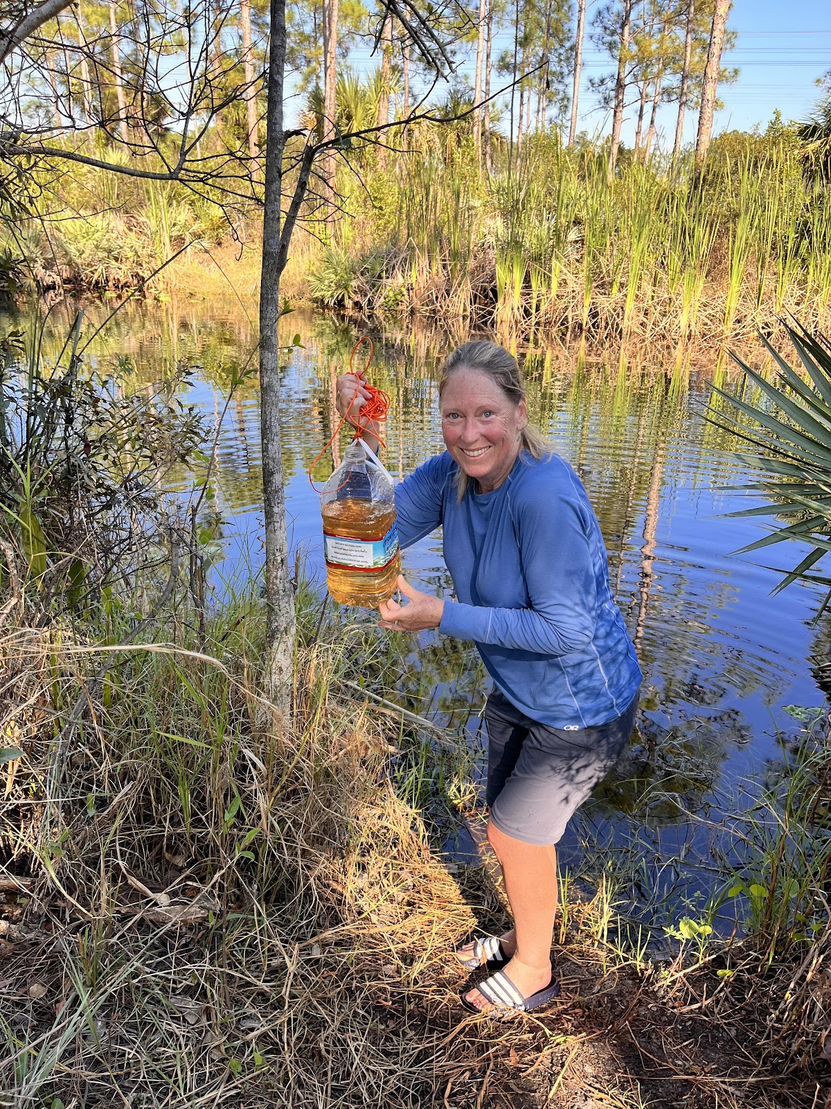
We had been advised to throw a corded jug into the canal for fetching water as we were told there was a ‘healthy’ population of alligators. We obliged, and there were jugs left there, but I’m not sure it was necessary. Most alligators are quite shy. While the water is very tannin colored it tasted fine after filtering.
Day two dawned and we headed to Bowman Island a short ten miles away. I had initially planned such a short day because I thought we’d be slogging through water. The trail was exceptionally dry and we only walked through a little bit of water. When we got to the island we also discovered it wasn’t even currently an island as much of the surrounding water was gone. Nevertheless, it was our favorite camp spot as we enjoyed the night sounds and its tropical/jungly vibe. There is a huge colony of Barred owls here who hooted, chortled and mewed at each other all night. It felt very exotic. We also had a fun time talking about everything related to backpacking and travel with our new hiking friend. We built a little fire to keep the mosquitoes at bay. There was space for our 3 small backpacking tents and there was probably room for 1 more.


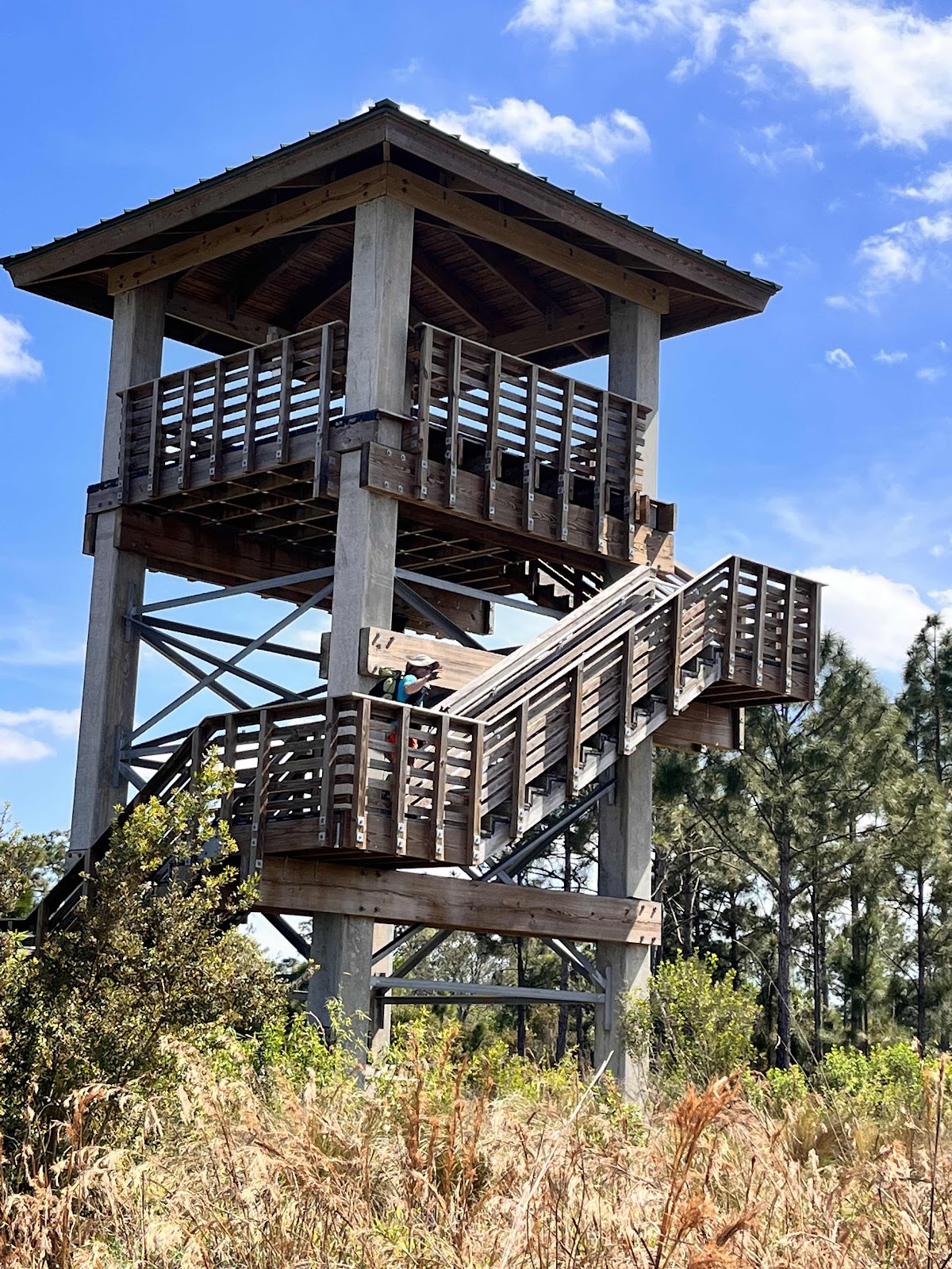
It’s 16 miles to the next legal camping spot called Soggy Socks. I had called and gotten a free permit for here a month earlier from the Loxahatchee Slough. We did cross a few small sections of wet trail and under different watery circumstances this 16 mile stretch could be a doozy. Part way through the day we came to our water cache and enjoyed clear water.
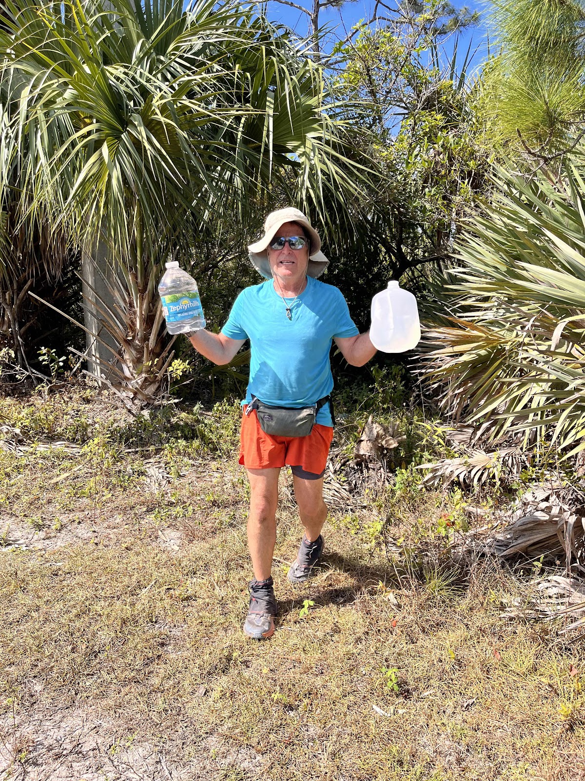
(The jug on the right is the best for caching.) We laid in the shade here for a while before the short road walk to enter the Loxahatchee Slough. Loxahatchee is lovely and we stopped and enjoyed the views and shade from the many benches we found along the way. Their viewing tower was a treat too and we rested in its shade for quite a long time. Did I mention it was hot!


We hiked it February 28 through March 4, 2023 and we were told by locals that it was unseasonably hot and the trail was also much drier than we had expected. While the dry trail made for easy walking, the upper 80’s and low 90 degree Fahrenheit temperatures did slow us down.
To plan for this trip I used the FarOut app, Florida Hikes, Jupiter Hikes and most importantly the Florida Trail Lox Chapter, who are the wonderful caretakers of this trail.
We hiked with a friend and used two cars. We met in the afternoon at Hobe Beach park and left a car there. We were advised by the Jupiter police station to leave a note on the dashboard with the words ‘ocean to lake hikers’, so the patrolling officer would know the car was not abandoned.
We then headed in the second car to the Beeline Highway and about trail mile 35 -where the railroad tracks cross -to leave a couple gallons of water hidden in the palmettos. We knew that we’d be wanting some fresh water by this point of the trail. The best jugs to use are the cheap plastic ones that are super light, so that it’s easier to pack them out. Another option is to come back by and pick up your empty jugs at the end of your hike.
I had earlier in the month gotten a free permit from the Dupais WEA for camping, so we set our GPS for there. Camping at Dupais was great. We heard a huge pack of coyotes run by howling in the dark. It was super cool and eerie. In the morning we drove to the picnic pavilion to begin our hike. We followed the white blaze to the orange blazed OTLHT. We had been told that our car would be safer here than the NENA trailhead. We also left a note on our dash, just in case a ranger came by. The mileage is about the same as starting from the LOST/NENA trailhead at Lake Okeechobee. Another option would be to Uber from Hobe Beach to the NENA trailhead.
We hiked for a few miles before stopping to dry our gear out. Florida hiking generally means a lot of condensation and scheduling in some drying time is important to us. We hiked through a controlled burn area for a while and while taking a break at the four mile camp we met a young man on his very first backpacking trip. He had been dreaming of this hike since 2020 and his excitement was contagious. Later, we all camped together at the Powerline Camp at trail mile 14.5. There’s quite a bit of room along the levee for tents and there’s multiple posts for hammock hangs.
We had been advised to throw a corded jug into the canal for fetching water as we were told there was a ‘healthy’ population of alligators. We obliged, and there were jugs left there, but I’m not sure it was necessary. Most alligators are quite shy. While the water is very tannin colored it tasted fine after filtering.
Day two dawned and we headed to Bowman Island a short ten miles away. I had initially planned such a short day because I thought we’d be slogging through water. The trail was exceptionally dry and we only walked through a little bit of water. When we got to the island we also discovered it wasn’t even currently an island as much of the surrounding water was gone. Nevertheless, it was our favorite camp spot as we enjoyed the night sounds and its tropical/jungly vibe. There is a huge colony of Barred owls here who hooted, chortled and mewed at each other all night. It felt very exotic. We also had a fun time talking about everything related to backpacking and travel with our new hiking friend. We built a little fire to keep the mosquitoes at bay. There was space for our 3 small backpacking tents and there was probably room for 1 more.
I went ‘off’ the island for the sunset and it didn’t disappoint.
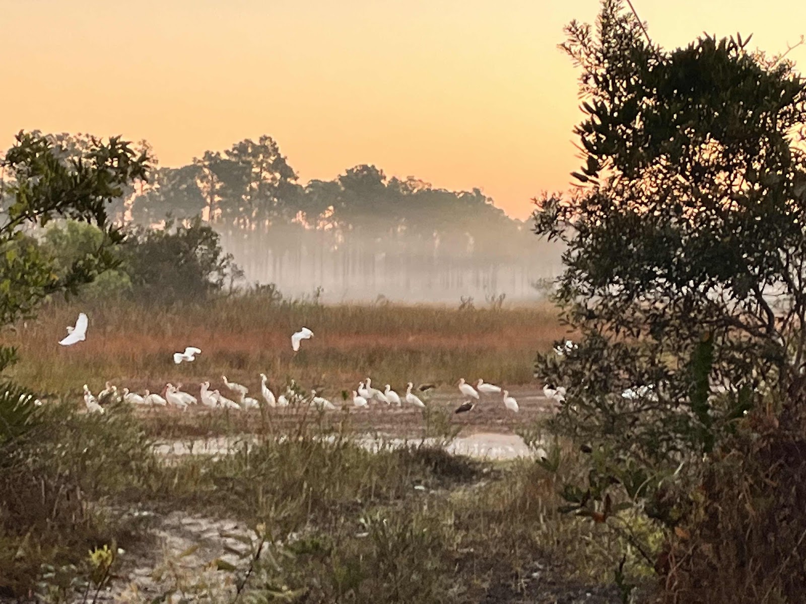
We got an early start the next morning to beat the heat and we were treated to a beautiful sunrise.
It’s 16 miles to the next legal camping spot called Soggy Socks. I had called and gotten a free permit for here a month earlier from the Loxahatchee Slough. We did cross a few small sections of wet trail and under different watery circumstances this 16 mile stretch could be a doozy. Part way through the day we came to our water cache and enjoyed clear water.
(The jug on the right is the best for caching.) We laid in the shade here for a while before the short road walk to enter the Loxahatchee Slough. Loxahatchee is lovely and we stopped and enjoyed the views and shade from the many benches we found along the way. Their viewing tower was a treat too and we rested in its shade for quite a long time. Did I mention it was hot!
End of the day had us all camped at little Soggy Socks. We fitted in 3 tents and in a pinch, I’d reckon you could fit 1 more. Maybe. They also had posts for hammocks.
We retrieved water from the nearby canal under the bridge, as there were concrete retaining blocks that made it easier to walk to the waters edge. We saw a few big gators by the culverts about an eighth of a mile away, but the water was pretty clear, so with a lookout for the alligators, we just quickly scooped up the water. It was also a nice spot to catch the last rays of the day.
Day 4 had us sleeping in, as the nearby Mexican Restaurant, called Guacamole’s, didn’t open until 10 am. Our new hiking buddy left early, as his plan had him finishing the trail today- 20 miles to the beach. We had decided, while hiking, to be old geezers and hike about 15 miles to Scrub Jay camp in Jonathan Dickenson State Park. We would then finish on the fifth day at sunrise. I had, unfortunately, not gotten a permit beforehand. Luckily though, we called and snagged a permit that had just been canceled. Win!
We met our new friend at the road crossing to the Food Plaza on Indiantown Road. He was coming from the 7-11, just as we were heading to it.
It’s always fun meeting new people along the trail and apparently even coordinating outfits for the photo shoot.
The Mexican restaurant did not disappoint and we also filled up on some Gatorade and ice cold water from the 7-11 to help with the high temps. This Food Plaza is right by the trail and besides the 7-11 and Mexican Restaurant there is a pizza place and produce stand. These two opened later, so we didn’t check them out.
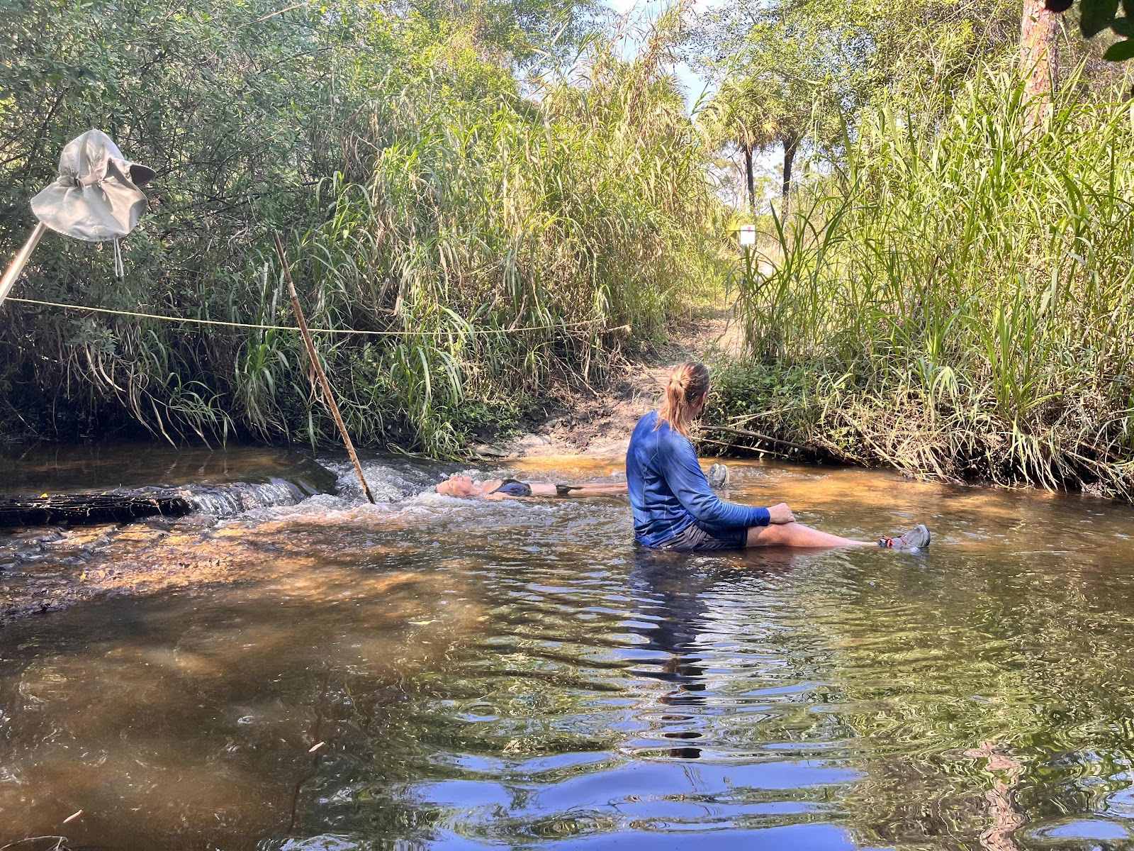
Our afternoon was intentionally slow hiking, as we knew Scrub Jay Camp did not have shade. We would just hike a few miles and then sit in some shade; rinse and repeat. When we found this little shallow stream of clear running water (Hobe Grove Ditch), we really got into it. What sweet relief.
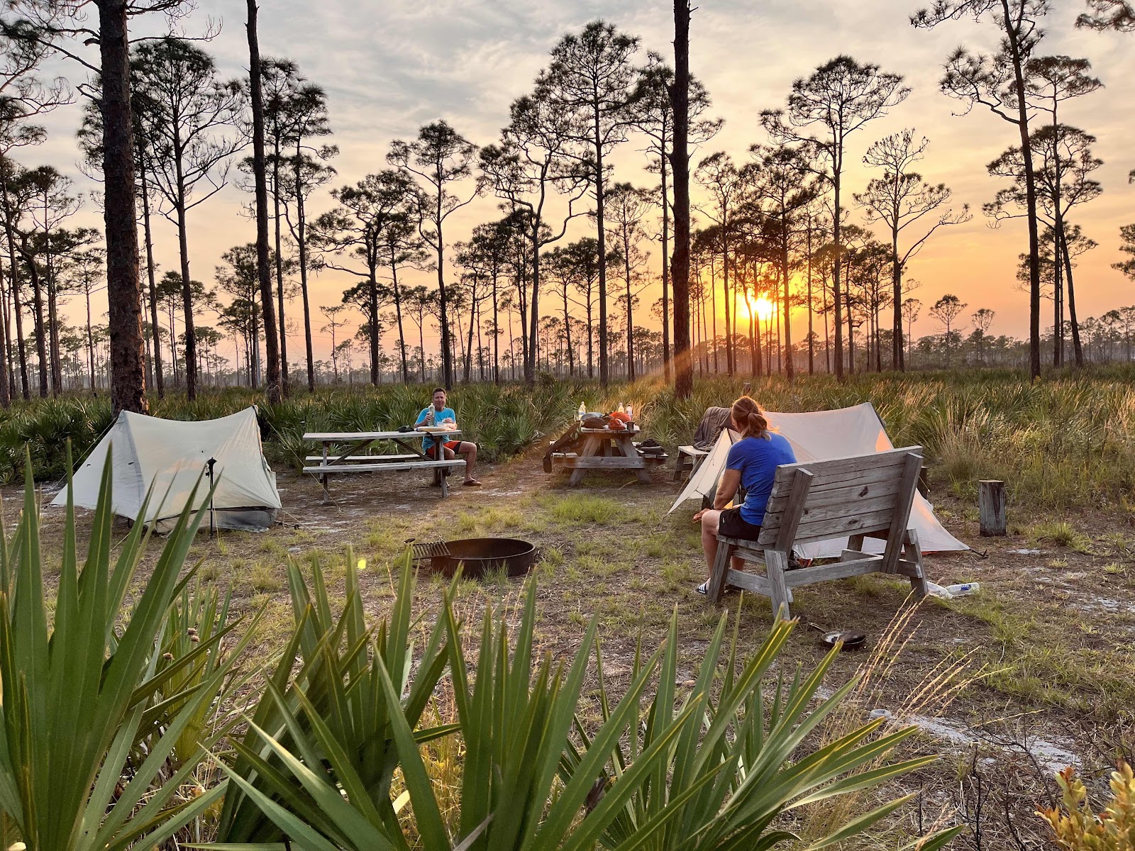
We got our tents up at Scrub Jay in time to enjoy one last beautiful sunset. We could not get the pitcher pump here to work, even after one hour of priming with two gallons of water. We settled on collecting a bit of nearby marsh water by the power lines. The pit toilet here gets a 5 star rating in our books; very clean and nice.
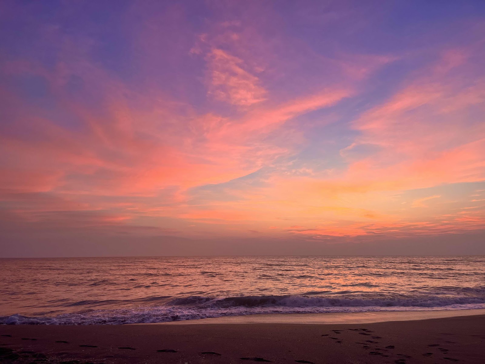
We hit the trail around 4 am on our final day, as we wanted to be sure to be at the beach for sunrise. There was sugar sand and some small dunes before leaving the park and we were very thankful it was sunless. A road walk into Hobe Sound town and then along Bridge Street to the beach. We got here well before dawn and made ourselves some coffee while we waited on the sun.
What a glorious ending it was!
We highly recommend this trail for those who want to get a taste of what backpacking in Florida is like. We saw many varieties of flowers, pines, palms, palmettos, cypress and countless other forms of vegetation. In the fauna realm, we heard coyotes, owls and a variety of songbirds, and saw turkeys, numerous water fowl and a few birds of prey as well as the ubiquitous soaring vulture. We also saw deer, rabbits, alligators, black racer snakes, a raccoon, squirrels and a host of spiders and winged insects.
A slideshow of our hike:
Our itinerary:
Day 1: 14.5 miles to Powerline Camp
Day 2: 10 miles to Bowman Island
Day 3: 16 miles to Soggy Socks
Day 4: 15 miles Scrub Jay
Day 5: 5 miles to Hobe Beach
There are multiple other itineraries to hike this trail, as there are numerous camping spots along the way. We chose these particular camping spots because there was readily available water at each site and we desired this pace. If you are a strong fast hiker a three day plan might be better, and I can easily see how 4 days would be doable. If one desired to really saunter along, and the trail was deep in water, a 6 day plan could be devised. The one day you can’t change though, is the 16 mile day from Bowman Island to Soggy Socks, as there are no other legal camping spots. It would be nice if another spot was created in this stretch of trail for those who might desire a more leisurely pace.
I’d suggest calling for permits as early as possible because this trail is becoming popular. Call the State Park first as those are the hardest permits to acquire and then plan your trip accordingly.
Dupais WEA phone number-561-924-5310
Loxahatchee Slough (Mary Canada) - 561-233-2400
Jonathan Dickinson State Park- 772-546-2771
Comments
Post a Comment
We love your comments or questions. Have a great day and live a good life.